Lightning Peak Topo Map Washington
To zoom in, hover over the map of Lightning Peak
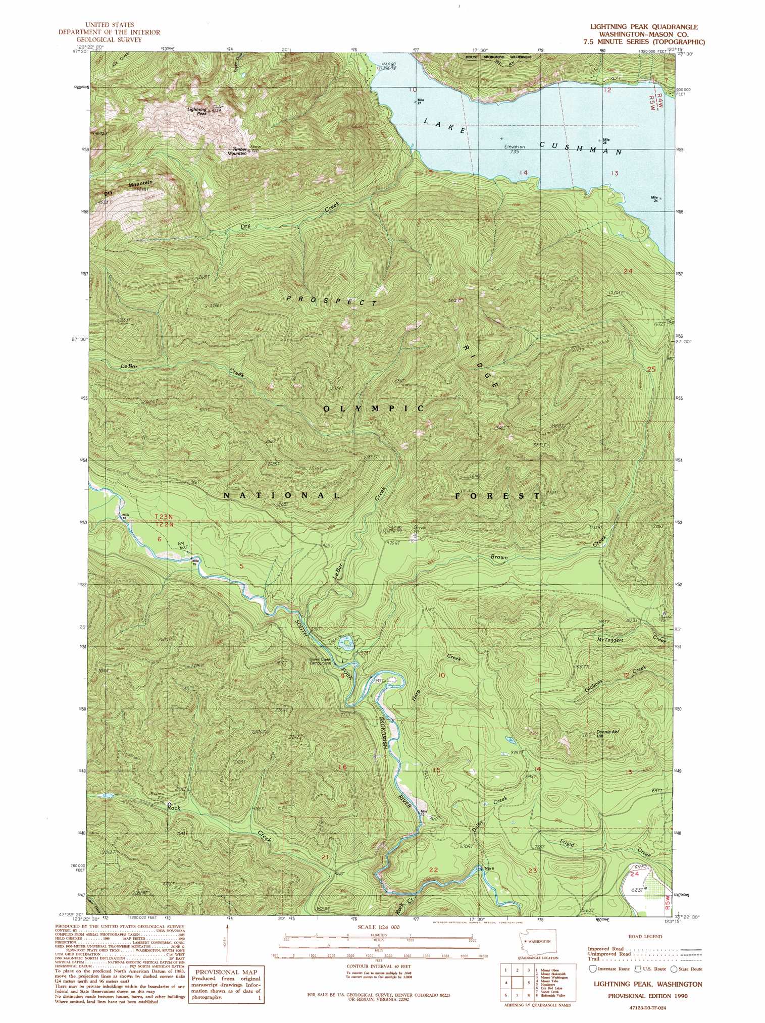
USGS Topo Quad 47123d3 - 1:24,000 scale
| Topo Map Name: | Lightning Peak |
| USGS Topo Quad ID: | 47123d3 |
| Print Size: | ca. 21 1/4" wide x 27" high |
| Southeast Coordinates: | 47.375° N latitude / 123.25° W longitude |
| Map Center Coordinates: | 47.4375° N latitude / 123.3125° W longitude |
| U.S. State: | WA |
| Filename: | o47123d3.jpg |
| Download Map JPG Image: | Lightning Peak topo map 1:24,000 scale |
| Map Type: | Topographic |
| Topo Series: | 7.5´ |
| Map Scale: | 1:24,000 |
| Source of Map Images: | United States Geological Survey (USGS) |
| Alternate Map Versions: |
Lightning Peak WA 1990, updated 1990 Download PDF Buy paper map Lightning Peak WA 2011 Download PDF Buy paper map Lightning Peak WA 2014 Download PDF Buy paper map |
| FStopo: | US Forest Service topo Lightning Peak is available: Download FStopo PDF Download FStopo TIF |
1:24,000 Topo Quads surrounding Lightning Peak
Mount Christie |
Chimney Peak |
Mount Steel |
The Brothers |
Mount Jupiter |
Mount Hoquiam |
Mount Olsen |
Mount Skokomish |
Mount Washington |
Eldon |
Wynoochee Lake |
Mount Tebo |
Lightning Peak |
Hoodsport |
Lilliwaup |
Grisdale |
Dry Bed Lakes |
Vance Creek |
Skokomish Valley |
Union |
Wynoochee Valley Ne |
Matlock |
Nahwatzel Lake |
Shelton Valley |
Shelton |
> Back to 47123a1 at 1:100,000 scale
> Back to 47122a1 at 1:250,000 scale
> Back to U.S. Topo Maps home
Lightning Peak topo map: Gazetteer
Lightning Peak: Ridges
Prospect Ridge elevation 1071m 3513′Lightning Peak: Streams
Brown Creek elevation 177m 580′Dalby Creek elevation 111m 364′
Dry Creek elevation 225m 738′
Harp Creek elevation 162m 531′
Le Bar Creek elevation 225m 738′
Rock Creek elevation 123m 403′
Lightning Peak: Summits
Dennie Ahl Hill elevation 589m 1932′Lightning Peak elevation 1343m 4406′
Timber Mountain elevation 1225m 4019′
Lightning Peak digital topo map on disk
Buy this Lightning Peak topo map showing relief, roads, GPS coordinates and other geographical features, as a high-resolution digital map file on DVD: