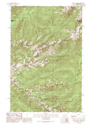
Mount Olsen Topo Map Washington
To zoom in, hover over the map of Mount Olsen
USGS Topo Quad 47123e4 - 1:24,000 scale
| Topo Map Name: | Mount Olsen |
| USGS Topo Quad ID: | 47123e4 |
| Print Size: | ca. 21 1/4" wide x 27" high |
| Southeast Coordinates: | 47.5° N latitude / 123.375° W longitude |
| Map Center Coordinates: | 47.5625° N latitude / 123.4375° W longitude |
| U.S. State: | WA |
| Filename: | o47123e4.jpg |
| Download Map JPG Image: | Mount Olsen topo map 1:24,000 scale |
| Map Type: | Topographic |
| Topo Series: | 7.5´ |
| Map Scale: | 1:24,000 |
| Source of Map Images: | United States Geological Survey (USGS) |
| Alternate Map Versions: |
Mount Olson WA 1990, updated 1990 Download PDF Buy paper map Mount Olson WA 1999, updated 2001 Download PDF Buy paper map Mount Olson WA 2011 Download PDF Buy paper map Mount Olson WA 2014 Download PDF Buy paper map |
| FStopo: | US Forest Service topo Mount Olson is available: Download FStopo PDF Download FStopo TIF |
1:24,000 Topo Quads surrounding Mount Olsen
> Back to 47123e1 at 1:100,000 scale
> Back to 47122a1 at 1:250,000 scale
> Back to U.S. Topo Maps home
Mount Olsen topo map: Gazetteer
Mount Olsen: Lakes
Lake Success elevation 1264m 4146′McGravey Lakes elevation 1219m 3999′
Mount Olsen: Ridges
Six Ridge elevation 1192m 3910′Mount Olsen: Streams
Donahue Creek elevation 426m 1397′Five Stream elevation 325m 1066′
Madeline Creek elevation 416m 1364′
McKay Creek elevation 528m 1732′
O'Neil Creek elevation 364m 1194′
Seven Stream elevation 448m 1469′
Six Stream elevation 385m 1263′
Snowfield Creek elevation 537m 1761′
Tumble Creek elevation 472m 1548′
Mount Olsen: Summits
Mount Olson elevation 1583m 5193′Wonder Mountain elevation 1324m 4343′
Mount Olsen digital topo map on disk
Buy this Mount Olsen topo map showing relief, roads, GPS coordinates and other geographical features, as a high-resolution digital map file on DVD:


