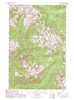
Mount Christie Topo Map Washington
To zoom in, hover over the map of Mount Christie
USGS Topo Quad 47123f5 - 1:24,000 scale
| Topo Map Name: | Mount Christie |
| USGS Topo Quad ID: | 47123f5 |
| Print Size: | ca. 21 1/4" wide x 27" high |
| Southeast Coordinates: | 47.625° N latitude / 123.5° W longitude |
| Map Center Coordinates: | 47.6875° N latitude / 123.5625° W longitude |
| U.S. State: | WA |
| Filename: | o47123f5.jpg |
| Download Map JPG Image: | Mount Christie topo map 1:24,000 scale |
| Map Type: | Topographic |
| Topo Series: | 7.5´ |
| Map Scale: | 1:24,000 |
| Source of Map Images: | United States Geological Survey (USGS) |
| Alternate Map Versions: |
Mount Christie WA 1989, updated 1989 Download PDF Buy paper map Mount Christie WA 1990, updated 1990 Download PDF Buy paper map Mount Christie WA 1999, updated 2003 Download PDF Buy paper map Mount Christie WA 2011 Download PDF Buy paper map Mount Christie WA 2014 Download PDF Buy paper map |
1:24,000 Topo Quads surrounding Mount Christie
> Back to 47123e1 at 1:100,000 scale
> Back to 47122a1 at 1:250,000 scale
> Back to U.S. Topo Maps home
Mount Christie topo map: Gazetteer
Mount Christie: Flats
Martins Park elevation 1325m 4347′Mount Christie: Gaps
Low Divide elevation 1120m 3674′Mount Christie: Lakes
Lake Margaret elevation 1106m 3628′Lake Mary elevation 1097m 3599′
Martins Lakes elevation 1430m 4691′
Mount Christie: Streams
Delabarre Creek elevation 668m 2191′Geoduck Creek elevation 537m 1761′
Promise Creek elevation 641m 2103′
Rhodes Creek elevation 356m 1167′
Seattle Creek elevation 670m 2198′
Mount Christie: Summits
Mount Christie elevation 1873m 6145′Mount Lawson elevation 1647m 5403′
Mount Noyes elevation 1843m 6046′
Mount Seattle elevation 1892m 6207′
Muncaster Mountain elevation 1802m 5912′
Mount Christie digital topo map on disk
Buy this Mount Christie topo map showing relief, roads, GPS coordinates and other geographical features, as a high-resolution digital map file on DVD:


