Thimble Mountain Topo Map Washington
To zoom in, hover over the map of Thimble Mountain
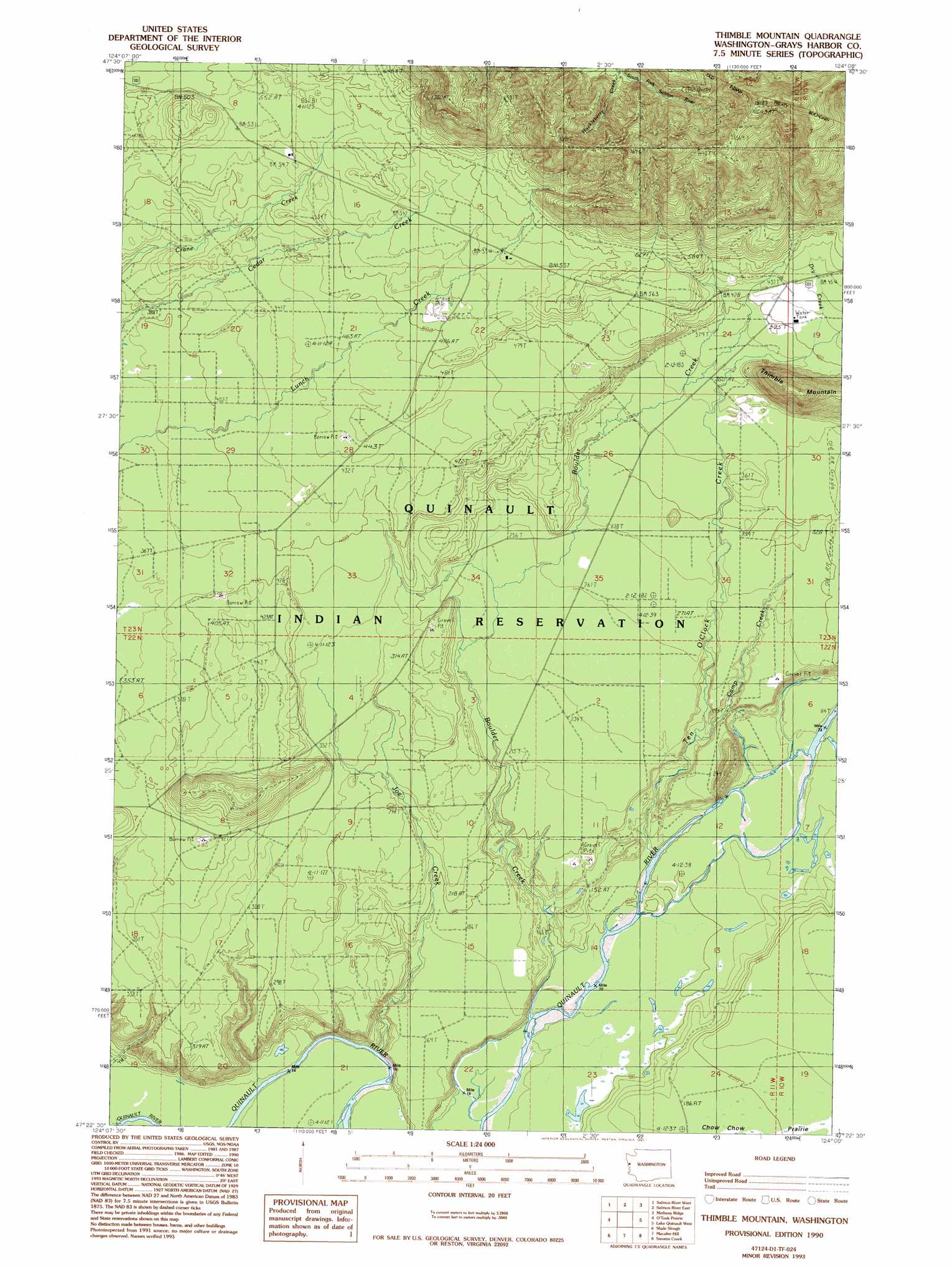
USGS Topo Quad 47124d1 - 1:24,000 scale
| Topo Map Name: | Thimble Mountain |
| USGS Topo Quad ID: | 47124d1 |
| Print Size: | ca. 21 1/4" wide x 27" high |
| Southeast Coordinates: | 47.375° N latitude / 124° W longitude |
| Map Center Coordinates: | 47.4375° N latitude / 124.0625° W longitude |
| U.S. State: | WA |
| Filename: | o47124d1.jpg |
| Download Map JPG Image: | Thimble Mountain topo map 1:24,000 scale |
| Map Type: | Topographic |
| Topo Series: | 7.5´ |
| Map Scale: | 1:24,000 |
| Source of Map Images: | United States Geological Survey (USGS) |
| Alternate Map Versions: |
Thimble Mountain WA 1990, updated 1990 Download PDF Buy paper map Thimble Mountain WA 1990, updated 1993 Download PDF Buy paper map Thimble Mountain WA 2011 Download PDF Buy paper map Thimble Mountain WA 2014 Download PDF Buy paper map |
| FStopo: | US Forest Service topo Thimble Mountain is available: Download FStopo PDF Download FStopo TIF |
1:24,000 Topo Quads surrounding Thimble Mountain
Kalaoch Ridge |
Christmas Creek |
Stequaleho Creek |
Kloochman Rock |
Bob Creek |
Queets |
Salmon River West |
Salmon River East |
Matheny Ridge |
Finley Creek |
Tunnel Island |
O'Took Prairie |
Thimble Mountain |
Quinault Lake West |
Quinault Lake East |
Taholah |
Shale Slough |
Macafee Hill |
Stevens Creek |
Burnt Hill |
Moclips |
Carlisle |
Humptulips |
Railroad Camp |
> Back to 47124a1 at 1:100,000 scale
> Back to 47124a1 at 1:250,000 scale
> Back to U.S. Topo Maps home
Thimble Mountain topo map: Gazetteer
Thimble Mountain: Streams
Boulder Creek elevation 26m 85′Camp Creek elevation 53m 173′
Dry Creek elevation 120m 393′
Huckleberry Creek elevation 244m 800′
Joe Creek elevation 41m 134′
Ten O'Clock Creek elevation 31m 101′
Thimble Mountain: Summits
Thimble Mountain elevation 242m 793′Thimble Mountain digital topo map on disk
Buy this Thimble Mountain topo map showing relief, roads, GPS coordinates and other geographical features, as a high-resolution digital map file on DVD: