Tunnel Island Topo Map Washington
To zoom in, hover over the map of Tunnel Island
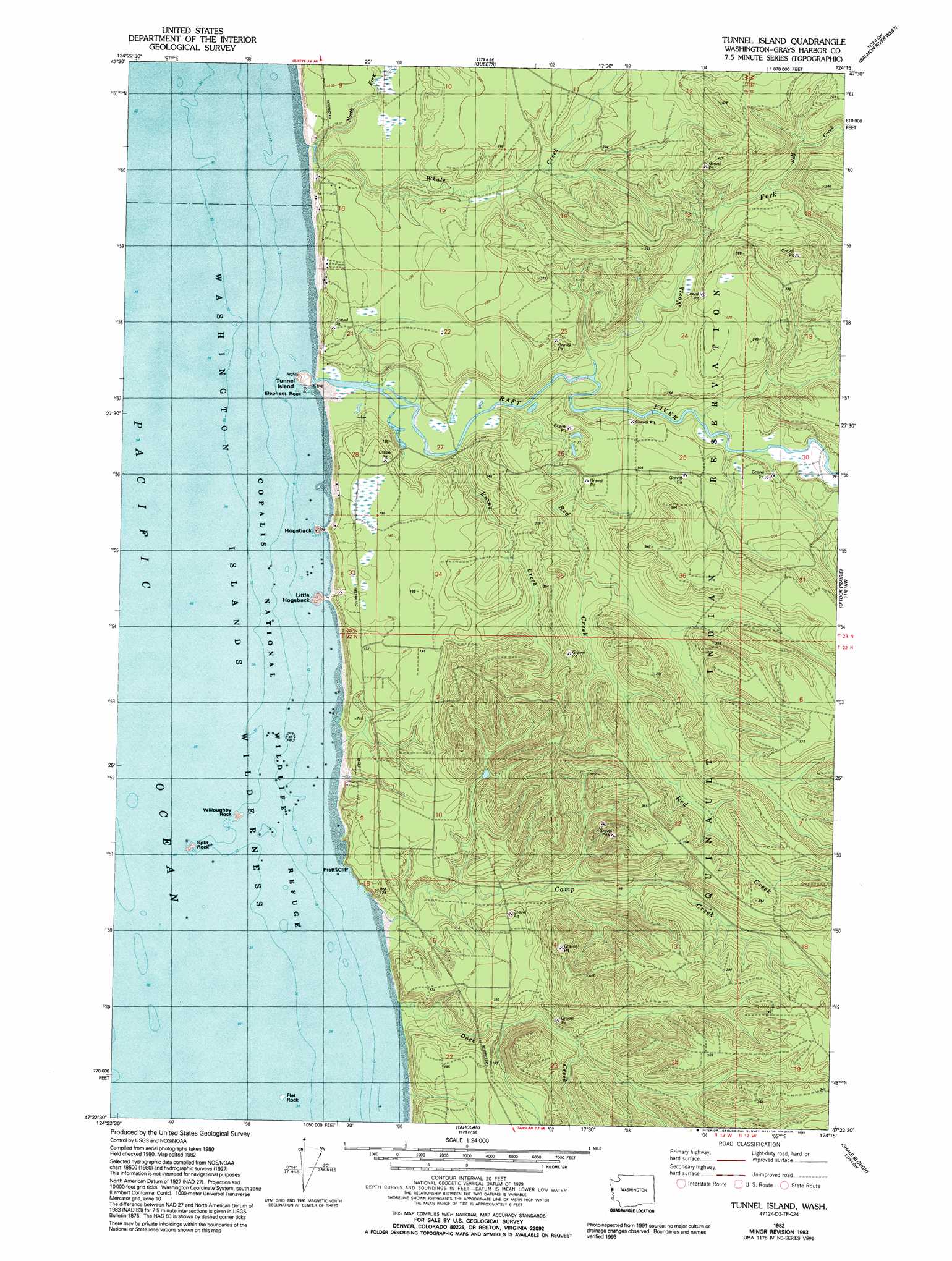
USGS Topo Quad 47124d3 - 1:24,000 scale
| Topo Map Name: | Tunnel Island |
| USGS Topo Quad ID: | 47124d3 |
| Print Size: | ca. 21 1/4" wide x 27" high |
| Southeast Coordinates: | 47.375° N latitude / 124.25° W longitude |
| Map Center Coordinates: | 47.4375° N latitude / 124.3125° W longitude |
| U.S. State: | WA |
| Filename: | o47124d3.jpg |
| Download Map JPG Image: | Tunnel Island topo map 1:24,000 scale |
| Map Type: | Topographic |
| Topo Series: | 7.5´ |
| Map Scale: | 1:24,000 |
| Source of Map Images: | United States Geological Survey (USGS) |
| Alternate Map Versions: |
Tunnel Island WA 1982, updated 1982 Download PDF Buy paper map Tunnel Island WA 1982, updated 1993 Download PDF Buy paper map Tunnel Island WA 2011 Download PDF Buy paper map Tunnel Island WA 2014 Download PDF Buy paper map |
1:24,000 Topo Quads surrounding Tunnel Island
Destruction Island |
Kalaoch Ridge |
Christmas Creek |
Stequaleho Creek |
|
Queets |
Salmon River West |
Salmon River East |
||
Tunnel Island |
O'Took Prairie |
Thimble Mountain |
||
Taholah |
Shale Slough |
Macafee Hill |
||
Moclips |
Carlisle |
> Back to 47124a1 at 1:100,000 scale
> Back to 47124a1 at 1:250,000 scale
> Back to U.S. Topo Maps home
Tunnel Island topo map: Gazetteer
Tunnel Island: Capes
Hogsback elevation 27m 88′Little Hogsback elevation 9m 29′
Tunnel Island: Cliffs
Pratt Cliff elevation 44m 144′Tunnel Island: Islands
Flat Rock elevation 0m 0′Split Rock elevation 0m 0′
Tunnel Island elevation 6m 19′
Willoughby Rock elevation 0m 0′
Tunnel Island: Parks
Copalis National Wildlife Refuge elevation 0m 0′Tunnel Island: Pillars
Elephant Rock elevation 0m 0′Tunnel Island: Streams
Camp Creek elevation 5m 16′Duck Creek elevation 0m 0′
North Fork Raft River elevation 14m 45′
North Fork Whale Creek elevation 28m 91′
Raft River elevation 4m 13′
Rainy Creek elevation 20m 65′
Red Creek elevation 9m 29′
Whale Creek elevation 24m 78′
Wolf Creek elevation 24m 78′
Tunnel Island digital topo map on disk
Buy this Tunnel Island topo map showing relief, roads, GPS coordinates and other geographical features, as a high-resolution digital map file on DVD: