Salmon River West Topo Map Washington
To zoom in, hover over the map of Salmon River West
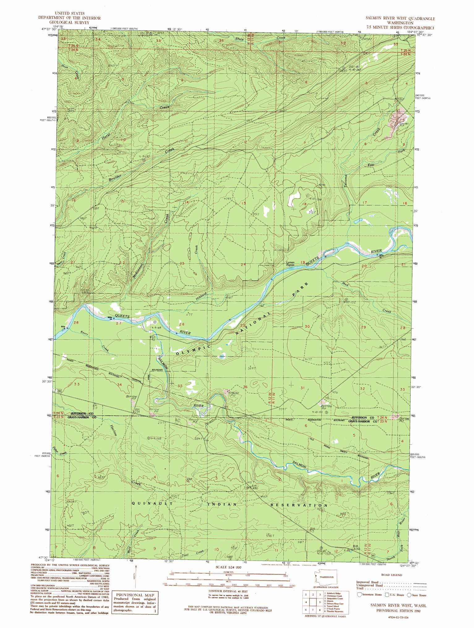
USGS Topo Quad 47124e2 - 1:24,000 scale
| Topo Map Name: | Salmon River West |
| USGS Topo Quad ID: | 47124e2 |
| Print Size: | ca. 21 1/4" wide x 27" high |
| Southeast Coordinates: | 47.5° N latitude / 124.125° W longitude |
| Map Center Coordinates: | 47.5625° N latitude / 124.1875° W longitude |
| U.S. State: | WA |
| Filename: | o47124e2.jpg |
| Download Map JPG Image: | Salmon River West topo map 1:24,000 scale |
| Map Type: | Topographic |
| Topo Series: | 7.5´ |
| Map Scale: | 1:24,000 |
| Source of Map Images: | United States Geological Survey (USGS) |
| Alternate Map Versions: |
Salmon River West WA 1990, updated 1990 Download PDF Buy paper map Salmon River West WA 2011 Download PDF Buy paper map Salmon River West WA 2014 Download PDF Buy paper map |
| FStopo: | US Forest Service topo Salmon River West is available: Download FStopo PDF Download FStopo TIF |
1:24,000 Topo Quads surrounding Salmon River West
Hoh Head |
Anderson Creek |
Winfield Creek |
Spruce Mountain |
Owl Mountain |
Destruction Island |
Kalaoch Ridge |
Christmas Creek |
Stequaleho Creek |
Kloochman Rock |
Queets |
Salmon River West |
Salmon River East |
Matheny Ridge |
|
Tunnel Island |
O'Took Prairie |
Thimble Mountain |
Quinault Lake West |
|
Taholah |
Shale Slough |
Macafee Hill |
Stevens Creek |
> Back to 47124e1 at 1:100,000 scale
> Back to 47124a1 at 1:250,000 scale
> Back to U.S. Topo Maps home
Salmon River West topo map: Gazetteer
Salmon River West: Rapids
Lyman Rapids elevation 36m 118′Salmon River West: Streams
East Fork Tacoma Creek elevation 67m 219′Hibbard Creek elevation 25m 82′
Knorr Creek elevation 16m 52′
McKinnon Creek elevation 20m 65′
Mud Creek elevation 37m 121′
Salmon River elevation 25m 82′
Tacoma Creek elevation 39m 127′
Salmon River West digital topo map on disk
Buy this Salmon River West topo map showing relief, roads, GPS coordinates and other geographical features, as a high-resolution digital map file on DVD: