Spruce Mountain Topo Map Washington
To zoom in, hover over the map of Spruce Mountain
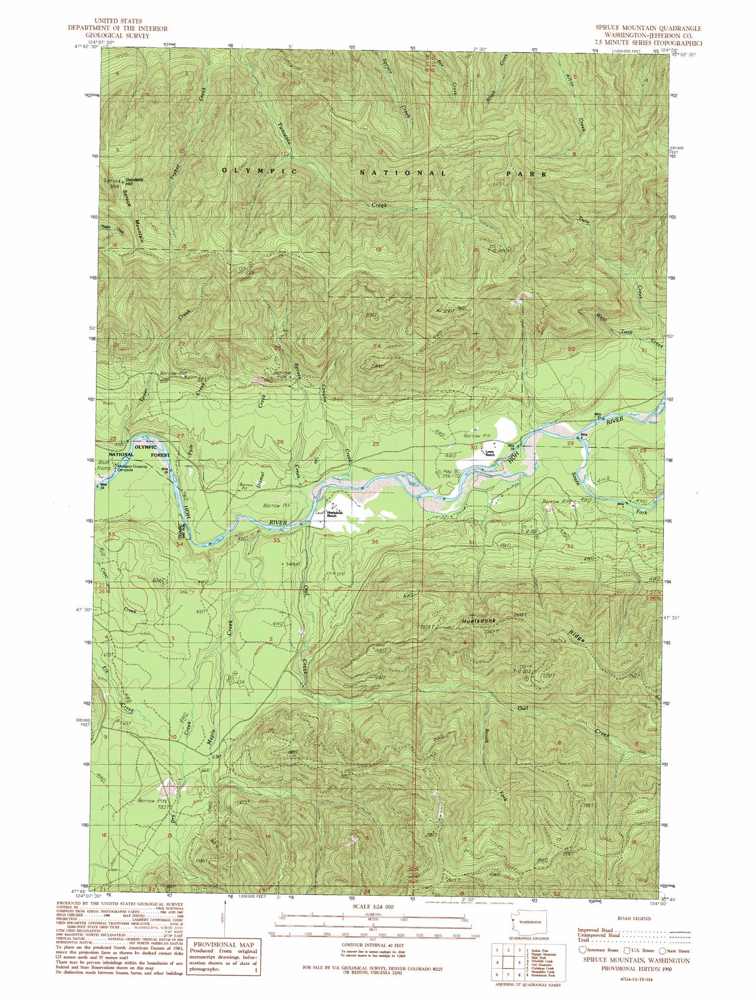
USGS Topo Quad 47124g1 - 1:24,000 scale
| Topo Map Name: | Spruce Mountain |
| USGS Topo Quad ID: | 47124g1 |
| Print Size: | ca. 21 1/4" wide x 27" high |
| Southeast Coordinates: | 47.75° N latitude / 124° W longitude |
| Map Center Coordinates: | 47.8125° N latitude / 124.0625° W longitude |
| U.S. State: | WA |
| Filename: | o47124g1.jpg |
| Download Map JPG Image: | Spruce Mountain topo map 1:24,000 scale |
| Map Type: | Topographic |
| Topo Series: | 7.5´ |
| Map Scale: | 1:24,000 |
| Source of Map Images: | United States Geological Survey (USGS) |
| Alternate Map Versions: |
Spruce Mountain WA 1990, updated 1990 Download PDF Buy paper map Spruce Mountain WA 2011 Download PDF Buy paper map Spruce Mountain WA 2014 Download PDF Buy paper map |
| FStopo: | US Forest Service topo Spruce Mountain is available: Download FStopo PDF Download FStopo TIF |
1:24,000 Topo Quads surrounding Spruce Mountain
Lake Pleasant |
Deadmans Hill |
Snider Peak |
Mount Muller |
Lake Crescent |
Reade Hill |
Indian Pass |
Hunger Mountain |
Slide Peak |
Bogachiel Peak |
Anderson Creek |
Winfield Creek |
Spruce Mountain |
Owl Mountain |
Mount Tom |
Kalaoch Ridge |
Christmas Creek |
Stequaleho Creek |
Kloochman Rock |
Bob Creek |
Queets |
Salmon River West |
Salmon River East |
Matheny Ridge |
Finley Creek |
> Back to 47124e1 at 1:100,000 scale
> Back to 47124a1 at 1:250,000 scale
> Back to U.S. Topo Maps home
Spruce Mountain topo map: Gazetteer
Spruce Mountain: Bridges
Huelsdonk Bridge elevation 113m 370′Spruce Mountain: Ridges
Huelsdonk Ridge elevation 835m 2739′Spruce Mountain: Streams
Canyon Creek elevation 119m 390′Dismal Creek elevation 106m 347′
Dry Creek elevation 155m 508′
Maple Creek elevation 108m 354′
Owl Creek elevation 111m 364′
Pole Creek elevation 98m 321′
South Fork Hoh River elevation 131m 429′
South Fork Owl Creek elevation 291m 954′
Spruce Creek elevation 108m 354′
Tower Creek elevation 97m 318′
Spruce Mountain: Summits
Geodetic Hill elevation 921m 3021′Peak Six elevation 969m 3179′
Spruce Mountain elevation 920m 3018′
Spruce Mountain: Trails
Bogachiel-Hoh Trail elevation 900m 2952′Spruce Mountain digital topo map on disk
Buy this Spruce Mountain topo map showing relief, roads, GPS coordinates and other geographical features, as a high-resolution digital map file on DVD: