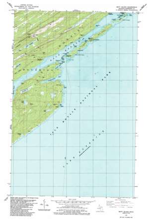
Mott Island Topo Map Michigan
To zoom in, hover over the map of Mott Island
USGS Topo Quad 48088a5 - 1:24,000 scale
| Topo Map Name: | Mott Island |
| USGS Topo Quad ID: | 48088a5 |
| Print Size: | ca. 21 1/4" wide x 27" high |
| Southeast Coordinates: | 48° N latitude / 88.5° W longitude |
| Map Center Coordinates: | 48.0625° N latitude / 88.5625° W longitude |
| U.S. State: | MI |
| Filename: | o48088a5.jpg |
| Download Map JPG Image: | Mott Island topo map 1:24,000 scale |
| Map Type: | Topographic |
| Topo Series: | 7.5´ |
| Map Scale: | 1:24,000 |
| Source of Map Images: | United States Geological Survey (USGS) |
| Alternate Map Versions: |
Mott Island MI 1985, updated 1986 Download PDF Buy paper map Mott Island MI 2011 Download PDF Buy paper map Mott Island MI 2014 Download PDF Buy paper map Mott Island MI 2017 Download PDF Buy paper map |
1:24,000 Topo Quads surrounding Mott Island
Belle Harbor |
Rock Harbor Lodge |
Passage Island |
||
Todd Harbor |
McCargoe Cove |
Mott Island |
||
Malone Bay |
Lake Richie |
|||
> Back to 48088a1 at 1:100,000 scale
> Back to 48088a1 at 1:250,000 scale
> Back to U.S. Topo Maps home
Mott Island topo map: Gazetteer
Mott Island: Bays
Conglomerate Bay elevation 183m 600′Dollar Bay elevation 187m 613′
Gilberts Hole elevation 183m 600′
Lea Cove elevation 183m 600′
Rock Harbor elevation 183m 600′
Tonkin Bay elevation 183m 600′
Mott Island: Capes
Baker Point elevation 196m 643′Indian Head Point elevation 193m 633′
Mine Point elevation 189m 620′
Saginaw Point elevation 189m 620′
Starvation Point elevation 189m 620′
Mott Island: Channels
Lorelei Lane elevation 183m 600′Middle Islands Passage elevation 183m 600′
Mott Island: Islands
Burnt Island elevation 183m 600′Cemetery Island elevation 186m 610′
Davidson Island elevation 184m 603′
East Caribou Island elevation 189m 620′
Inner Hill Island elevation 189m 620′
Mad Island elevation 184m 603′
Middle Islands elevation 183m 600′
Mott Island elevation 193m 633′
Outer Hill Island elevation 189m 620′
Rabbit Island elevation 189m 620′
Star Island elevation 185m 606′
West Caribou Island elevation 189m 620′
Mott Island: Lakes
Epidote Lake elevation 188m 616′Forbes Lake elevation 236m 774′
Lake Benson elevation 242m 793′
Lake John elevation 190m 623′
Lake Ojibway elevation 251m 823′
Newt Lake elevation 252m 826′
Sumner Lake elevation 202m 662′
Mott Island: Mines
Epidote Mine elevation 198m 649′Lucky Bay Mine elevation 214m 702′
Ransom Mine elevation 212m 695′
Saginaw Mine elevation 197m 646′
Siskowit Mine elevation 196m 643′
Mott Island: Streams
Benson Creek elevation 187m 613′Mott Island: Summits
Mount Ojibway elevation 345m 1131′Mount Saginaw elevation 274m 898′
Ransom Hill elevation 266m 872′
Mott Island: Trails
Daisy Farm Trail elevation 262m 859′Mount Ojibway Trail elevation 235m 770′
Rock Harbor Trail elevation 189m 620′
Mott Island digital topo map on disk
Buy this Mott Island topo map showing relief, roads, GPS coordinates and other geographical features, as a high-resolution digital map file on DVD:


