Todd Harbor Topo Map Michigan
To zoom in, hover over the map of Todd Harbor
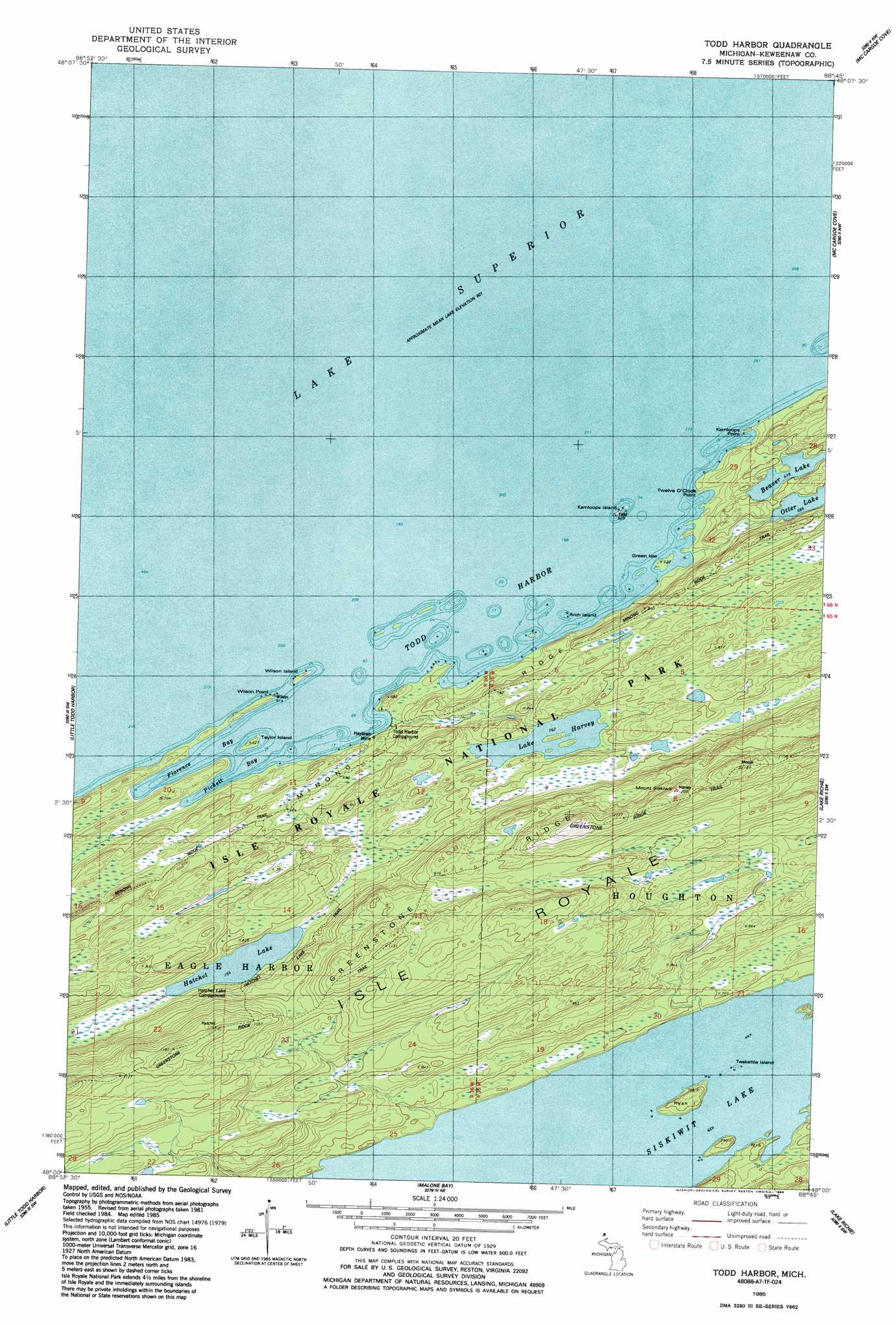
USGS Topo Quad 48088a7 - 1:24,000 scale
| Topo Map Name: | Todd Harbor |
| USGS Topo Quad ID: | 48088a7 |
| Print Size: | ca. 21 1/4" wide x 27" high |
| Southeast Coordinates: | 48° N latitude / 88.75° W longitude |
| Map Center Coordinates: | 48.0625° N latitude / 88.8125° W longitude |
| U.S. State: | MI |
| Filename: | o48088a7.jpg |
| Download Map JPG Image: | Todd Harbor topo map 1:24,000 scale |
| Map Type: | Topographic |
| Topo Series: | 7.5´ |
| Map Scale: | 1:24,000 |
| Source of Map Images: | United States Geological Survey (USGS) |
| Alternate Map Versions: |
Todd Harbor MI 1985, updated 1986 Download PDF Buy paper map Todd Harbor MI 1985, updated 1986 Download PDF Buy paper map Todd Harbor MI 2011 Download PDF Buy paper map Todd Harbor MI 2014 Download PDF Buy paper map Todd Harbor MI 2017 Download PDF Buy paper map |
1:24,000 Topo Quads surrounding Todd Harbor
Belle Harbor |
||||
Todd Harbor |
McCargoe Cove |
Mott Island |
||
Sugar Mountain |
Point Houghton |
Malone Bay |
Lake Richie |
|
Feldtmann Ridge |
Point Houghton |
> Back to 48088a1 at 1:100,000 scale
> Back to 48088a1 at 1:250,000 scale
> Back to U.S. Topo Maps home
Todd Harbor topo map: Gazetteer
Todd Harbor: Bays
Florence Bay elevation 183m 600′Pickett Bay elevation 183m 600′
Todd Harbor elevation 183m 600′
Todd Harbor: Capes
Kamloops Point elevation 183m 600′Twelve O'Clock Point elevation 189m 620′
Wilson Point elevation 189m 620′
Todd Harbor: Islands
Arch Island elevation 183m 600′Green Isle elevation 189m 620′
Isle Royale elevation 197m 646′
Kamloops Island elevation 184m 603′
Ryan Island elevation 220m 721′
Taylor Island elevation 189m 620′
Teakettle Island elevation 197m 646′
Wilson Island elevation 189m 620′
Todd Harbor: Lakes
Beaver Lake elevation 202m 662′Hatchet Lake elevation 229m 751′
Lake Harvey elevation 232m 761′
Otter Lake elevation 208m 682′
Siskiwit Lake elevation 197m 646′
Todd Harbor: Mines
Haytown Mine elevation 188m 616′Todd Harbor: Parks
Isle Royale National Park elevation 198m 649′Todd Harbor: Ridges
Greenstone Ridge elevation 294m 964′Todd Harbor: Summits
Mount Siskiwit elevation 360m 1181′Todd Harbor: Trails
Greenstone Ridge Trail elevation 302m 990′Hatchett Lake Trail elevation 237m 777′
Minong Ridge Fire Manway elevation 243m 797′
Todd Harbor digital topo map on disk
Buy this Todd Harbor topo map showing relief, roads, GPS coordinates and other geographical features, as a high-resolution digital map file on DVD: