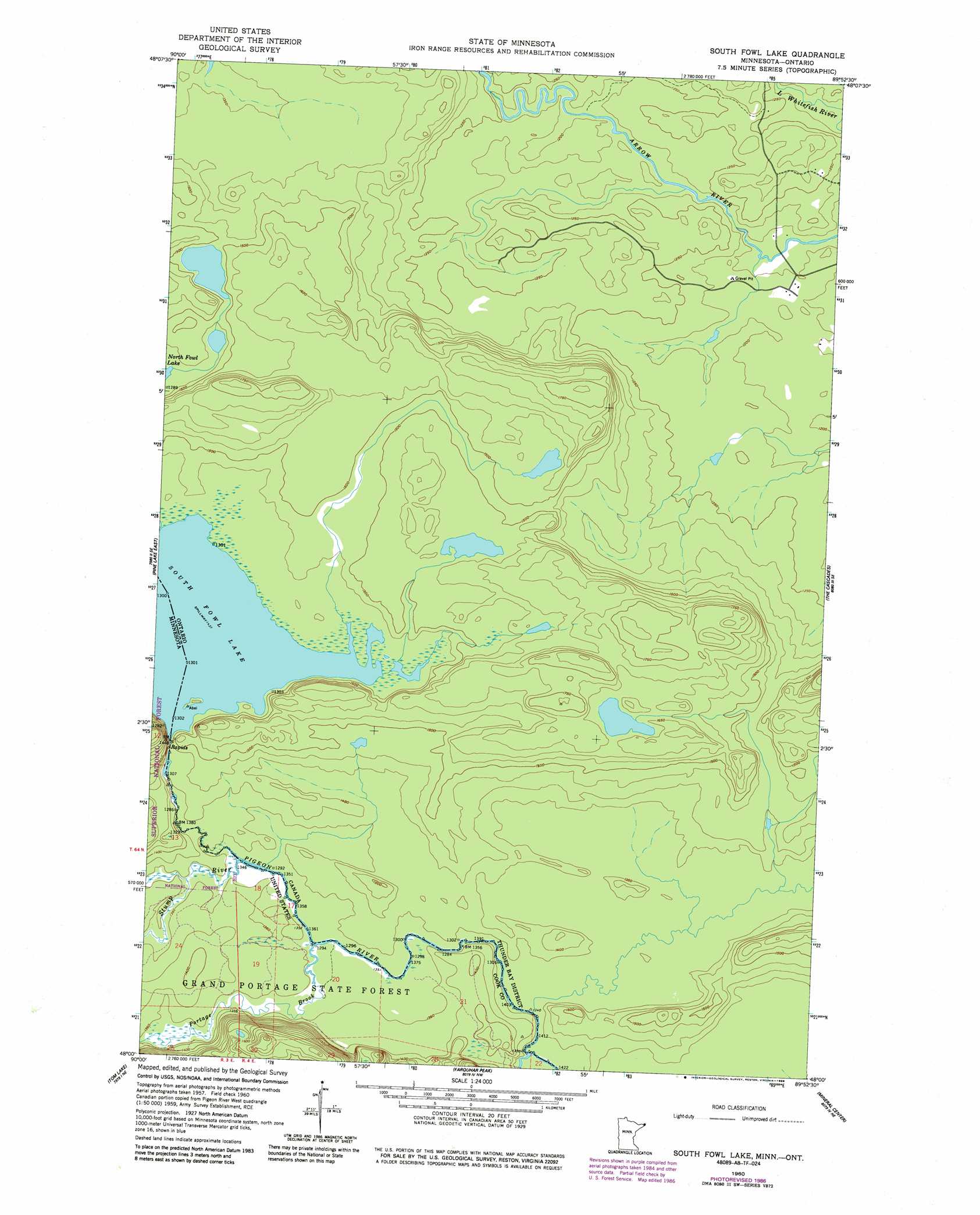
South Fowl Lake Topo Map Minnesota
To zoom in, hover over the map of South Fowl Lake
USGS Topo Quad 48089a8 - 1:24,000 scale
| Topo Map Name: | South Fowl Lake |
| USGS Topo Quad ID: | 48089a8 |
| Print Size: | ca. 21 1/4" wide x 27" high |
| Southeast Coordinates: | 48° N latitude / 89.875° W longitude |
| Map Center Coordinates: | 48.0625° N latitude / 89.9375° W longitude |
| U.S. State: | MN |
| Filename: | o48089a8.jpg |
| Download Map JPG Image: | South Fowl Lake topo map 1:24,000 scale |
| Map Type: | Topographic |
| Topo Series: | 7.5´ |
| Map Scale: | 1:24,000 |
| Source of Map Images: | United States Geological Survey (USGS) |
| Alternate Map Versions: |
South Fowl Lake MN 1960, updated 1961 Download PDF Buy paper map South Fowl Lake MN 1960, updated 1968 Download PDF Buy paper map South Fowl Lake MN 1960, updated 1978 Download PDF Buy paper map South Fowl Lake MN 1960, updated 1986 Download PDF Buy paper map South Fowl Lake MN 2012 Download PDF Buy paper map South Fowl Lake MN 2013 Download PDF Buy paper map South Fowl Lake MN 2016 Download PDF Buy paper map |
| FStopo: | US Forest Service topo South Fowl Lake is available: Download FStopo PDF Download FStopo TIF |
1:24,000 Topo Quads surrounding South Fowl Lake
Pine Lake West |
Pine Lake East |
South Fowl Lake |
The Cascades |
|
Northern Light Lake |
Tom Lake |
Farquhar Peak |
Mineral Center |
Mineral Center East |
Kadunce River |
Marr Island |
Hovland |
> Back to 48089a1 at 1:100,000 scale
> Back to 48088a1 at 1:250,000 scale
> Back to U.S. Topo Maps home
South Fowl Lake topo map: Gazetteer
South Fowl Lake: Dams
South Fowl Lake Dam elevation 443m 1453′South Fowl Lake: Lakes
South Fowl Lake elevation 517m 1696′South Fowl Lake: Reservoirs
Fowl Lake elevation 443m 1453′South Fowl Lake: Streams
Portage Brook elevation 415m 1361′Stump River elevation 416m 1364′
Swamp River elevation 408m 1338′
South Fowl Lake digital topo map on disk
Buy this South Fowl Lake topo map showing relief, roads, GPS coordinates and other geographical features, as a high-resolution digital map file on DVD: