Pine Lake East Topo Map Minnesota
To zoom in, hover over the map of Pine Lake East
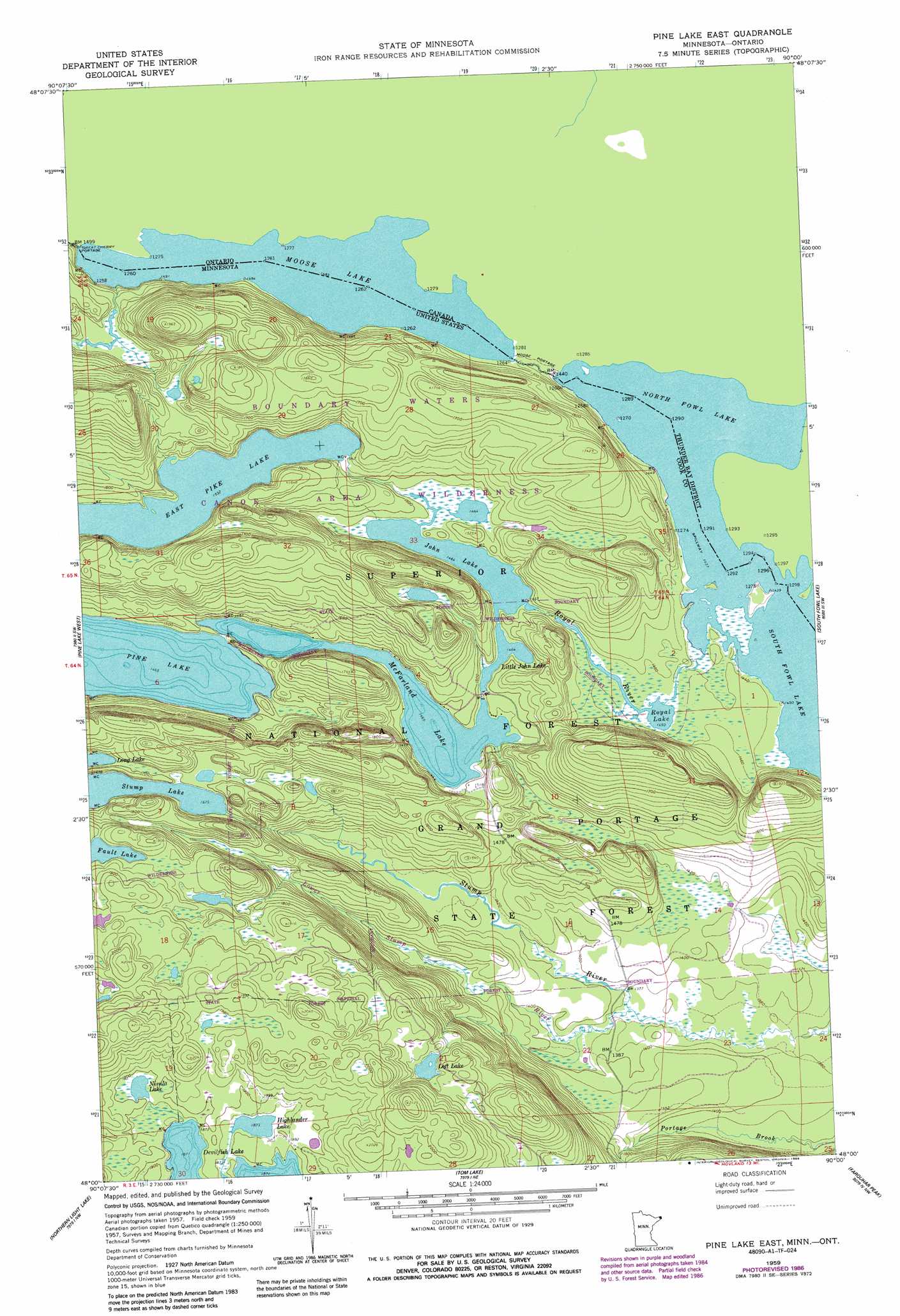
USGS Topo Quad 48090a1 - 1:24,000 scale
| Topo Map Name: | Pine Lake East |
| USGS Topo Quad ID: | 48090a1 |
| Print Size: | ca. 21 1/4" wide x 27" high |
| Southeast Coordinates: | 48° N latitude / 90° W longitude |
| Map Center Coordinates: | 48.0625° N latitude / 90.0625° W longitude |
| U.S. State: | MN |
| Filename: | o48090a1.jpg |
| Download Map JPG Image: | Pine Lake East topo map 1:24,000 scale |
| Map Type: | Topographic |
| Topo Series: | 7.5´ |
| Map Scale: | 1:24,000 |
| Source of Map Images: | United States Geological Survey (USGS) |
| Alternate Map Versions: |
Pine Lake East MN 1959, updated 1965 Download PDF Buy paper map Pine Lake East MN 1959, updated 1978 Download PDF Buy paper map Pine Lake East MN 1959, updated 1986 Download PDF Buy paper map Pine Lake East MN 2011 Download PDF Buy paper map Pine Lake East MN 2013 Download PDF Buy paper map Pine Lake East MN 2016 Download PDF Buy paper map |
| FStopo: | US Forest Service topo Pine Lake East is available: Download FStopo PDF Download FStopo TIF |
1:24,000 Topo Quads surrounding Pine Lake East
Crocodile Lake |
Pine Lake West |
Pine Lake East |
South Fowl Lake |
The Cascades |
Pine Mountain |
Northern Light Lake |
Tom Lake |
Farquhar Peak |
Mineral Center |
Grand Marais |
Kadunce River |
Marr Island |
Hovland |
> Back to 48090a1 at 1:100,000 scale
> Back to 48090a1 at 1:250,000 scale
> Back to U.S. Topo Maps home
Pine Lake East topo map: Gazetteer
Pine Lake East: Lakes
East Pike Lake elevation 467m 1532′Highlander Lake elevation 571m 1873′
John Lake elevation 446m 1463′
Little John Lake elevation 446m 1463′
Loft Lake elevation 564m 1850′
McFarland Lake elevation 447m 1466′
Moose Lake elevation 452m 1482′
Nisula Lake elevation 575m 1886′
North Fowl Lake elevation 437m 1433′
Royal Lake elevation 442m 1450′
Pine Lake East: Streams
Lower Stump River elevation 419m 1374′Royal River elevation 438m 1437′
Pine Lake East digital topo map on disk
Buy this Pine Lake East topo map showing relief, roads, GPS coordinates and other geographical features, as a high-resolution digital map file on DVD: