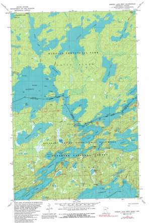
Ensign Lake West Topo Map Minnesota
To zoom in, hover over the map of Ensign Lake West
USGS Topo Quad 48091a4 - 1:24,000 scale
| Topo Map Name: | Ensign Lake West |
| USGS Topo Quad ID: | 48091a4 |
| Print Size: | ca. 21 1/4" wide x 27" high |
| Southeast Coordinates: | 48° N latitude / 91.375° W longitude |
| Map Center Coordinates: | 48.0625° N latitude / 91.4375° W longitude |
| U.S. State: | MN |
| Filename: | o48091a4.jpg |
| Download Map JPG Image: | Ensign Lake West topo map 1:24,000 scale |
| Map Type: | Topographic |
| Topo Series: | 7.5´ |
| Map Scale: | 1:24,000 |
| Source of Map Images: | United States Geological Survey (USGS) |
| Alternate Map Versions: |
Ensign Lake SW MN 1976, updated 1979 Download PDF Buy paper map Ensign Lake West MN 1981, updated 1981 Download PDF Buy paper map Ensign Lake West MN 1981, updated 1986 Download PDF Buy paper map Ensign Lake West MN 2011 Download PDF Buy paper map Ensign Lake West MN 2013 Download PDF Buy paper map Ensign Lake West MN 2016 Download PDF Buy paper map |
| FStopo: | US Forest Service topo Ensign Lake West is available: Download FStopo PDF Download FStopo TIF |
1:24,000 Topo Quads surrounding Ensign Lake West
> Back to 48091a1 at 1:100,000 scale
> Back to 48090a1 at 1:250,000 scale
> Back to U.S. Topo Maps home
Ensign Lake West topo map: Gazetteer
Ensign Lake West: Bays
Bass Bay elevation 435m 1427′Bayley Bay elevation 396m 1299′
Inlet Bay elevation 396m 1299′
Newfound Bay elevation 435m 1427′
North Bay elevation 435m 1427′
Rice Bay elevation 396m 1299′
Ensign Lake West: Dams
Prairie Portage Dam elevation 406m 1332′Ensign Lake West: Islands
Beaver Island elevation 402m 1318′Half Burnt Island elevation 445m 1459′
Horseshoe Island elevation 411m 1348′
Three Sisters Island elevation 435m 1427′
Ensign Lake West: Lakes
Birch Lake elevation 408m 1338′Found Lake elevation 412m 1351′
Grub Lake elevation 448m 1469′
Jerky Lake elevation 454m 1489′
Jinx Lake elevation 442m 1450′
Juggler Lake elevation 412m 1351′
Manomin Lake elevation 407m 1335′
Moose Lake elevation 408m 1338′
Newfound Lake elevation 408m 1338′
Perdu Lake elevation 418m 1371′
Skull Lake elevation 412m 1351′
Spigot Lake elevation 430m 1410′
Splash Lake elevation 410m 1345′
Spree Lake elevation 430m 1410′
Sucker Lake elevation 408m 1338′
Thermal Lake elevation 412m 1351′
Wooden Leg Lake elevation 436m 1430′
Ensign Lake West: Populated Places
Prairie Portage elevation 402m 1318′Ensign Lake West: Reservoirs
Sucker Lake elevation 406m 1332′Ensign Lake West digital topo map on disk
Buy this Ensign Lake West topo map showing relief, roads, GPS coordinates and other geographical features, as a high-resolution digital map file on DVD:


