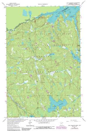
Lake Jeanette Topo Map Minnesota
To zoom in, hover over the map of Lake Jeanette
USGS Topo Quad 48092b3 - 1:24,000 scale
| Topo Map Name: | Lake Jeanette |
| USGS Topo Quad ID: | 48092b3 |
| Print Size: | ca. 21 1/4" wide x 27" high |
| Southeast Coordinates: | 48.125° N latitude / 92.25° W longitude |
| Map Center Coordinates: | 48.1875° N latitude / 92.3125° W longitude |
| U.S. State: | MN |
| Filename: | o48092b3.jpg |
| Download Map JPG Image: | Lake Jeanette topo map 1:24,000 scale |
| Map Type: | Topographic |
| Topo Series: | 7.5´ |
| Map Scale: | 1:24,000 |
| Source of Map Images: | United States Geological Survey (USGS) |
| Alternate Map Versions: |
Lake Jeanette MN 1963, updated 1965 Download PDF Buy paper map Lake Jeanette MN 1963, updated 1974 Download PDF Buy paper map Lake Jeanette MN 1963, updated 1987 Download PDF Buy paper map Lake Jeanette MN 2011 Download PDF Buy paper map Lake Jeanette MN 2013 Download PDF Buy paper map Lake Jeanette MN 2016 Download PDF Buy paper map |
| FStopo: | US Forest Service topo Lake Jeanette is available: Download FStopo PDF Download FStopo TIF |
1:24,000 Topo Quads surrounding Lake Jeanette
> Back to 48092a1 at 1:100,000 scale
> Back to 48092a1 at 1:250,000 scale
> Back to U.S. Topo Maps home
Lake Jeanette topo map: Gazetteer
Lake Jeanette: Falls
Devils Cascade elevation 368m 1207′Fiftysix Rapids elevation 344m 1128′
Loon Falls elevation 353m 1158′
Lake Jeanette: Lakes
Lake Jeanette elevation 409m 1341′Loon Lake elevation 354m 1161′
Nugget Lake elevation 406m 1332′
Upper Pauness Lake elevation 377m 1236′
Wolfpack Lake elevation 397m 1302′
Lake Jeanette: Streams
Beaver Stream elevation 342m 1122′Gaunt Creek elevation 386m 1266′
Little Indian Sioux River elevation 354m 1161′
Maude Creek elevation 405m 1328′
Nigh Creek elevation 413m 1354′
Nugget Creek elevation 386m 1266′
Screwgee Creek elevation 406m 1332′
Wolfpack Creek elevation 380m 1246′
Lake Jeanette digital topo map on disk
Buy this Lake Jeanette topo map showing relief, roads, GPS coordinates and other geographical features, as a high-resolution digital map file on DVD:


