Kabustasa Lake Topo Map Minnesota
To zoom in, hover over the map of Kabustasa Lake
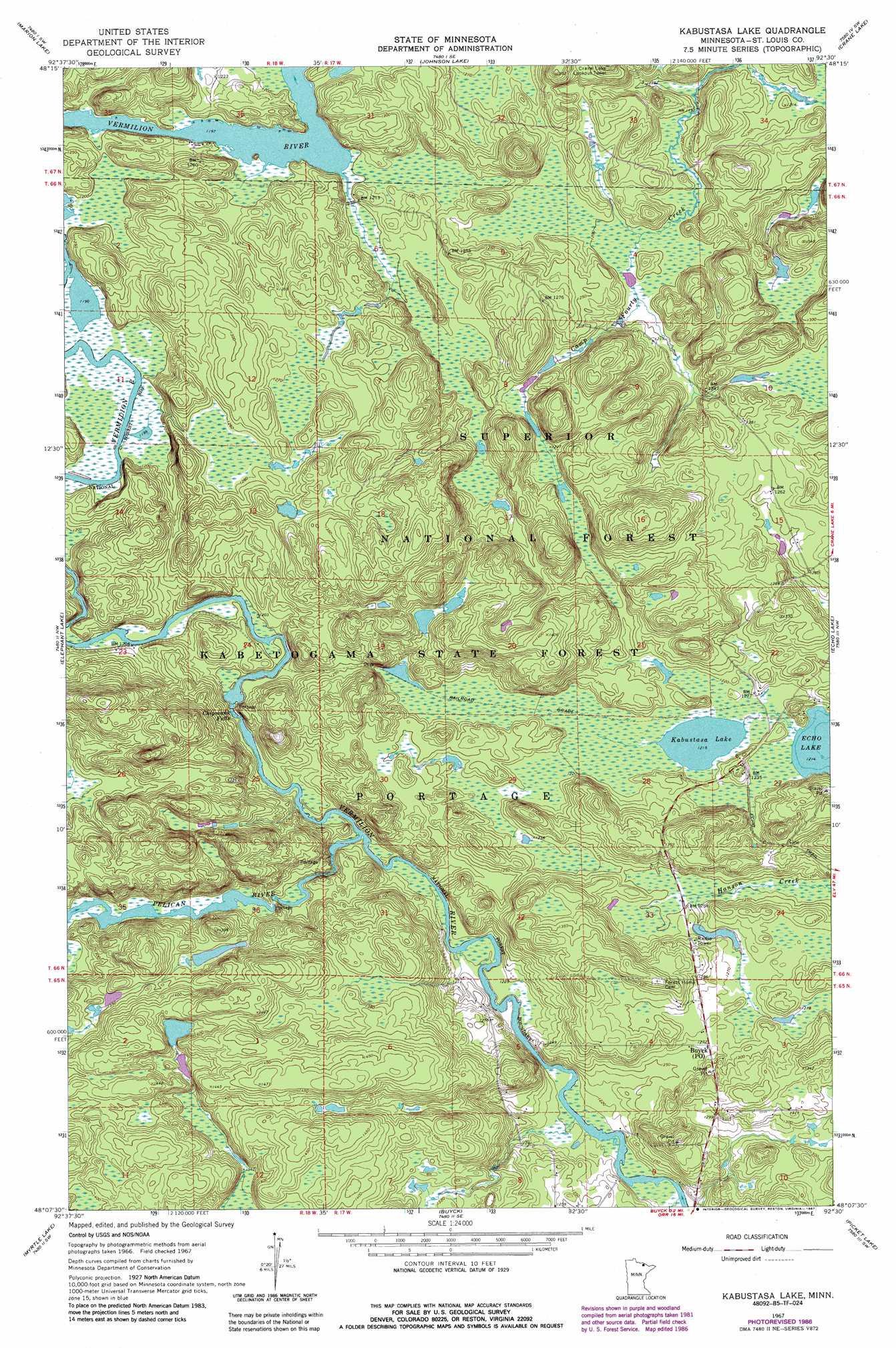
USGS Topo Quad 48092b5 - 1:24,000 scale
| Topo Map Name: | Kabustasa Lake |
| USGS Topo Quad ID: | 48092b5 |
| Print Size: | ca. 21 1/4" wide x 27" high |
| Southeast Coordinates: | 48.125° N latitude / 92.5° W longitude |
| Map Center Coordinates: | 48.1875° N latitude / 92.5625° W longitude |
| U.S. State: | MN |
| Filename: | o48092b5.jpg |
| Download Map JPG Image: | Kabustasa Lake topo map 1:24,000 scale |
| Map Type: | Topographic |
| Topo Series: | 7.5´ |
| Map Scale: | 1:24,000 |
| Source of Map Images: | United States Geological Survey (USGS) |
| Alternate Map Versions: |
Kabustasa Lake MN 1967, updated 1969 Download PDF Buy paper map Kabustasa Lake MN 1967, updated 1984 Download PDF Buy paper map Kabustasa Lake MN 1967, updated 1987 Download PDF Buy paper map Kabustasa Lake MN 2011 Download PDF Buy paper map Kabustasa Lake MN 2013 Download PDF Buy paper map Kabustasa Lake MN 2016 Download PDF Buy paper map |
| FStopo: | US Forest Service topo Kabustasa Lake is available: Download FStopo PDF Download FStopo TIF |
1:24,000 Topo Quads surrounding Kabustasa Lake
Ash River Ne |
Namakan Island |
Hale Bay |
Redhorse Bay |
|
Ash River Se |
Marion Lake |
Johnson Lake |
Crane Lake |
Snow Bay |
Orr Ne |
Elephant Lake |
Kabustasa Lake |
Echo Lake |
Lake Jeanette |
Orr |
Myrtle Lake |
Buyck |
Picket Lake |
Astrid Lake |
Gheen |
Haley |
Norwegian Bay |
Vermilion Dam |
Sioux Pine Island |
> Back to 48092a1 at 1:100,000 scale
> Back to 48092a1 at 1:250,000 scale
> Back to U.S. Topo Maps home
Kabustasa Lake topo map: Gazetteer
Kabustasa Lake: Areas
John Congdon Goldmine Wetlands elevation 366m 1200′Kabustasa Lake: Dams
Daniels Pond Dam elevation 380m 1246′Morris Finstad Wildlife Pond Dam elevation 380m 1246′
Kabustasa Lake: Falls
Chipmunk Falls elevation 366m 1200′Kabustasa Lake: Lakes
Kabustasa Lake elevation 371m 1217′Kabustasa Lake: Post Offices
Buyck Post Office elevation 388m 1272′Kabustasa Lake: Reservoirs
Daniels Pond elevation 380m 1246′Kabustasa Lake: Streams
Pelican River elevation 369m 1210′Kabustasa Lake digital topo map on disk
Buy this Kabustasa Lake topo map showing relief, roads, GPS coordinates and other geographical features, as a high-resolution digital map file on DVD: