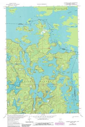
Coleman Island Topo Map Minnesota
To zoom in, hover over the map of Coleman Island
USGS Topo Quad 48092c1 - 1:24,000 scale
| Topo Map Name: | Coleman Island |
| USGS Topo Quad ID: | 48092c1 |
| Print Size: | ca. 21 1/4" wide x 27" high |
| Southeast Coordinates: | 48.25° N latitude / 92° W longitude |
| Map Center Coordinates: | 48.3125° N latitude / 92.0625° W longitude |
| U.S. State: | MN |
| Filename: | o48092c1.jpg |
| Download Map JPG Image: | Coleman Island topo map 1:24,000 scale |
| Map Type: | Topographic |
| Topo Series: | 7.5´ |
| Map Scale: | 1:24,000 |
| Source of Map Images: | United States Geological Survey (USGS) |
| Alternate Map Versions: |
Coleman Island MN 1963, updated 1964 Download PDF Buy paper map Coleman Island MN 1963, updated 1987 Download PDF Buy paper map Coleman Island MN 2011 Download PDF Buy paper map Coleman Island MN 2013 Download PDF Buy paper map Coleman Island MN 2016 Download PDF Buy paper map |
| FStopo: | US Forest Service topo Coleman Island is available: Download FStopo PDF Download FStopo TIF |
1:24,000 Topo Quads surrounding Coleman Island
Snow Bay |
Takucmich Lake |
Coleman Island |
||
Lake Jeanette |
Shell Lake |
Lake Agnes |
Iron Lake |
Friday Bay |
Astrid Lake |
Bootleg Lake |
Lapond Lake |
Angleworm Lake |
Fourtown Lake |
> Back to 48092a1 at 1:100,000 scale
> Back to 48092a1 at 1:250,000 scale
> Back to U.S. Topo Maps home
Coleman Island topo map: Gazetteer
Coleman Island: Bays
Lady Boot Bay elevation 361m 1184′Never Fail Bay elevation 361m 1184′
Coleman Island: Channels
Fish Stake Narrows elevation 361m 1184′Coleman Island: Islands
Coleman Island elevation 383m 1256′Twentyfive Island elevation 370m 1213′
Coleman Island: Lakes
Arch Lake elevation 368m 1207′Chase Lake elevation 385m 1263′
Ge-be-on-e-quet Lake elevation 373m 1223′
Green Lake elevation 391m 1282′
Kelsey Lake elevation 367m 1204′
Lac la Croix elevation 361m 1184′
Mug Lake elevation 361m 1184′
Pekan Lake elevation 393m 1289′
Pocket Lake elevation 364m 1194′
Profit Lake elevation 394m 1292′
Toe Lake elevation 361m 1184′
Wabang Lake elevation 385m 1263′
Yabut Lake elevation 415m 1361′
Coleman Island: Streams
Ge-be-on-e-quet Creek elevation 363m 1190′Pocket Creek elevation 361m 1184′
Coleman Island digital topo map on disk
Buy this Coleman Island topo map showing relief, roads, GPS coordinates and other geographical features, as a high-resolution digital map file on DVD:


