Johnson Landing Se Topo Map Minnesota
To zoom in, hover over the map of Johnson Landing Se
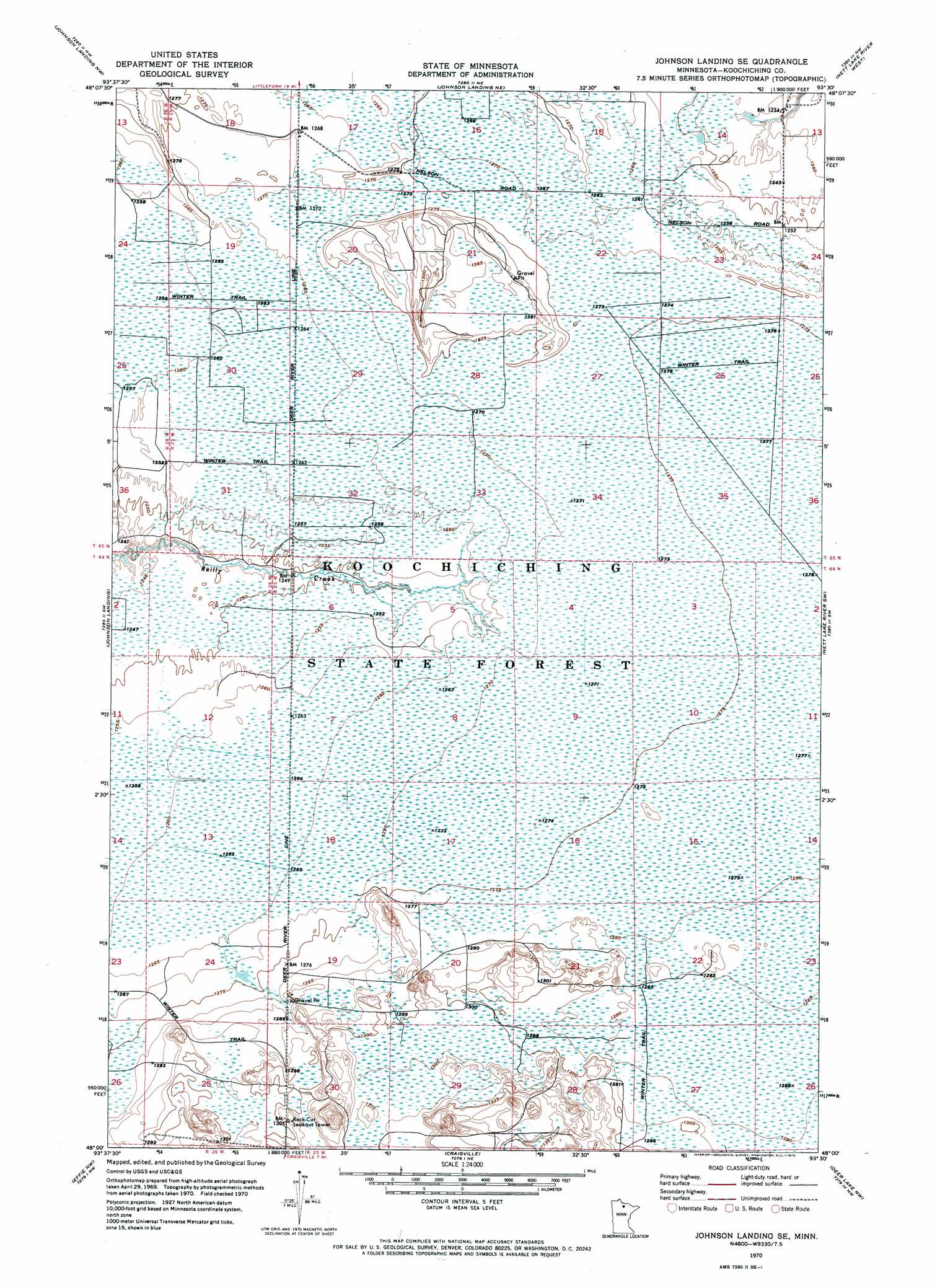
USGS Topo Quad 48093a5 - 1:24,000 scale
| Topo Map Name: | Johnson Landing Se |
| USGS Topo Quad ID: | 48093a5 |
| Print Size: | ca. 21 1/4" wide x 27" high |
| Southeast Coordinates: | 48° N latitude / 93.5° W longitude |
| Map Center Coordinates: | 48.0625° N latitude / 93.5625° W longitude |
| U.S. State: | MN |
| Filename: | p48093a5.jpg |
| Download Map JPG Image: | Johnson Landing Se topo map 1:24,000 scale |
| Map Type: | Orthophoto |
| Topo Series: | 7.5´ |
| Map Scale: | 1:24,000 |
| Source of Map Images: | United States Geological Survey (USGS) |
| Alternate Map Versions: |
Johnson Landing SE MN 1970, updated 1973 Download PDF Buy paper map Johnson Landing SE MN 2010 Download PDF Buy paper map Johnson Landing SE MN 2013 Download PDF Buy paper map Johnson Landing SE MN 2016 Download PDF Buy paper map |
1:24,000 Topo Quads surrounding Johnson Landing Se
Lindford Se |
Littlefork Sw |
Littlefork Se |
Ericsburg Sw |
Ericsburg Se |
Big Falls |
Johnson Landing Nw |
Johnson Landing Ne |
Nett Lake River West |
Nett Lake River East |
Big Falls Se |
Johnson Landing |
Johnson Landing Se |
Nett Lake River Sw |
Nett Lake River Se |
Wildwood Ne |
Effie Nw |
Craigville |
Deer Lake Nw |
Deer Lake Ne |
Wildwood Se |
Effie |
Effie Se |
Deer Lake West |
Deer Lake East |
> Back to 48093a1 at 1:100,000 scale
> Back to 48092a1 at 1:250,000 scale
> Back to U.S. Topo Maps home
No gazetteer data is available for the Johnson Landing Se topo map sheet.
Johnson Landing Se digital topo map on disk
Buy this Johnson Landing Se topo map showing relief, roads, GPS coordinates and other geographical features, as a high-resolution digital map file on DVD: