Nett Lake Ne Topo Map Minnesota
To zoom in, hover over the map of Nett Lake Ne
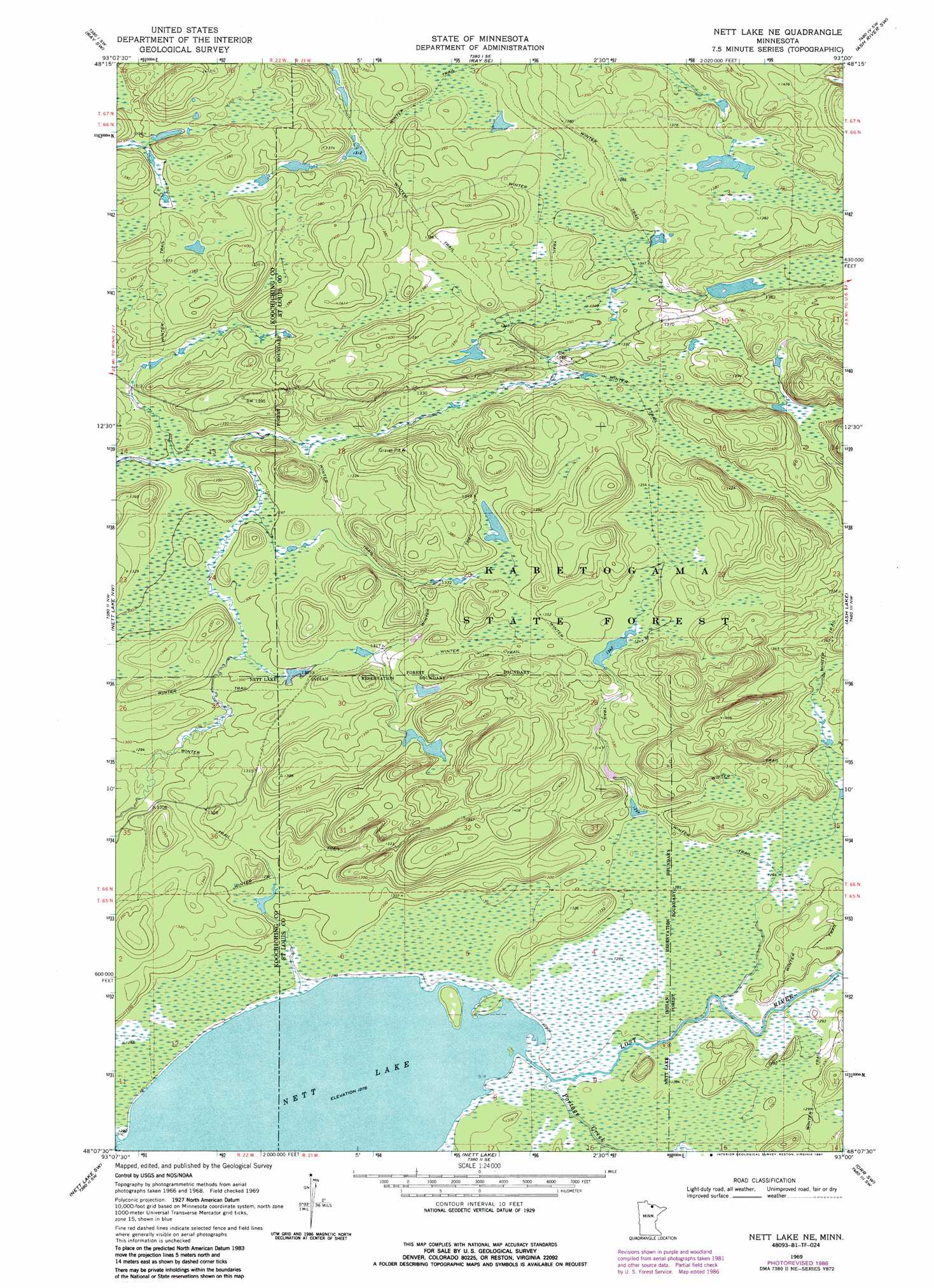
USGS Topo Quad 48093b1 - 1:24,000 scale
| Topo Map Name: | Nett Lake Ne |
| USGS Topo Quad ID: | 48093b1 |
| Print Size: | ca. 21 1/4" wide x 27" high |
| Southeast Coordinates: | 48.125° N latitude / 93° W longitude |
| Map Center Coordinates: | 48.1875° N latitude / 93.0625° W longitude |
| U.S. State: | MN |
| Filename: | o48093b1.jpg |
| Download Map JPG Image: | Nett Lake Ne topo map 1:24,000 scale |
| Map Type: | Topographic |
| Topo Series: | 7.5´ |
| Map Scale: | 1:24,000 |
| Source of Map Images: | United States Geological Survey (USGS) |
| Alternate Map Versions: |
Nett Lake NE MN 1969, updated 1971 Download PDF Buy paper map Nett Lake NE MN 1969, updated 1987 Download PDF Buy paper map Nett Lake NE MN 2011 Download PDF Buy paper map Nett Lake NE MN 2013 Download PDF Buy paper map Nett Lake NE MN 2016 Download PDF Buy paper map |
| FStopo: | US Forest Service topo Nett Lake NE is available: Download FStopo PDF Download FStopo TIF |
1:24,000 Topo Quads surrounding Nett Lake Ne
Ericsburg |
Ray |
Kabetogama |
Daley Bay |
Ash River Ne |
Ericsburg Se |
Ray Sw |
Ray Se |
Ash River Sw |
Ash River Se |
Nett Lake River East |
Nett Lake Nw |
Nett Lake Ne |
Ash Lake |
Orr Ne |
Nett Lake River Se |
Nett Lake Sw |
Nett Lake |
Orr Sw |
Orr |
Deer Lake Ne |
Rauch |
Silverdale |
Gheen Nw |
Gheen |
> Back to 48093a1 at 1:100,000 scale
> Back to 48092a1 at 1:250,000 scale
> Back to U.S. Topo Maps home
Nett Lake Ne topo map: Gazetteer
Nett Lake Ne: Streams
Lost River elevation 390m 1279′Portage Creek elevation 390m 1279′
Nett Lake Ne digital topo map on disk
Buy this Nett Lake Ne topo map showing relief, roads, GPS coordinates and other geographical features, as a high-resolution digital map file on DVD: