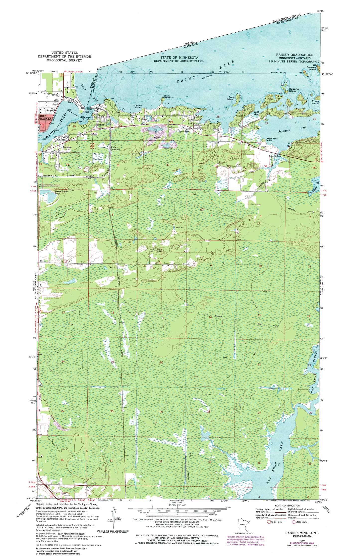
Ranier Topo Map Minnesota
To zoom in, hover over the map of Ranier
USGS Topo Quad 48093e3 - 1:24,000 scale
| Topo Map Name: | Ranier |
| USGS Topo Quad ID: | 48093e3 |
| Print Size: | ca. 21 1/4" wide x 27" high |
| Southeast Coordinates: | 48.5° N latitude / 93.25° W longitude |
| Map Center Coordinates: | 48.5625° N latitude / 93.3125° W longitude |
| U.S. State: | MN |
| Filename: | o48093e3.jpg |
| Download Map JPG Image: | Ranier topo map 1:24,000 scale |
| Map Type: | Topographic |
| Topo Series: | 7.5´ |
| Map Scale: | 1:24,000 |
| Source of Map Images: | United States Geological Survey (USGS) |
| Alternate Map Versions: |
Ranier MN 1963, updated 1987 Download PDF Buy paper map Ranier MN 1969, updated 1971 Download PDF Buy paper map Ranier MN 1969, updated 1983 Download PDF Buy paper map Ranier MN 1999, updated 2003 Download PDF Buy paper map Ranier MN 2010 Download PDF Buy paper map Ranier MN 2013 Download PDF Buy paper map Ranier MN 2016 Download PDF Buy paper map |
| FStopo: | US Forest Service topo Ranier is available: Download FStopo PDF Download FStopo TIF |
1:24,000 Topo Quads surrounding Ranier
Pelland |
International Falls |
Ranier |
Island View |
Cranberry Bay |
Littlefork |
Ericsburg Nw |
Ericsburg |
Ray |
Kabetogama |
Littlefork Se |
Ericsburg Sw |
Ericsburg Se |
Ray Sw |
Ray Se |
> Back to 48093e1 at 1:100,000 scale
> Back to 48092a1 at 1:250,000 scale
> Back to U.S. Topo Maps home
Ranier topo map: Gazetteer
Ranier: Airports
International Seaplane Base elevation 340m 1115′Ranier: Bays
Elks Bay elevation 338m 1108′Jackfish Bay elevation 338m 1108′
Sand Bay elevation 338m 1108′
Ranier: Capes
Birch Point elevation 340m 1115′High Rock Point elevation 338m 1108′
Ogard Point elevation 338m 1108′
Ranier: Islands
Enos Island elevation 339m 1112′Roberts Island elevation 338m 1108′
Ranier: Parks
Clarks Park elevation 342m 1122′Jackfish Bay Wayside Park elevation 346m 1135′
Ranier: Populated Places
Falls Junction elevation 344m 1128′Jameson elevation 341m 1118′
Ranier elevation 342m 1122′
Ranier: Post Offices
Ranier Post Office elevation 343m 1125′Ranier: Streams
Jackfish Creek elevation 338m 1108′Ranier digital topo map on disk
Buy this Ranier topo map showing relief, roads, GPS coordinates and other geographical features, as a high-resolution digital map file on DVD: