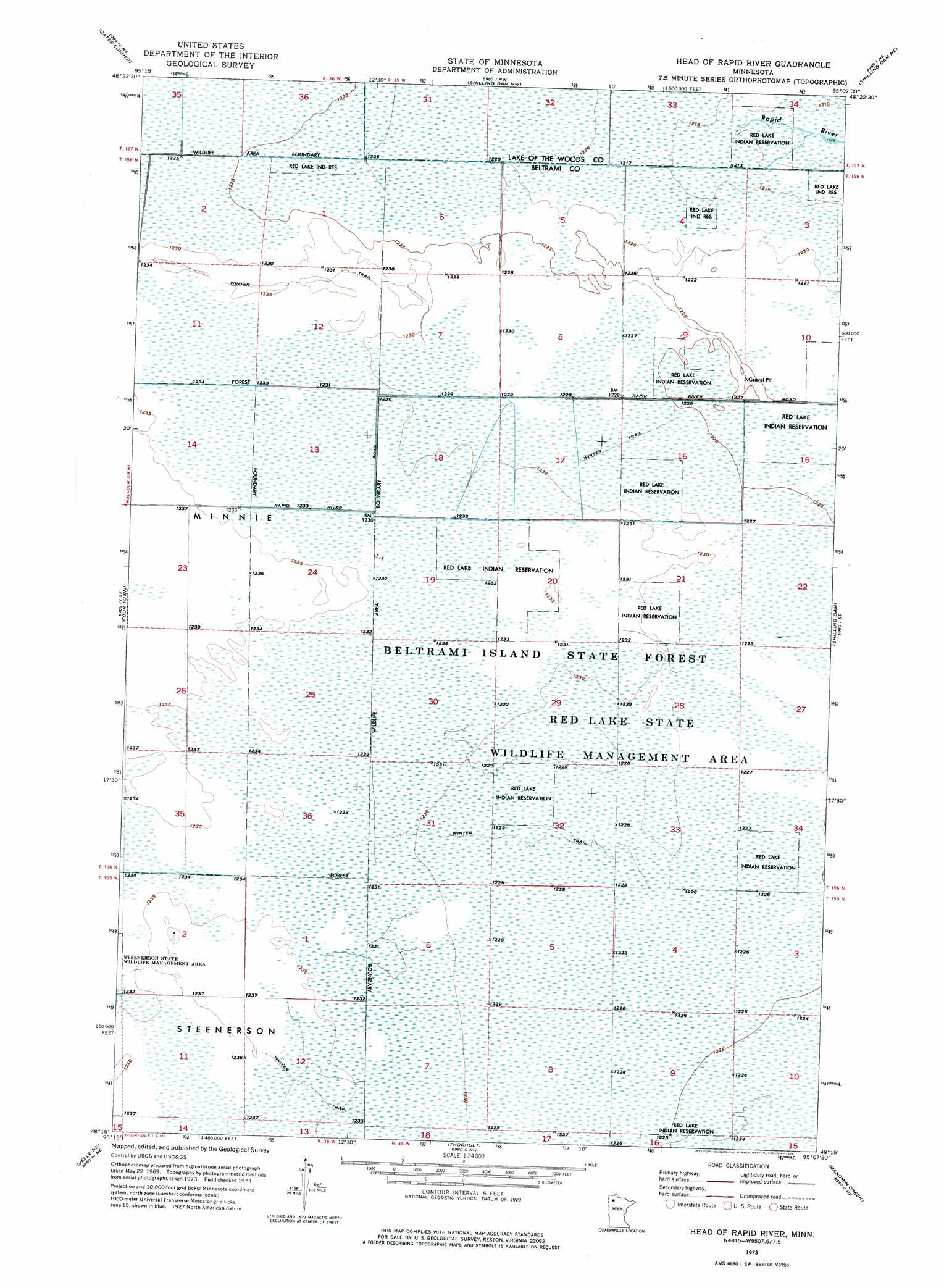
Head Of Rapid River Topo Map Minnesota
To zoom in, hover over the map of Head Of Rapid River
USGS Topo Quad 48095c2 - 1:24,000 scale
| Topo Map Name: | Head Of Rapid River |
| USGS Topo Quad ID: | 48095c2 |
| Print Size: | ca. 21 1/4" wide x 27" high |
| Southeast Coordinates: | 48.25° N latitude / 95.125° W longitude |
| Map Center Coordinates: | 48.3125° N latitude / 95.1875° W longitude |
| U.S. State: | MN |
| Filename: | p48095c2.jpg |
| Download Map JPG Image: | Head Of Rapid River topo map 1:24,000 scale |
| Map Type: | Orthophoto |
| Topo Series: | 7.5´ |
| Map Scale: | 1:24,000 |
| Source of Map Images: | United States Geological Survey (USGS) |
| Alternate Map Versions: |
Head of Rapid River MN 1973, updated 1976 Download PDF Buy paper map Head of Rapid River MN 2010 Download PDF Buy paper map Head of Rapid River MN 2013 Download PDF Buy paper map Head of Rapid River MN 2016 Download PDF Buy paper map |
1:24,000 Topo Quads surrounding Head Of Rapid River
Mulligan Lake Sw |
Mulligan Lake |
Winter Road Lake Sw |
Winter Road Lake Se |
Graceton Sw |
Four Town Nw |
Gates Corner |
Shilling Dam Nw |
Shilling Dam Ne |
Oaks Corner |
Carmel |
Four Town |
Head Of Rapid River |
Shilling Dam |
Oaks Corner Sw |
Jelle |
Jelle Ne |
Thorhult |
Manomin Creek |
Ponemah Nw |
Cahill Lake |
Gimiwan Lake |
Mosquito Creek |
Manomin Creek Se |
Ponemah |
> Back to 48095a1 at 1:100,000 scale
> Back to 48094a1 at 1:250,000 scale
> Back to U.S. Topo Maps home
Head Of Rapid River topo map: Gazetteer
Head Of Rapid River: Parks
Red Lake State Wildlife Management Area elevation 375m 1230′Head Of Rapid River: Post Offices
Shilling Post Office (historical) elevation 374m 1227′Head Of Rapid River digital topo map on disk
Buy this Head Of Rapid River topo map showing relief, roads, GPS coordinates and other geographical features, as a high-resolution digital map file on DVD: