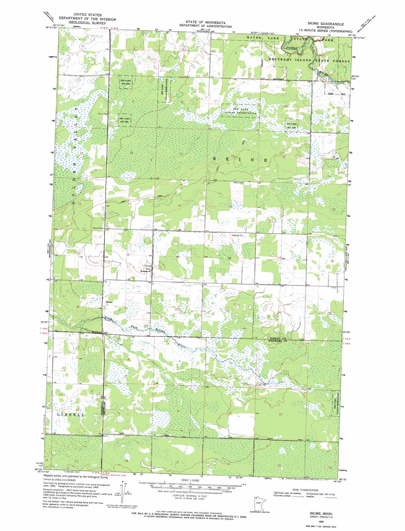
Skime Topo Map Minnesota
To zoom in, hover over the map of Skime
USGS Topo Quad 48095e5 - 1:24,000 scale
| Topo Map Name: | Skime |
| USGS Topo Quad ID: | 48095e5 |
| Print Size: | ca. 21 1/4" wide x 27" high |
| Southeast Coordinates: | 48.5° N latitude / 95.5° W longitude |
| Map Center Coordinates: | 48.5625° N latitude / 95.5625° W longitude |
| U.S. State: | MN |
| Filename: | o48095e5.jpg |
| Download Map JPG Image: | Skime topo map 1:24,000 scale |
| Map Type: | Topographic |
| Topo Series: | 7.5´ |
| Map Scale: | 1:24,000 |
| Source of Map Images: | United States Geological Survey (USGS) |
| Alternate Map Versions: |
Skime MN 1969, updated 1971 Download PDF Buy paper map Skime MN 2010 Download PDF Buy paper map Skime MN 2013 Download PDF Buy paper map Skime MN 2016 Download PDF Buy paper map |
1:24,000 Topo Quads surrounding Skime
Roseau |
Malung |
Salol |
Warroad Sw |
Warroad Se |
Thief Lake Ne |
Wannaska |
Wannaska Ne |
Mulligan Lake Nw |
Mulligan Lake Ne |
Thief Lake Se |
Wannaska Sw |
Skime |
Mulligan Lake Sw |
Mulligan Lake |
Gatzke |
Randeen Ridge |
Grygla Ne |
Four Town Nw |
Gates Corner |
Gatzke Se |
Grygla Sw |
Grygla |
Carmel |
Four Town |
> Back to 48095e1 at 1:100,000 scale
> Back to 48094a1 at 1:250,000 scale
> Back to U.S. Topo Maps home
Skime topo map: Gazetteer
Skime: Dams
Hayes Lake Dam elevation 362m 1187′Skime: Parks
Hayes Lake State Park elevation 365m 1197′Skime: Populated Places
Skime elevation 362m 1187′Skime: Post Offices
Skime Post Office (historical) elevation 362m 1187′Skime: Reservoirs
Hayes Lake elevation 362m 1187′Skime digital topo map on disk
Buy this Skime topo map showing relief, roads, GPS coordinates and other geographical features, as a high-resolution digital map file on DVD: