Warroad Sw Topo Map Minnesota
To zoom in, hover over the map of Warroad Sw
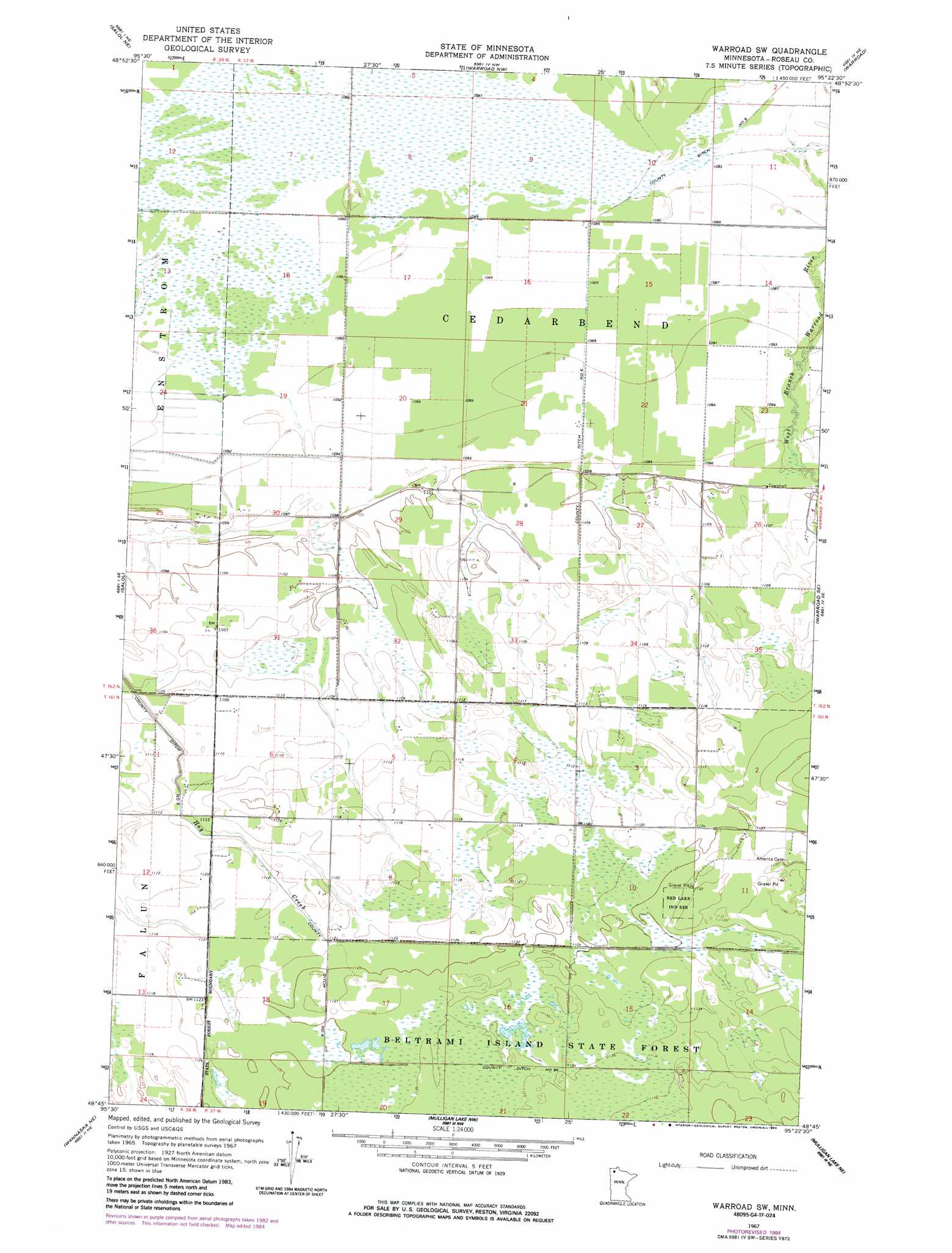
USGS Topo Quad 48095g4 - 1:24,000 scale
| Topo Map Name: | Warroad Sw |
| USGS Topo Quad ID: | 48095g4 |
| Print Size: | ca. 21 1/4" wide x 27" high |
| Southeast Coordinates: | 48.75° N latitude / 95.375° W longitude |
| Map Center Coordinates: | 48.8125° N latitude / 95.4375° W longitude |
| U.S. State: | MN |
| Filename: | o48095g4.jpg |
| Download Map JPG Image: | Warroad Sw topo map 1:24,000 scale |
| Map Type: | Topographic |
| Topo Series: | 7.5´ |
| Map Scale: | 1:24,000 |
| Source of Map Images: | United States Geological Survey (USGS) |
| Alternate Map Versions: |
Warroad SW MN 1967, updated 1969 Download PDF Buy paper map Warroad SW MN 1967, updated 1984 Download PDF Buy paper map Warroad SW MN 2010 Download PDF Buy paper map Warroad SW MN 2013 Download PDF Buy paper map Warroad SW MN 2016 Download PDF Buy paper map |
1:24,000 Topo Quads surrounding Warroad Sw
Salol Nw |
Salol Ne |
Warroad Nw |
Warroad |
Roosevelt Nw |
Malung |
Salol |
Warroad Sw |
Warroad Se |
Swift |
Wannaska |
Wannaska Ne |
Mulligan Lake Nw |
Mulligan Lake Ne |
Winter Road Lake Nw |
Wannaska Sw |
Skime |
Mulligan Lake Sw |
Mulligan Lake |
Winter Road Lake Sw |
> Back to 48095e1 at 1:100,000 scale
> Back to 48094a1 at 1:250,000 scale
> Back to U.S. Topo Maps home
Warroad Sw topo map: Gazetteer
Warroad Sw: Canals
County Ditch Number Nine elevation 336m 1102′County Ditch Number Six elevation 332m 1089′
County Ditch Number Twentyfour elevation 345m 1131′
Warroad Sw: Post Offices
Cedarbend Post Office (historical) elevation 336m 1102′Warroad Sw digital topo map on disk
Buy this Warroad Sw topo map showing relief, roads, GPS coordinates and other geographical features, as a high-resolution digital map file on DVD: