Malung Topo Map Minnesota
To zoom in, hover over the map of Malung
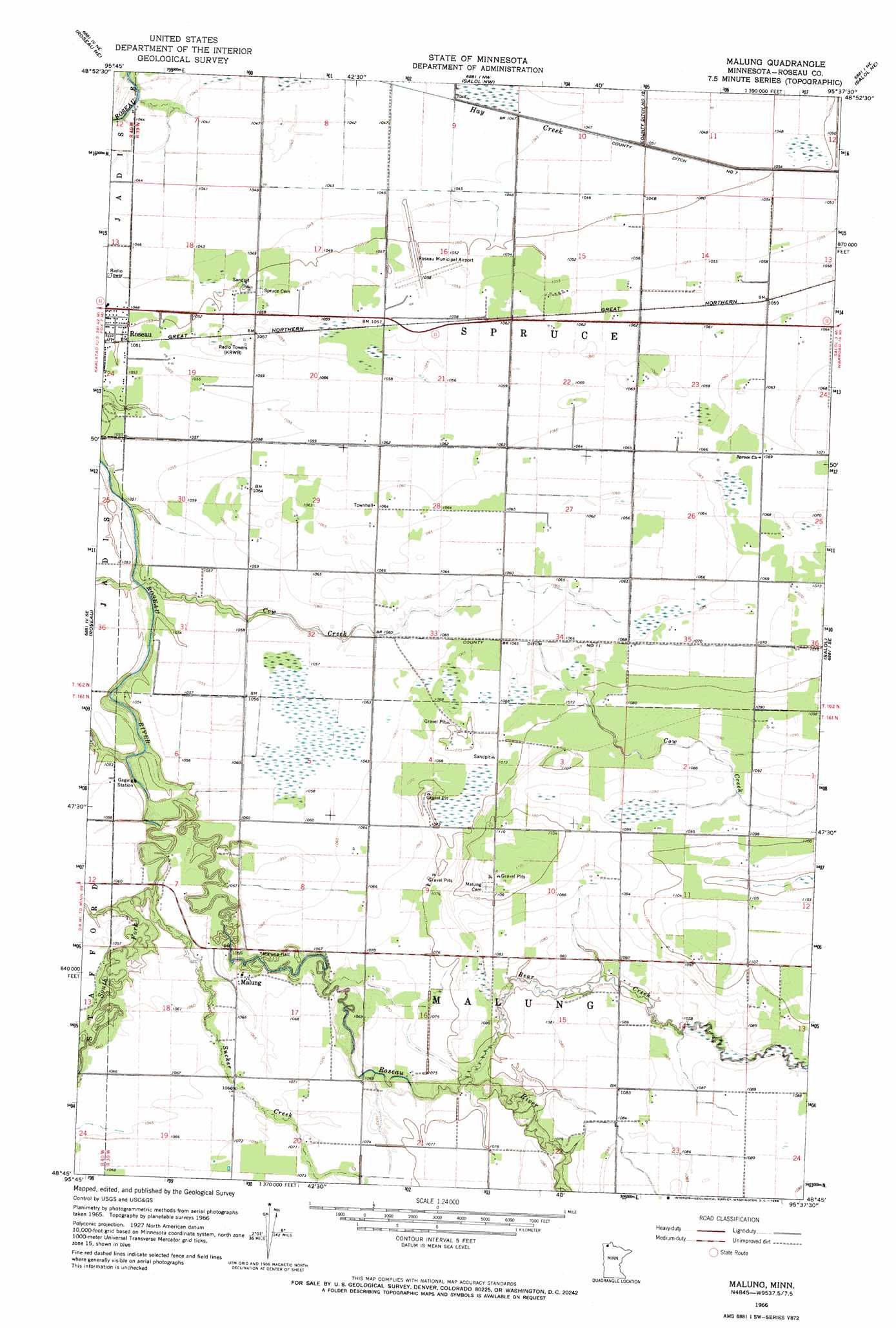
USGS Topo Quad 48095g6 - 1:24,000 scale
| Topo Map Name: | Malung |
| USGS Topo Quad ID: | 48095g6 |
| Print Size: | ca. 21 1/4" wide x 27" high |
| Southeast Coordinates: | 48.75° N latitude / 95.625° W longitude |
| Map Center Coordinates: | 48.8125° N latitude / 95.6875° W longitude |
| U.S. State: | MN |
| Filename: | o48095g6.jpg |
| Download Map JPG Image: | Malung topo map 1:24,000 scale |
| Map Type: | Topographic |
| Topo Series: | 7.5´ |
| Map Scale: | 1:24,000 |
| Source of Map Images: | United States Geological Survey (USGS) |
| Alternate Map Versions: |
Malung MN 1966, updated 1968 Download PDF Buy paper map Malung MN 2010 Download PDF Buy paper map Malung MN 2013 Download PDF Buy paper map Malung MN 2016 Download PDF Buy paper map |
1:24,000 Topo Quads surrounding Malung
Pinecreek |
Roseau Ne |
Salol Nw |
Salol Ne |
Warroad Nw |
Fox |
Roseau |
Malung |
Salol |
Warroad Sw |
Thief Lake Nw |
Thief Lake Ne |
Wannaska |
Wannaska Ne |
Mulligan Lake Nw |
Thief Lake |
Thief Lake Se |
Wannaska Sw |
Skime |
Mulligan Lake Sw |
> Back to 48095e1 at 1:100,000 scale
> Back to 48094a1 at 1:250,000 scale
> Back to U.S. Topo Maps home
Malung topo map: Gazetteer
Malung: Airports
Roseau Municipal Airport elevation 321m 1053′Malung: Canals
County Ditch Number Eleven elevation 325m 1066′Malung: Populated Places
Malung elevation 324m 1062′Mobile Court East elevation 320m 1049′
Malung: Post Offices
Malung Post Office (historical) elevation 324m 1062′Mandus Post Office (historical) elevation 324m 1062′
Malung: Streams
Bear Creek elevation 324m 1062′Cow Creek elevation 315m 1033′
South Fork Roseau River elevation 318m 1043′
Sucker Creek elevation 318m 1043′
Malung digital topo map on disk
Buy this Malung topo map showing relief, roads, GPS coordinates and other geographical features, as a high-resolution digital map file on DVD: