Roseau Topo Map Minnesota
To zoom in, hover over the map of Roseau
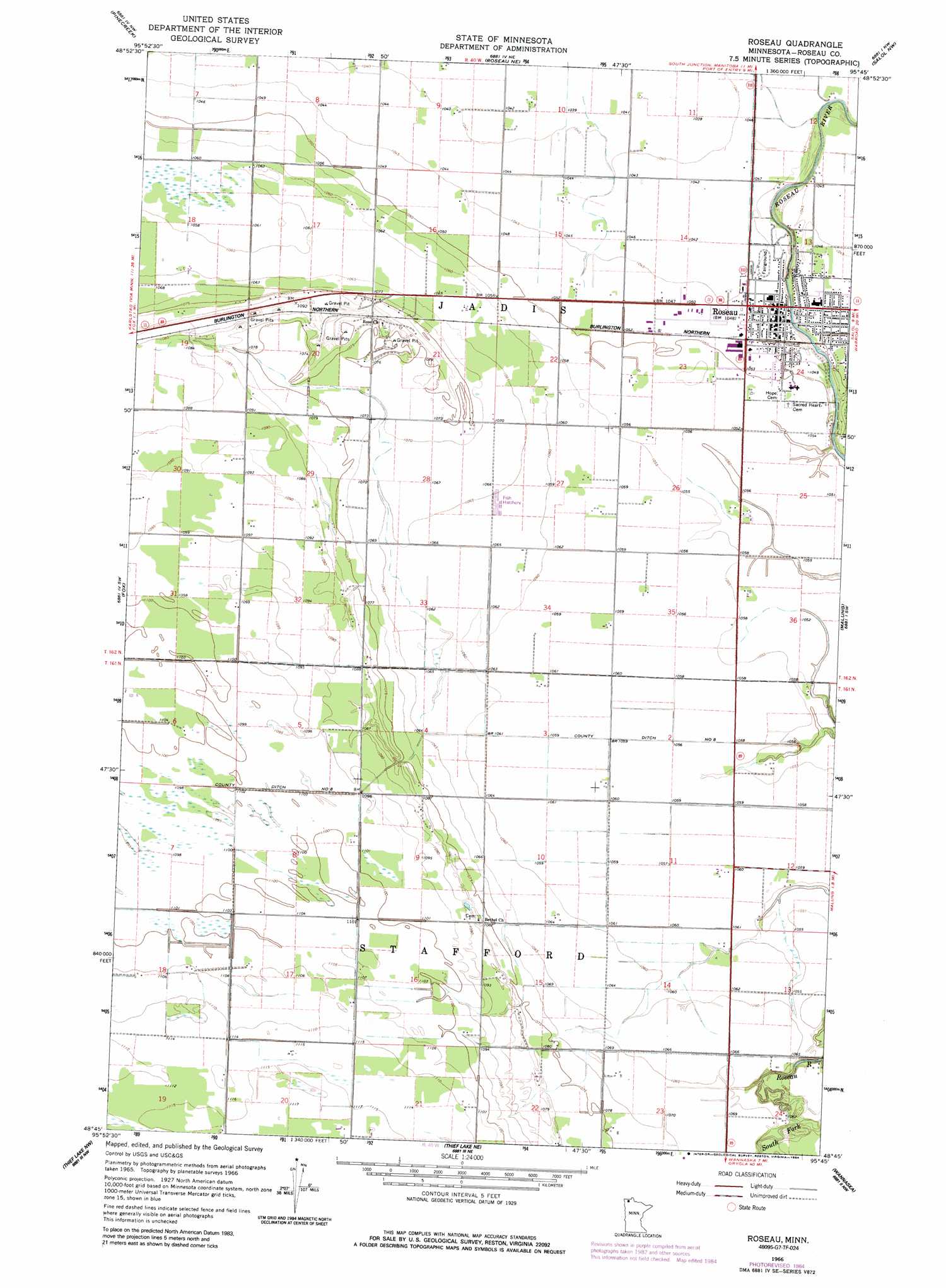
USGS Topo Quad 48095g7 - 1:24,000 scale
| Topo Map Name: | Roseau |
| USGS Topo Quad ID: | 48095g7 |
| Print Size: | ca. 21 1/4" wide x 27" high |
| Southeast Coordinates: | 48.75° N latitude / 95.75° W longitude |
| Map Center Coordinates: | 48.8125° N latitude / 95.8125° W longitude |
| U.S. State: | MN |
| Filename: | o48095g7.jpg |
| Download Map JPG Image: | Roseau topo map 1:24,000 scale |
| Map Type: | Topographic |
| Topo Series: | 7.5´ |
| Map Scale: | 1:24,000 |
| Source of Map Images: | United States Geological Survey (USGS) |
| Alternate Map Versions: |
Roseau MN 1966, updated 1968 Download PDF Buy paper map Roseau MN 1966, updated 1984 Download PDF Buy paper map Roseau MN 2010 Download PDF Buy paper map Roseau MN 2013 Download PDF Buy paper map Roseau MN 2016 Download PDF Buy paper map |
1:24,000 Topo Quads surrounding Roseau
Badger Ne |
Pinecreek |
Roseau Ne |
Salol Nw |
Salol Ne |
Badger |
Fox |
Roseau |
Malung |
Salol |
Greenbush Ne |
Thief Lake Nw |
Thief Lake Ne |
Wannaska |
Wannaska Ne |
Greenbush Se |
Thief Lake |
Thief Lake Se |
Wannaska Sw |
Skime |
> Back to 48095e1 at 1:100,000 scale
> Back to 48094a1 at 1:250,000 scale
> Back to U.S. Topo Maps home
Roseau topo map: Gazetteer
Roseau: Canals
County Ditch Number Eight elevation 322m 1056′Roseau: Parks
Roseau City Park elevation 319m 1046′Roseau: Populated Places
Oak Manor Mobile Home Village elevation 320m 1049′Roseau elevation 320m 1049′
West Side Trailer Court elevation 319m 1046′
Roseau: Post Offices
Dawd Post Office (historical) elevation 340m 1115′Roseau Post Office elevation 319m 1046′
Roseau digital topo map on disk
Buy this Roseau topo map showing relief, roads, GPS coordinates and other geographical features, as a high-resolution digital map file on DVD: