Warroad Topo Map Minnesota
To zoom in, hover over the map of Warroad
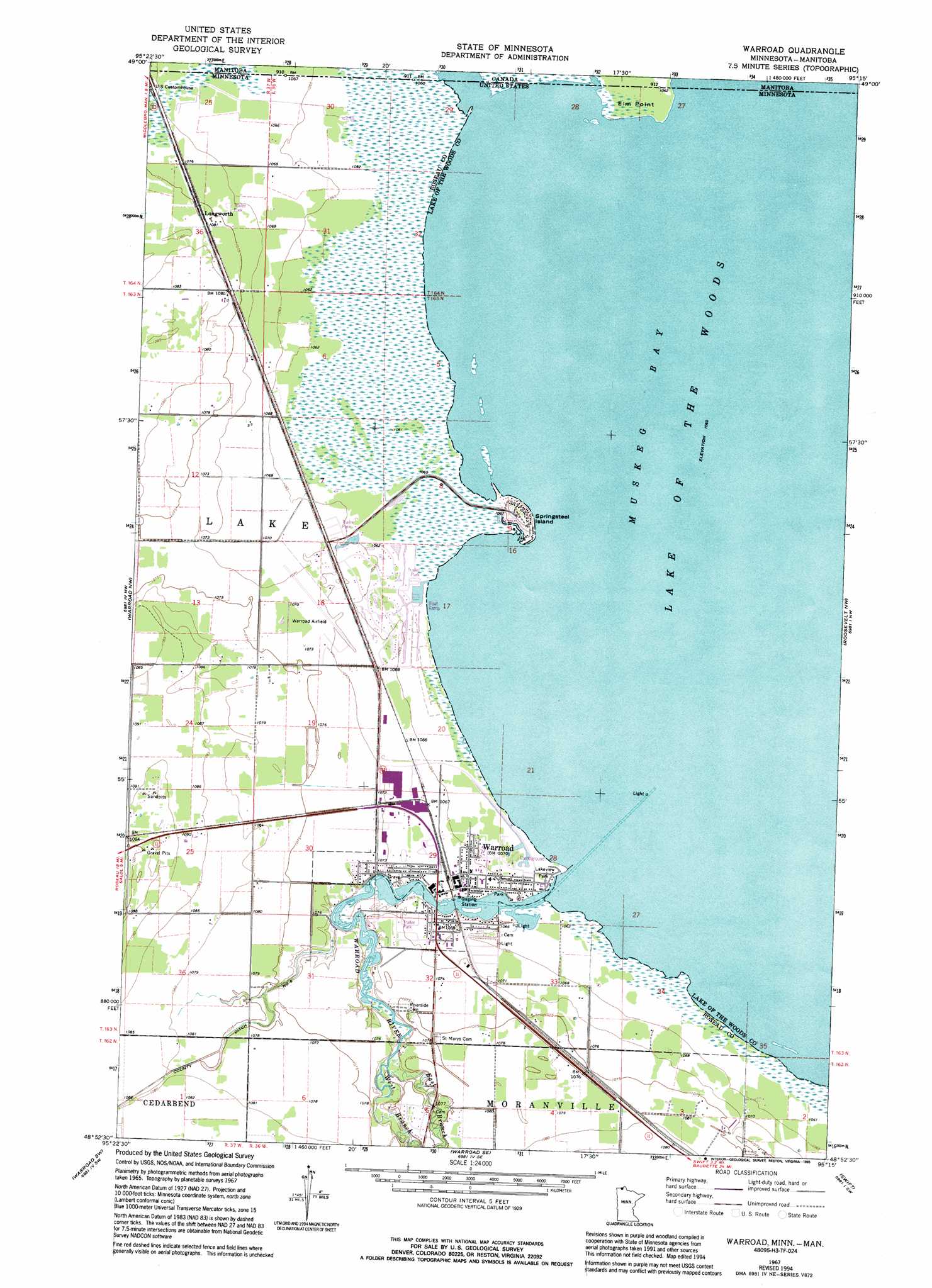
USGS Topo Quad 48095h3 - 1:24,000 scale
| Topo Map Name: | Warroad |
| USGS Topo Quad ID: | 48095h3 |
| Print Size: | ca. 21 1/4" wide x 27" high |
| Southeast Coordinates: | 48.875° N latitude / 95.25° W longitude |
| Map Center Coordinates: | 48.9375° N latitude / 95.3125° W longitude |
| U.S. State: | MN |
| Filename: | o48095h3.jpg |
| Download Map JPG Image: | Warroad topo map 1:24,000 scale |
| Map Type: | Topographic |
| Topo Series: | 7.5´ |
| Map Scale: | 1:24,000 |
| Source of Map Images: | United States Geological Survey (USGS) |
| Alternate Map Versions: |
Warroad MN 1967, updated 1969 Download PDF Buy paper map Warroad MN 1967, updated 1988 Download PDF Buy paper map Warroad MN 1967, updated 1995 Download PDF Buy paper map Warroad MN 2010 Download PDF Buy paper map Warroad MN 2013 Download PDF Buy paper map Warroad MN 2016 Download PDF Buy paper map |
1:24,000 Topo Quads surrounding Warroad
Buffalo Bay Nw |
Buffalo Bay Ne |
|||
Salol Ne |
Warroad Nw |
Warroad |
Roosevelt Nw |
Roosevelt Ne |
Salol |
Warroad Sw |
Warroad Se |
Swift |
Roosevelt |
Wannaska Ne |
Mulligan Lake Nw |
Mulligan Lake Ne |
Winter Road Lake Nw |
Winter Road Lake |
> Back to 48095e1 at 1:100,000 scale
> Back to 48094a1 at 1:250,000 scale
> Back to U.S. Topo Maps home
Warroad topo map: Gazetteer
Warroad: Airports
Warroad International-Swede Carlson Field elevation 327m 1072′Warroad: Capes
Elm Point elevation 325m 1066′Warroad: Islands
Springsteel Island elevation 327m 1072′Warroad: Parks
Fort Saint Charles Historical Marker elevation 325m 1066′Lakeview Park elevation 325m 1066′
Warroad City Park elevation 325m 1066′
Warroad Fur Post Historical Marker elevation 325m 1066′
Warroad Historical Marker elevation 325m 1066′
Warroad: Populated Places
Countryside Trailer Park elevation 326m 1069′Lakewood Trailer Park elevation 325m 1066′
Liberty Trailer Park elevation 325m 1066′
Longworth elevation 328m 1076′
North Star Court elevation 325m 1066′
Warroad elevation 325m 1066′
Warroad: Post Offices
Warroad Post Office elevation 325m 1066′Warroad: Streams
East Branch Warroad River elevation 324m 1062′Warroad River elevation 324m 1062′
West Branch Warroad River elevation 324m 1062′
Warroad digital topo map on disk
Buy this Warroad topo map showing relief, roads, GPS coordinates and other geographical features, as a high-resolution digital map file on DVD: