Holt Topo Map Minnesota
To zoom in, hover over the map of Holt
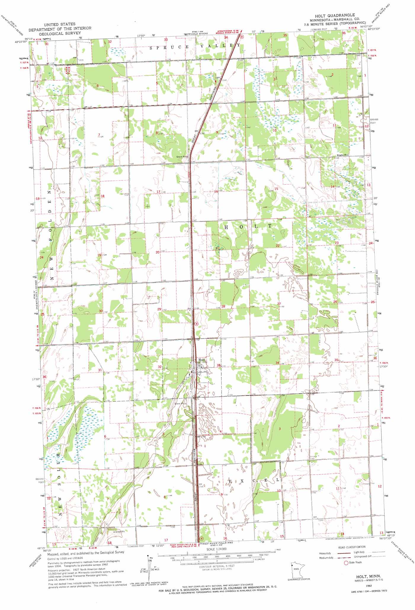
USGS Topo Quad 48096c2 - 1:24,000 scale
| Topo Map Name: | Holt |
| USGS Topo Quad ID: | 48096c2 |
| Print Size: | ca. 21 1/4" wide x 27" high |
| Southeast Coordinates: | 48.25° N latitude / 96.125° W longitude |
| Map Center Coordinates: | 48.3125° N latitude / 96.1875° W longitude |
| U.S. State: | MN |
| Filename: | o48096c2.jpg |
| Download Map JPG Image: | Holt topo map 1:24,000 scale |
| Map Type: | Topographic |
| Topo Series: | 7.5´ |
| Map Scale: | 1:24,000 |
| Source of Map Images: | United States Geological Survey (USGS) |
| Alternate Map Versions: |
Holt MN 1962, updated 1964 Download PDF Buy paper map Holt MN 2010 Download PDF Buy paper map Holt MN 2013 Download PDF Buy paper map Holt MN 2016 Download PDF Buy paper map |
1:24,000 Topo Quads surrounding Holt
Twistal Swamp |
Pelan Se |
Strathcona |
Greenbush Se |
Thief Lake |
Strandquist |
Nelson Slough |
Middle River |
Middle River Ne |
Gatzke Nw |
Ellerth |
Newfolden |
Holt |
Middle River Se |
Gatzke Sw |
Viking |
Rosewood |
Thief River Falls Nw |
Thief River Falls Ne |
Mavie |
Viking Sw |
Viking Se |
Thief River Falls |
Hazel |
Goodridge Sw |
> Back to 48096a1 at 1:100,000 scale
> Back to 48096a1 at 1:250,000 scale
> Back to U.S. Topo Maps home
Holt topo map: Gazetteer
Holt: Populated Places
Holt elevation 352m 1154′Holt: Post Offices
Holt Post Office (historical) elevation 352m 1154′Manor Post Office (historical) elevation 349m 1145′
Ringbo Post Office (historical) elevation 345m 1131′
Holt digital topo map on disk
Buy this Holt topo map showing relief, roads, GPS coordinates and other geographical features, as a high-resolution digital map file on DVD:
Eastern North Dakota & Eastern South Dakota
Buy digital topo maps: Eastern North Dakota & Eastern South Dakota