Badger Topo Map Minnesota
To zoom in, hover over the map of Badger
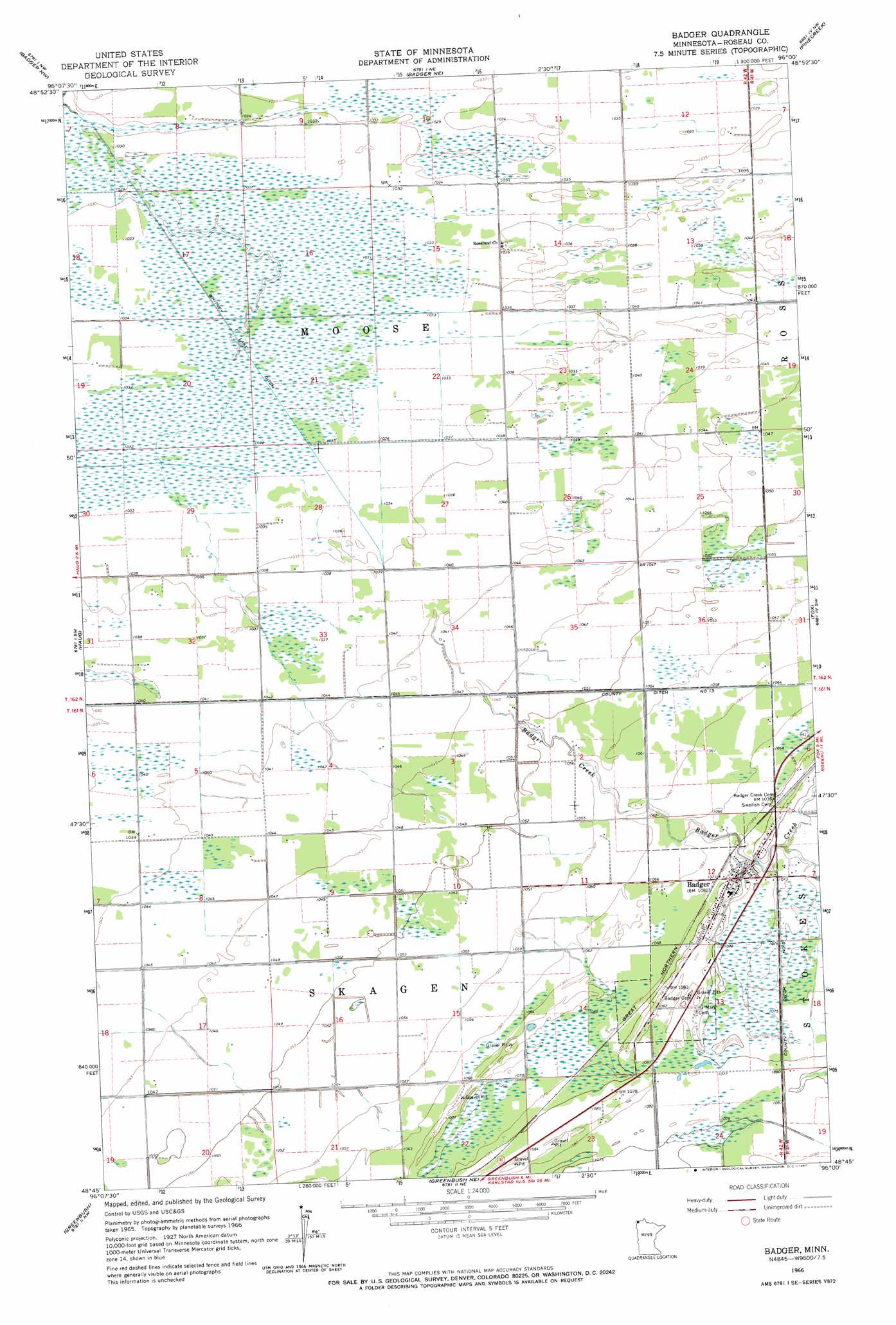
USGS Topo Quad 48096g1 - 1:24,000 scale
| Topo Map Name: | Badger |
| USGS Topo Quad ID: | 48096g1 |
| Print Size: | ca. 21 1/4" wide x 27" high |
| Southeast Coordinates: | 48.75° N latitude / 96° W longitude |
| Map Center Coordinates: | 48.8125° N latitude / 96.0625° W longitude |
| U.S. State: | MN |
| Filename: | o48096g1.jpg |
| Download Map JPG Image: | Badger topo map 1:24,000 scale |
| Map Type: | Topographic |
| Topo Series: | 7.5´ |
| Map Scale: | 1:24,000 |
| Source of Map Images: | United States Geological Survey (USGS) |
| Alternate Map Versions: |
Badger MN 1966, updated 1967 Download PDF Buy paper map Badger MN 2010 Download PDF Buy paper map Badger MN 2013 Download PDF Buy paper map Badger MN 2016 Download PDF Buy paper map |
1:24,000 Topo Quads surrounding Badger
Caribou Ne |
Badger Nw |
Badger Ne |
Pinecreek |
Roseau Ne |
Leo |
Haug |
Badger |
Fox |
Roseau |
Pelan Ne |
Greenbush |
Greenbush Ne |
Thief Lake Nw |
Thief Lake Ne |
Pelan Se |
Strathcona |
Greenbush Se |
Thief Lake |
Thief Lake Se |
> Back to 48096e1 at 1:100,000 scale
> Back to 48096a1 at 1:250,000 scale
> Back to U.S. Topo Maps home
Badger topo map: Gazetteer
Badger: Canals
County Ditch Number Five elevation 327m 1072′Whitney Lake Ditch elevation 314m 1030′
Badger: Populated Places
Badger elevation 330m 1082′Oak View Mobile Home Park elevation 329m 1079′
Palisade Mobile Home Park elevation 329m 1079′
Pioneer Mobile Home Park elevation 330m 1082′
Badger: Post Offices
Badger Post Office elevation 329m 1079′Lolita Post Office (historical) elevation 314m 1030′
Badger: Streams
Badger Creek elevation 317m 1040′Badger digital topo map on disk
Buy this Badger topo map showing relief, roads, GPS coordinates and other geographical features, as a high-resolution digital map file on DVD:
Eastern North Dakota & Eastern South Dakota
Buy digital topo maps: Eastern North Dakota & Eastern South Dakota