Lancaster Topo Map Minnesota
To zoom in, hover over the map of Lancaster
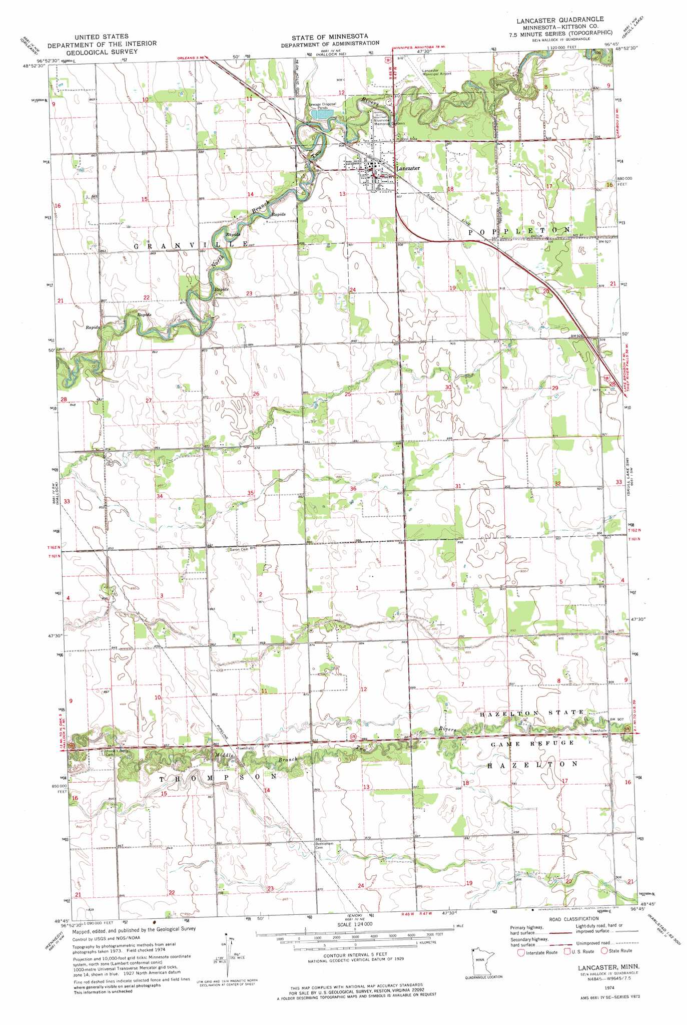
USGS Topo Quad 48096g7 - 1:24,000 scale
| Topo Map Name: | Lancaster |
| USGS Topo Quad ID: | 48096g7 |
| Print Size: | ca. 21 1/4" wide x 27" high |
| Southeast Coordinates: | 48.75° N latitude / 96.75° W longitude |
| Map Center Coordinates: | 48.8125° N latitude / 96.8125° W longitude |
| U.S. State: | MN |
| Filename: | o48096g7.jpg |
| Download Map JPG Image: | Lancaster topo map 1:24,000 scale |
| Map Type: | Topographic |
| Topo Series: | 7.5´ |
| Map Scale: | 1:24,000 |
| Source of Map Images: | United States Geological Survey (USGS) |
| Alternate Map Versions: |
Lancaster MN 1974, updated 1976 Download PDF Buy paper map Lancaster MN 2010 Download PDF Buy paper map Lancaster MN 2013 Download PDF Buy paper map Lancaster MN 2016 Download PDF Buy paper map |
1:24,000 Topo Quads surrounding Lancaster
Humboldt |
Orleans |
Hallock Ne |
Skull Lake |
Skull Lake Ne |
Hill Siding |
Hallock |
Lancaster |
Skull Lake Sw |
Skull Lake Se |
Mattson |
Kennedy |
Enok |
Lake Bronson |
Halma |
Drayton Se |
Donaldson |
Kennedy Se |
Karlstad Sw |
Karlstad |
> Back to 48096e1 at 1:100,000 scale
> Back to 48096a1 at 1:250,000 scale
> Back to U.S. Topo Maps home
Lancaster topo map: Gazetteer
Lancaster: Canals
Judicial Ditch Number Eightyfour elevation 277m 908′Lancaster: Parks
Hazelton State Game Refuge elevation 274m 898′Lancaster: Populated Places
Lancaster elevation 277m 908′Lancaster: Post Offices
Bonish Post Office (historical) elevation 268m 879′Lancaster Post Office elevation 277m 908′
Lancaster digital topo map on disk
Buy this Lancaster topo map showing relief, roads, GPS coordinates and other geographical features, as a high-resolution digital map file on DVD:
Eastern North Dakota & Eastern South Dakota
Buy digital topo maps: Eastern North Dakota & Eastern South Dakota