Badger Ne Topo Map Minnesota
To zoom in, hover over the map of Badger Ne
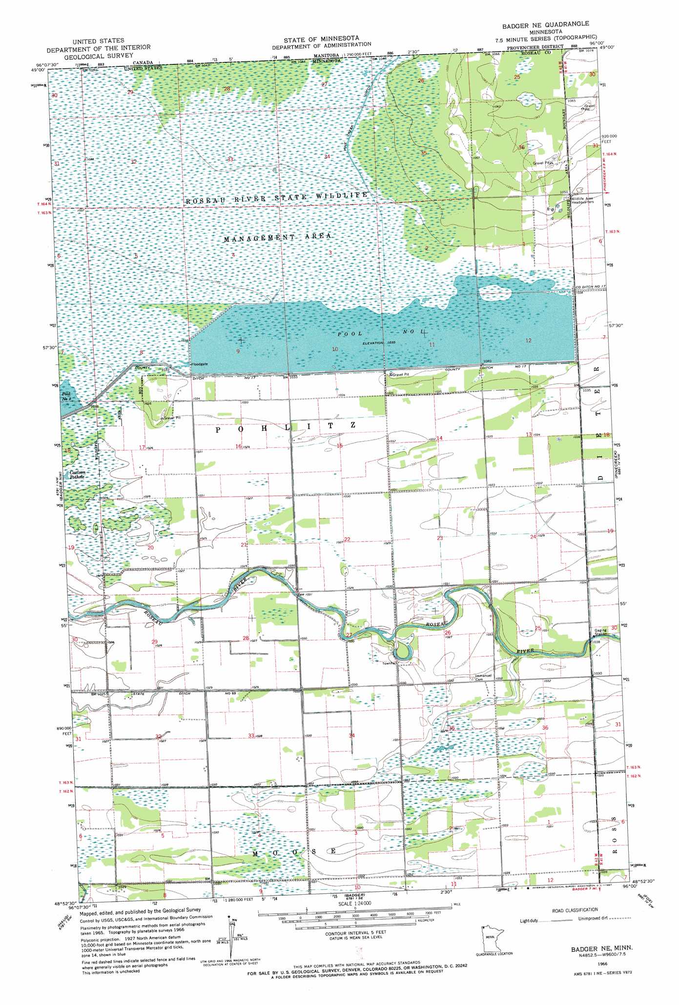
USGS Topo Quad 48096h1 - 1:24,000 scale
| Topo Map Name: | Badger Ne |
| USGS Topo Quad ID: | 48096h1 |
| Print Size: | ca. 21 1/4" wide x 27" high |
| Southeast Coordinates: | 48.875° N latitude / 96° W longitude |
| Map Center Coordinates: | 48.9375° N latitude / 96.0625° W longitude |
| U.S. State: | MN |
| Filename: | o48096h1.jpg |
| Download Map JPG Image: | Badger Ne topo map 1:24,000 scale |
| Map Type: | Topographic |
| Topo Series: | 7.5´ |
| Map Scale: | 1:24,000 |
| Source of Map Images: | United States Geological Survey (USGS) |
| Alternate Map Versions: |
Badger NE MN 1966, updated 1967 Download PDF Buy paper map Badger NE MN 2010 Download PDF Buy paper map Badger NE MN 2013 Download PDF Buy paper map Badger NE MN 2016 Download PDF Buy paper map |
1:24,000 Topo Quads surrounding Badger Ne
Caribou Ne |
Badger Nw |
Badger Ne |
Pinecreek |
Roseau Ne |
Leo |
Haug |
Badger |
Fox |
Roseau |
Pelan Ne |
Greenbush |
Greenbush Ne |
Thief Lake Nw |
Thief Lake Ne |
> Back to 48096e1 at 1:100,000 scale
> Back to 48096a1 at 1:250,000 scale
> Back to U.S. Topo Maps home
Badger Ne topo map: Gazetteer
Badger Ne: Canals
County Ditch Number Seventeen elevation 316m 1036′Pine Creek Ditch elevation 318m 1043′
Badger Ne: Dams
Roseau River Wildlife Management Area Pool 1 Dam elevation 316m 1036′Badger Ne: Post Offices
Duxby Post Office (historical) elevation 314m 1030′Badger Ne: Reservoirs
Pool 1 elevation 316m 1036′Pool Number One elevation 316m 1036′
Badger Ne digital topo map on disk
Buy this Badger Ne topo map showing relief, roads, GPS coordinates and other geographical features, as a high-resolution digital map file on DVD:
Eastern North Dakota & Eastern South Dakota
Buy digital topo maps: Eastern North Dakota & Eastern South Dakota