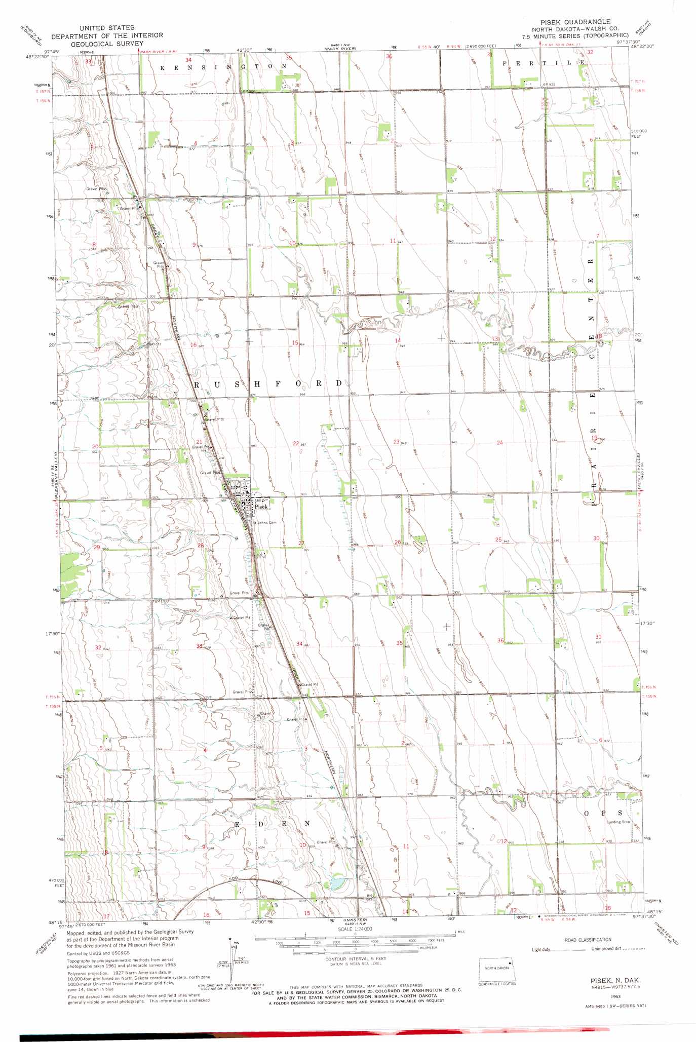
Pisek Topo Map North Dakota
To zoom in, hover over the map of Pisek
USGS Topo Quad 48097c6 - 1:24,000 scale
| Topo Map Name: | Pisek |
| USGS Topo Quad ID: | 48097c6 |
| Print Size: | ca. 21 1/4" wide x 27" high |
| Southeast Coordinates: | 48.25° N latitude / 97.625° W longitude |
| Map Center Coordinates: | 48.3125° N latitude / 97.6875° W longitude |
| U.S. State: | ND |
| Filename: | O48097C6.jpg |
| Download Map JPG Image: | Pisek topo map 1:24,000 scale |
| Map Type: | Topographic |
| Topo Series: | 7.5´ |
| Map Scale: | 1:24,000 |
| Source of Map Images: | United States Geological Survey (USGS) |
| Alternate Map Versions: |
Pisek ND 1963, updated 1964 Download PDF Buy paper map Pisek ND 2011 Download PDF Buy paper map Pisek ND 2014 Download PDF Buy paper map |
1:24,000 Topo Quads surrounding Pisek
Union |
Gardar |
Crystal |
Crystal Se |
Saint Thomas |
Edinburg Nw |
Edinburg |
Park River |
Nash |
Grafton |
Lankin |
Pleasant Valley |
Pisek |
Veseleyville |
Voss |
Dahlen |
Fordville |
Inkster |
Inkster Ne |
Forest River |
Fordville Sw |
Fordville Se |
Orr |
Inkster Se |
Gilby |
> Back to 48097a1 at 1:100,000 scale
> Back to 48096a1 at 1:250,000 scale
> Back to U.S. Topo Maps home
Pisek digital topo map on disk
Buy this Pisek topo map showing relief, roads, GPS coordinates and other geographical features, as a high-resolution digital map file on DVD:
Eastern North Dakota & Eastern South Dakota
Buy digital topo maps: Eastern North Dakota & Eastern South Dakota