Concrete Topo Map North Dakota
To zoom in, hover over the map of Concrete
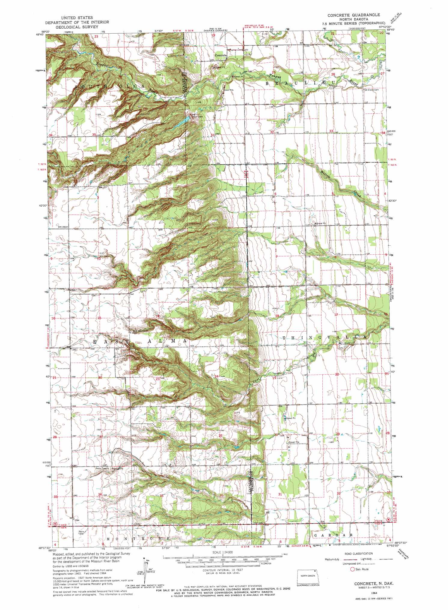
USGS Topo Quad 48097f8 - 1:24,000 scale
| Topo Map Name: | Concrete |
| USGS Topo Quad ID: | 48097f8 |
| Print Size: | ca. 21 1/4" wide x 27" high |
| Southeast Coordinates: | 48.625° N latitude / 97.875° W longitude |
| Map Center Coordinates: | 48.6875° N latitude / 97.9375° W longitude |
| U.S. State: | ND |
| Filename: | O48097F8.jpg |
| Download Map JPG Image: | Concrete topo map 1:24,000 scale |
| Map Type: | Topographic |
| Topo Series: | 7.5´ |
| Map Scale: | 1:24,000 |
| Source of Map Images: | United States Geological Survey (USGS) |
| Alternate Map Versions: |
Concrete ND 1964, updated 1965 Download PDF Buy paper map Concrete ND 2011 Download PDF Buy paper map Concrete ND 2014 Download PDF Buy paper map |
1:24,000 Topo Quads surrounding Concrete
Olga Nw |
Vang |
Walhalla |
Leroy |
Cavalier Nw |
Olga Sw |
Olga |
Hanks Corner |
Hallson |
Backoo |
Osnabrock |
Milton |
Concrete |
Mountain |
Hensel |
Osnabrock Sw |
Waterloo Lake |
Union |
Gardar |
Crystal |
Fairdale |
Adams |
Edinburg Nw |
Edinburg |
Park River |
> Back to 48097e1 at 1:100,000 scale
> Back to 48096a1 at 1:250,000 scale
> Back to U.S. Topo Maps home
Concrete digital topo map on disk
Buy this Concrete topo map showing relief, roads, GPS coordinates and other geographical features, as a high-resolution digital map file on DVD:
Eastern North Dakota & Eastern South Dakota
Buy digital topo maps: Eastern North Dakota & Eastern South Dakota