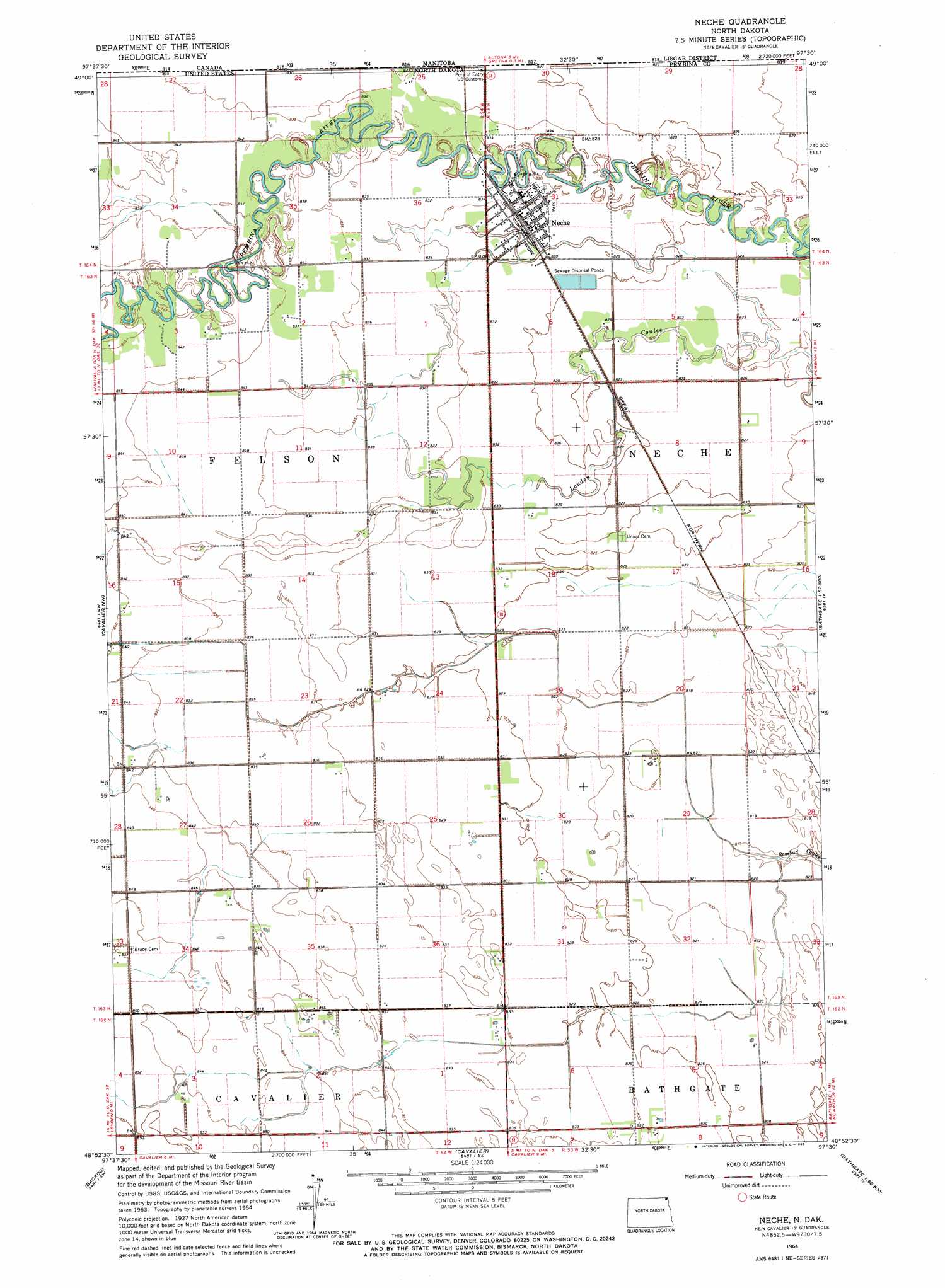
Neche Topo Map North Dakota
To zoom in, hover over the map of Neche
USGS Topo Quad 48097h5 - 1:24,000 scale
| Topo Map Name: | Neche |
| USGS Topo Quad ID: | 48097h5 |
| Print Size: | ca. 21 1/4" wide x 27" high |
| Southeast Coordinates: | 48.875° N latitude / 97.5° W longitude |
| Map Center Coordinates: | 48.9375° N latitude / 97.5625° W longitude |
| U.S. State: | ND |
| Filename: | O48097H5.jpg |
| Download Map JPG Image: | Neche topo map 1:24,000 scale |
| Map Type: | Topographic |
| Topo Series: | 7.5´ |
| Map Scale: | 1:24,000 |
| Source of Map Images: | United States Geological Survey (USGS) |
| Alternate Map Versions: |
Neche ND 1964, updated 1965 Download PDF Buy paper map Neche ND 2011 Download PDF Buy paper map Neche ND 2014 Download PDF Buy paper map |
1:24,000 Topo Quads surrounding Neche
Leroy |
Cavalier Nw |
Neche |
Bathgate |
Bathgate Ne |
Hallson |
Backoo |
Cavalier |
Hamilton |
Bathgate Se |
Mountain |
Hensel |
Crystal Ne |
Glasston |
Glasston Ne |
> Back to 48097e1 at 1:100,000 scale
> Back to 48096a1 at 1:250,000 scale
> Back to U.S. Topo Maps home
Neche topo map: Gazetteer
Neche: Dams
Neche Dam elevation 250m 820′Neche: Populated Places
Neche elevation 251m 823′Ottention (historical) elevation 253m 830′
Neche digital topo map on disk
Buy this Neche topo map showing relief, roads, GPS coordinates and other geographical features, as a high-resolution digital map file on DVD:
Eastern North Dakota & Eastern South Dakota
Buy digital topo maps: Eastern North Dakota & Eastern South Dakota