Lakota Topo Map North Dakota
To zoom in, hover over the map of Lakota
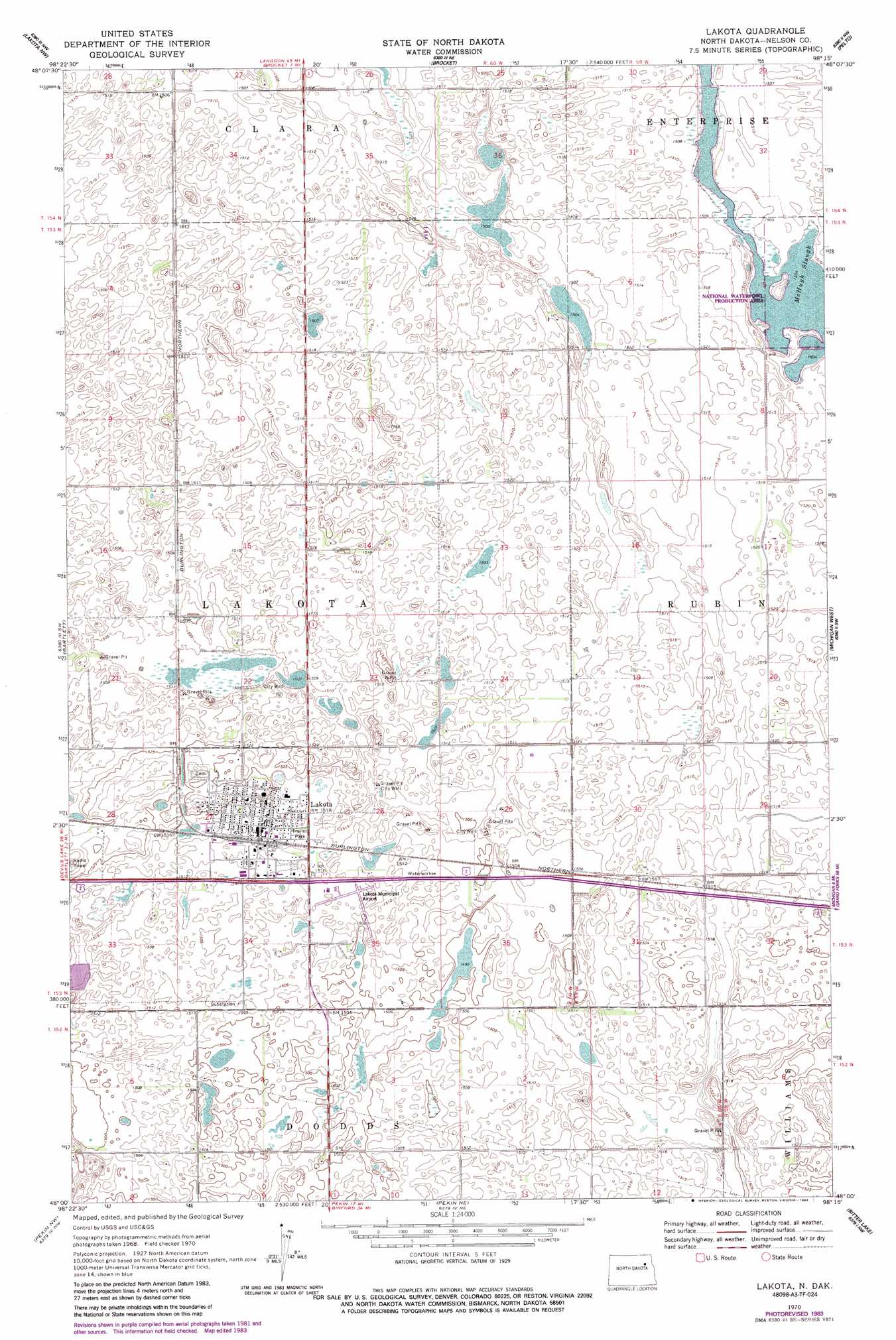
USGS Topo Quad 48098a3 - 1:24,000 scale
| Topo Map Name: | Lakota |
| USGS Topo Quad ID: | 48098a3 |
| Print Size: | ca. 21 1/4" wide x 27" high |
| Southeast Coordinates: | 48° N latitude / 98.25° W longitude |
| Map Center Coordinates: | 48.0625° N latitude / 98.3125° W longitude |
| U.S. State: | ND |
| Filename: | O48098A3.jpg |
| Download Map JPG Image: | Lakota topo map 1:24,000 scale |
| Map Type: | Topographic |
| Topo Series: | 7.5´ |
| Map Scale: | 1:24,000 |
| Source of Map Images: | United States Geological Survey (USGS) |
| Alternate Map Versions: |
Lakota ND 1970, updated 1972 Download PDF Buy paper map Lakota ND 1970, updated 1984 Download PDF Buy paper map Lakota ND 2011 Download PDF Buy paper map Lakota ND 2014 Download PDF Buy paper map |
1:24,000 Topo Quads surrounding Lakota
Derrick Se |
Edmore Sw |
Lawton |
Adams Sw |
Adams Se |
Southam |
Lakota Nw |
Brocket |
Pelto |
Whitman |
Doyon |
Bartlett |
Lakota |
Michigan West |
Michigan East |
Devils Lake Mountain |
Pekin Nw |
Pekin Ne |
Bitter Lake |
Lambs Lake |
Hamar |
Tolna |
Pekin |
Mcville |
Mcville Se |
> Back to 48098a1 at 1:100,000 scale
> Back to 48098a1 at 1:250,000 scale
> Back to U.S. Topo Maps home
Lakota topo map: Gazetteer
Lakota: Airports
Lakota Municipal Airport elevation 458m 1502′Lakota: Lakes
McHugh Slough elevation 459m 1505′Lakota: Populated Places
Lakota elevation 462m 1515′Lakota digital topo map on disk
Buy this Lakota topo map showing relief, roads, GPS coordinates and other geographical features, as a high-resolution digital map file on DVD:
Eastern North Dakota & Eastern South Dakota
Buy digital topo maps: Eastern North Dakota & Eastern South Dakota