Adams Topo Map North Dakota
To zoom in, hover over the map of Adams
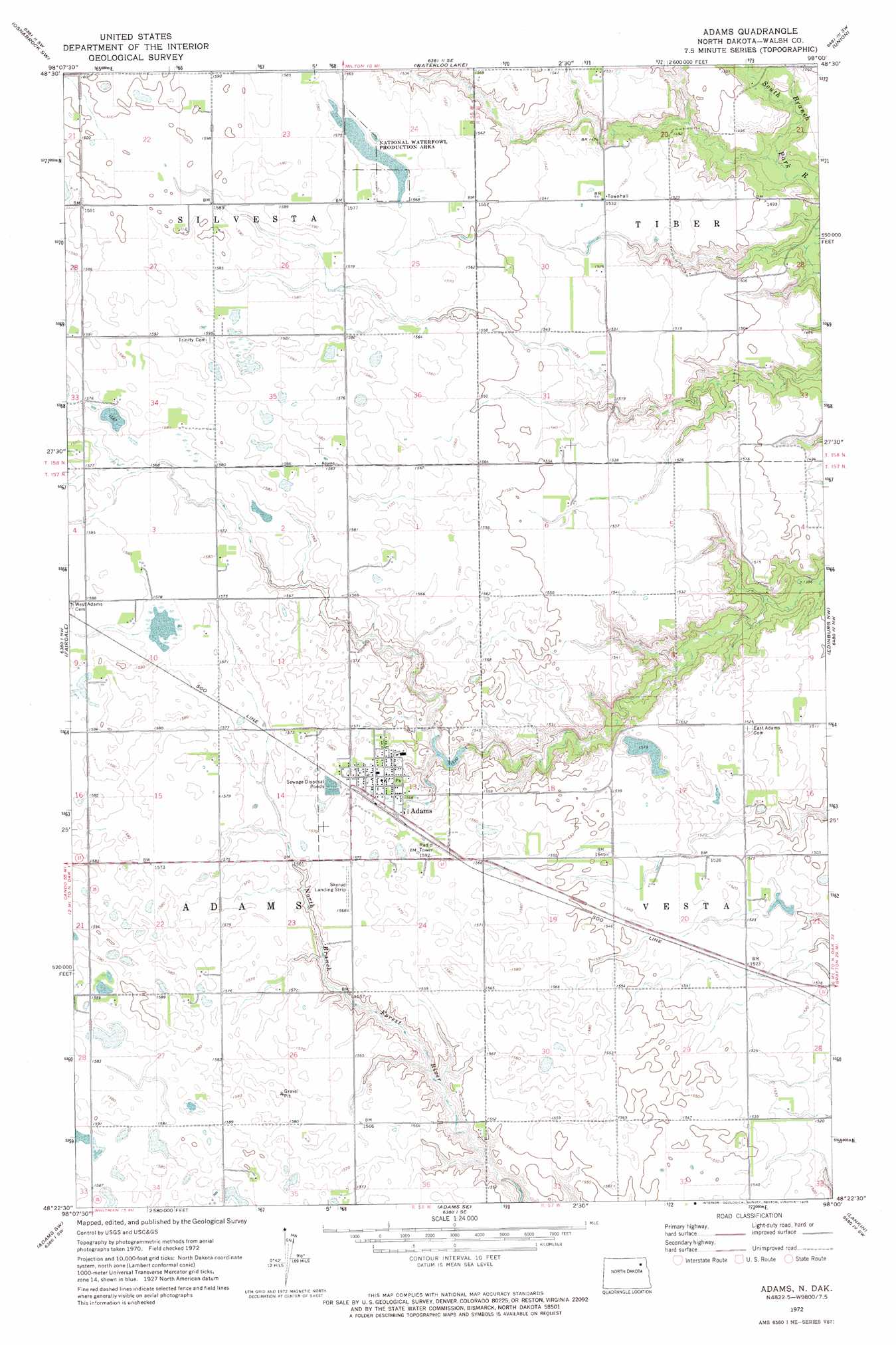
USGS Topo Quad 48098d1 - 1:24,000 scale
| Topo Map Name: | Adams |
| USGS Topo Quad ID: | 48098d1 |
| Print Size: | ca. 21 1/4" wide x 27" high |
| Southeast Coordinates: | 48.375° N latitude / 98° W longitude |
| Map Center Coordinates: | 48.4375° N latitude / 98.0625° W longitude |
| U.S. State: | ND |
| Filename: | O48098D1.jpg |
| Download Map JPG Image: | Adams topo map 1:24,000 scale |
| Map Type: | Topographic |
| Topo Series: | 7.5´ |
| Map Scale: | 1:24,000 |
| Source of Map Images: | United States Geological Survey (USGS) |
| Alternate Map Versions: |
Adams ND 1972, updated 1975 Download PDF Buy paper map Adams ND 2011 Download PDF Buy paper map Adams ND 2014 Download PDF Buy paper map |
1:24,000 Topo Quads surrounding Adams
Easby |
Osnabrock |
Milton |
Concrete |
Mountain |
Nekoma |
Osnabrock Sw |
Waterloo Lake |
Union |
Gardar |
Edmore Ne |
Fairdale |
Adams |
Edinburg Nw |
Edinburg |
Lawton |
Adams Sw |
Adams Se |
Lankin |
Pleasant Valley |
Brocket |
Pelto |
Whitman |
Dahlen |
Fordville |
> Back to 48098a1 at 1:100,000 scale
> Back to 48098a1 at 1:250,000 scale
> Back to U.S. Topo Maps home
Adams topo map: Gazetteer
Adams: Airports
Skyrud Skyway elevation 477m 1564′Adams: Dams
Adams Dam elevation 460m 1509′Adams: Populated Places
Adams elevation 479m 1571′Adams digital topo map on disk
Buy this Adams topo map showing relief, roads, GPS coordinates and other geographical features, as a high-resolution digital map file on DVD:
Eastern North Dakota & Eastern South Dakota
Buy digital topo maps: Eastern North Dakota & Eastern South Dakota