Brinsmade Sw Topo Map North Dakota
To zoom in, hover over the map of Brinsmade Sw
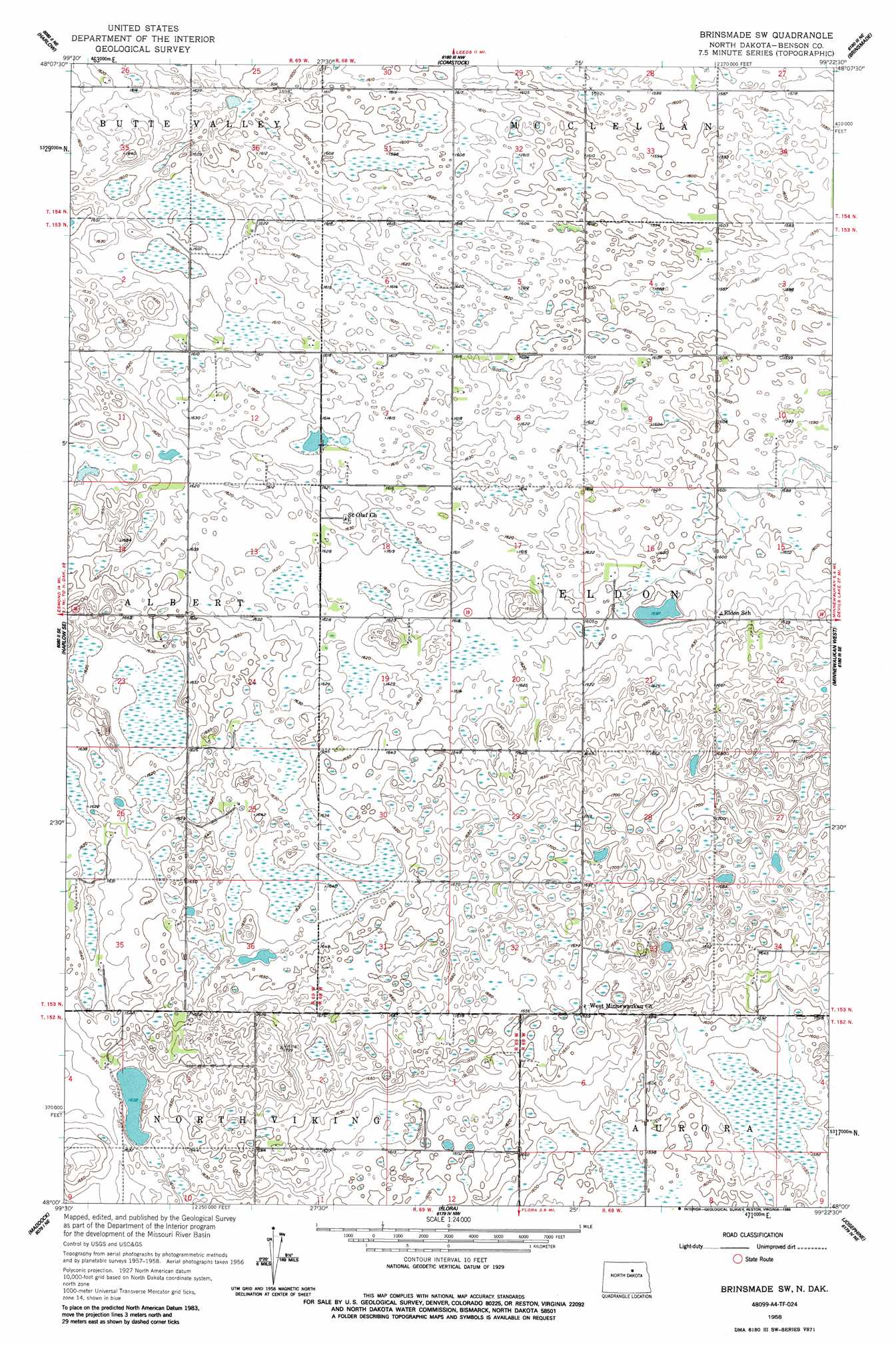
USGS Topo Quad 48099a4 - 1:24,000 scale
| Topo Map Name: | Brinsmade Sw |
| USGS Topo Quad ID: | 48099a4 |
| Print Size: | ca. 21 1/4" wide x 27" high |
| Southeast Coordinates: | 48° N latitude / 99.375° W longitude |
| Map Center Coordinates: | 48.0625° N latitude / 99.4375° W longitude |
| U.S. State: | ND |
| Filename: | O48099A4.jpg |
| Download Map JPG Image: | Brinsmade Sw topo map 1:24,000 scale |
| Map Type: | Topographic |
| Topo Series: | 7.5´ |
| Map Scale: | 1:24,000 |
| Source of Map Images: | United States Geological Survey (USGS) |
| Alternate Map Versions: |
Brinsmade SW ND 1958, updated 1959 Download PDF Buy paper map Brinsmade SW ND 1958, updated 1986 Download PDF Buy paper map Brinsmade SW ND 2011 Download PDF Buy paper map Brinsmade SW ND 2014 Download PDF Buy paper map |
1:24,000 Topo Quads surrounding Brinsmade Sw
Knox |
York |
Leeds |
Niles |
Churchs Ferry |
Baker |
Harlow |
Comstock |
Brinsmade |
Tilden |
Harlow Sw |
Harlow Se |
Brinsmade Sw |
Minnewaukan West |
Minnewauken East |
Hesper |
Maddock |
Flora |
Josephine |
Oberon |
Heimdal |
Hamberg |
Black Hammer Hill |
Flora Se |
Oberon Sw |
> Back to 48099a1 at 1:100,000 scale
> Back to 48098a1 at 1:250,000 scale
> Back to U.S. Topo Maps home
No gazetteer data is available for the Brinsmade Sw topo map sheet.
Brinsmade Sw digital topo map on disk
Buy this Brinsmade Sw topo map showing relief, roads, GPS coordinates and other geographical features, as a high-resolution digital map file on DVD:
Eastern North Dakota & Eastern South Dakota
Buy digital topo maps: Eastern North Dakota & Eastern South Dakota