Leeds Topo Map North Dakota
To zoom in, hover over the map of Leeds
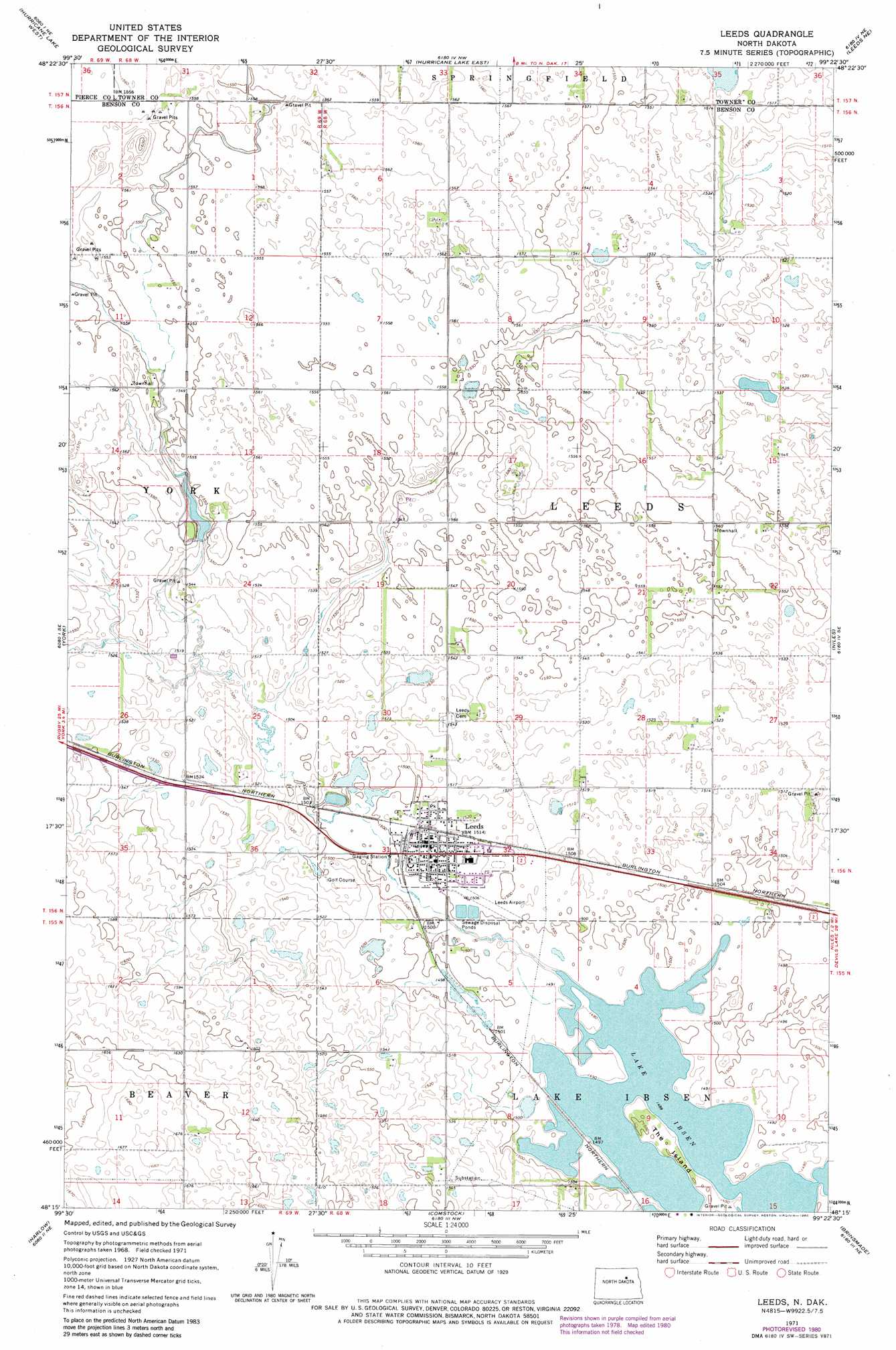
USGS Topo Quad 48099c4 - 1:24,000 scale
| Topo Map Name: | Leeds |
| USGS Topo Quad ID: | 48099c4 |
| Print Size: | ca. 21 1/4" wide x 27" high |
| Southeast Coordinates: | 48.25° N latitude / 99.375° W longitude |
| Map Center Coordinates: | 48.3125° N latitude / 99.4375° W longitude |
| U.S. State: | ND |
| Filename: | O48099C4.jpg |
| Download Map JPG Image: | Leeds topo map 1:24,000 scale |
| Map Type: | Topographic |
| Topo Series: | 7.5´ |
| Map Scale: | 1:24,000 |
| Source of Map Images: | United States Geological Survey (USGS) |
| Alternate Map Versions: |
Leeds ND 1971, updated 1973 Download PDF Buy paper map Leeds ND 1971, updated 1980 Download PDF Buy paper map Leeds ND 2011 Download PDF Buy paper map Leeds ND 2014 Download PDF Buy paper map |
1:24,000 Topo Quads surrounding Leeds
Island Lake |
Mylo Se |
Bisbee South |
Considine |
Egeland Sw |
Wolford |
Hurricane Lake West |
Hurricane Lake East |
Leeds Ne |
Cando |
Knox |
York |
Leeds |
Niles |
Churchs Ferry |
Baker |
Harlow |
Comstock |
Brinsmade |
Tilden |
Harlow Sw |
Harlow Se |
Brinsmade Sw |
Minnewaukan West |
Minnewauken East |
> Back to 48099a1 at 1:100,000 scale
> Back to 48098a1 at 1:250,000 scale
> Back to U.S. Topo Maps home
Leeds topo map: Gazetteer
Leeds: Airports
Leeds Municipal Airport elevation 458m 1502′Leeds: Dams
Iverson Dam elevation 467m 1532′Leeds: Islands
The Island elevation 457m 1499′Leeds: Lakes
Lake Ibsen elevation 454m 1489′Leeds: Populated Places
Leeds elevation 461m 1512′Leeds digital topo map on disk
Buy this Leeds topo map showing relief, roads, GPS coordinates and other geographical features, as a high-resolution digital map file on DVD:
Eastern North Dakota & Eastern South Dakota
Buy digital topo maps: Eastern North Dakota & Eastern South Dakota