Egeland Sw Topo Map North Dakota
To zoom in, hover over the map of Egeland Sw
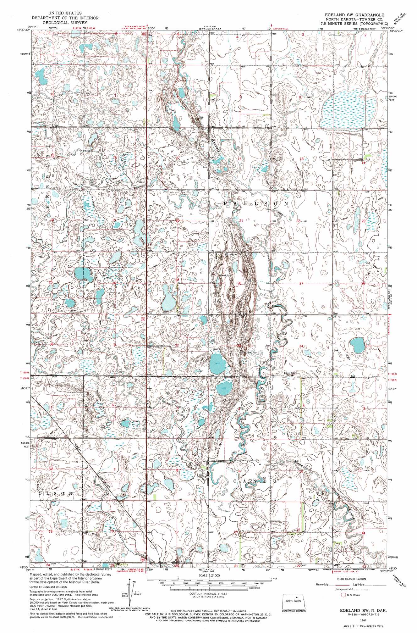
USGS Topo Quad 48099e2 - 1:24,000 scale
| Topo Map Name: | Egeland Sw |
| USGS Topo Quad ID: | 48099e2 |
| Print Size: | ca. 21 1/4" wide x 27" high |
| Southeast Coordinates: | 48.5° N latitude / 99.125° W longitude |
| Map Center Coordinates: | 48.5625° N latitude / 99.1875° W longitude |
| U.S. State: | ND |
| Filename: | O48099E2.jpg |
| Download Map JPG Image: | Egeland Sw topo map 1:24,000 scale |
| Map Type: | Topographic |
| Topo Series: | 7.5´ |
| Map Scale: | 1:24,000 |
| Source of Map Images: | United States Geological Survey (USGS) |
| Alternate Map Versions: |
Egeland SW ND 1962, updated 1963 Download PDF Buy paper map Egeland SW ND 2011 Download PDF Buy paper map Egeland SW ND 2014 Download PDF Buy paper map |
1:24,000 Topo Quads surrounding Egeland Sw
Hansboro Sw |
Hansboro Se |
Rock Lake |
Rock Lake Se |
Calvin |
Bisbee North |
Big Coulee Dam |
Snyder Lake |
Egeland |
Calio |
Bisbee South |
Considine |
Egeland Sw |
Egeland Se |
Munich Sw |
Hurricane Lake East |
Leeds Ne |
Cando |
Cando Ne |
Starkweather |
Leeds |
Niles |
Churchs Ferry |
Cando Se |
Webster |
> Back to 48099e1 at 1:100,000 scale
> Back to 48098a1 at 1:250,000 scale
> Back to U.S. Topo Maps home
Egeland Sw digital topo map on disk
Buy this Egeland Sw topo map showing relief, roads, GPS coordinates and other geographical features, as a high-resolution digital map file on DVD:
Eastern North Dakota & Eastern South Dakota
Buy digital topo maps: Eastern North Dakota & Eastern South Dakota