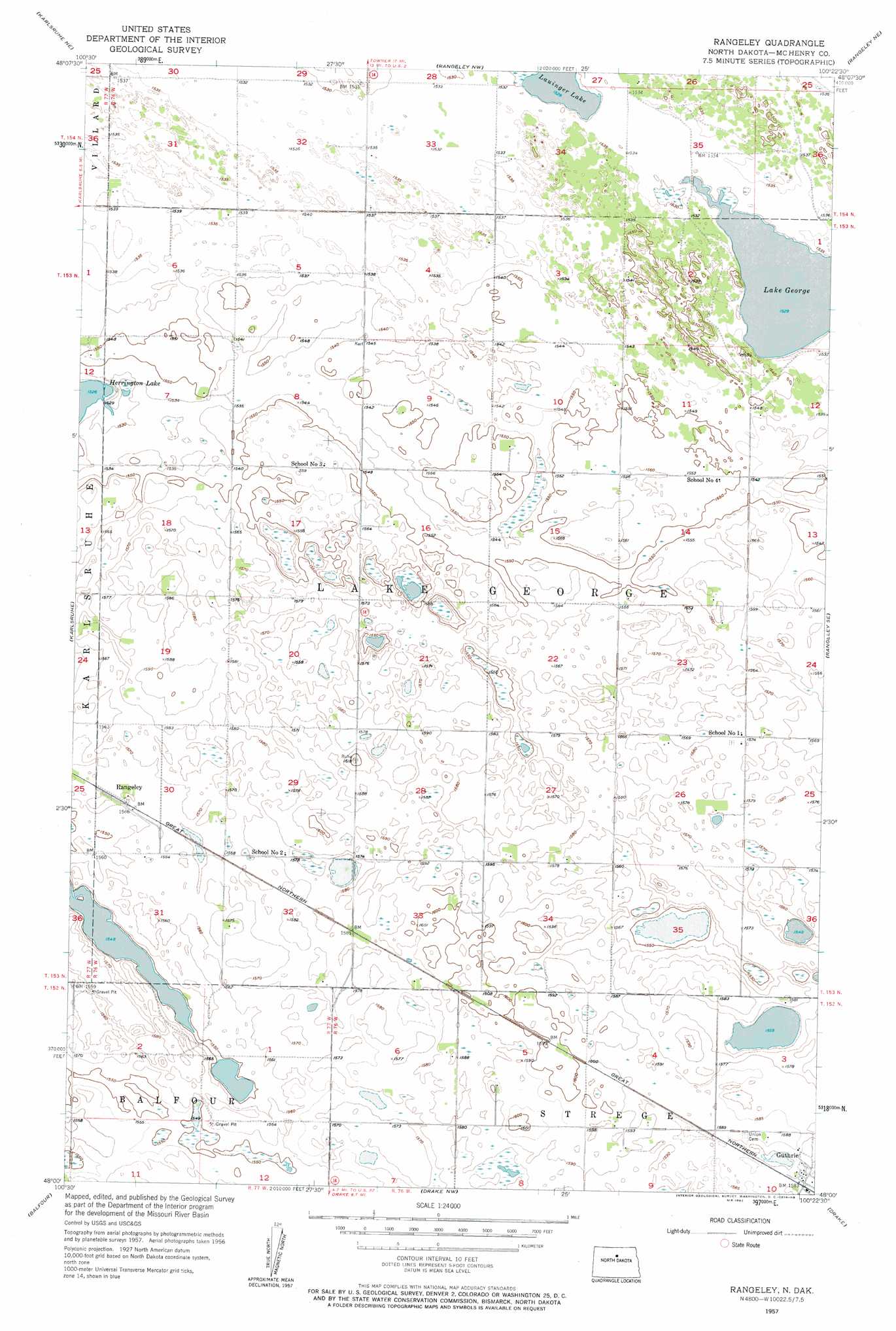
Rangeley Topo Map North Dakota
To zoom in, hover over the map of Rangeley
USGS Topo Quad 48100a4 - 1:24,000 scale
| Topo Map Name: | Rangeley |
| USGS Topo Quad ID: | 48100a4 |
| Print Size: | ca. 21 1/4" wide x 27" high |
| Southeast Coordinates: | 48° N latitude / 100.375° W longitude |
| Map Center Coordinates: | 48.0625° N latitude / 100.4375° W longitude |
| U.S. State: | ND |
| Filename: | O48100A4.jpg |
| Download Map JPG Image: | Rangeley topo map 1:24,000 scale |
| Map Type: | Topographic |
| Topo Series: | 7.5´ |
| Map Scale: | 1:24,000 |
| Source of Map Images: | United States Geological Survey (USGS) |
| Alternate Map Versions: |
Rangeley ND 1957, updated 1958 Download PDF Buy paper map Rangeley ND 2011 Download PDF Buy paper map Rangeley ND 2014 Download PDF Buy paper map |
1:24,000 Topo Quads surrounding Rangeley
Riga |
Denbigh |
Towner |
Towner Se |
Berwick |
Karlsruhe Nw |
Karlsruhe Ne |
Rangeley Nw |
Rangeley Ne |
Balta Nw |
Bergen |
Karlsruhe |
Rangeley |
Rangeley Se |
Orrin |
Balfour Nw |
Balfour |
Drake Nw |
Drake |
Anamoose |
Butte |
Kief |
Drake Sw |
Drake Se |
Anamoose Sw |
> Back to 48100a1 at 1:100,000 scale
> Back to 48100a1 at 1:250,000 scale
> Back to U.S. Topo Maps home
Rangeley topo map: Gazetteer
Rangeley: Lakes
Lake George elevation 466m 1528′Lauinger Lake elevation 466m 1528′
Rangeley: Populated Places
Guthrie elevation 484m 1587′Rangeley elevation 478m 1568′
Rangeley digital topo map on disk
Buy this Rangeley topo map showing relief, roads, GPS coordinates and other geographical features, as a high-resolution digital map file on DVD:
Eastern North Dakota & Eastern South Dakota
Buy digital topo maps: Eastern North Dakota & Eastern South Dakota