Denbigh Topo Map North Dakota
To zoom in, hover over the map of Denbigh
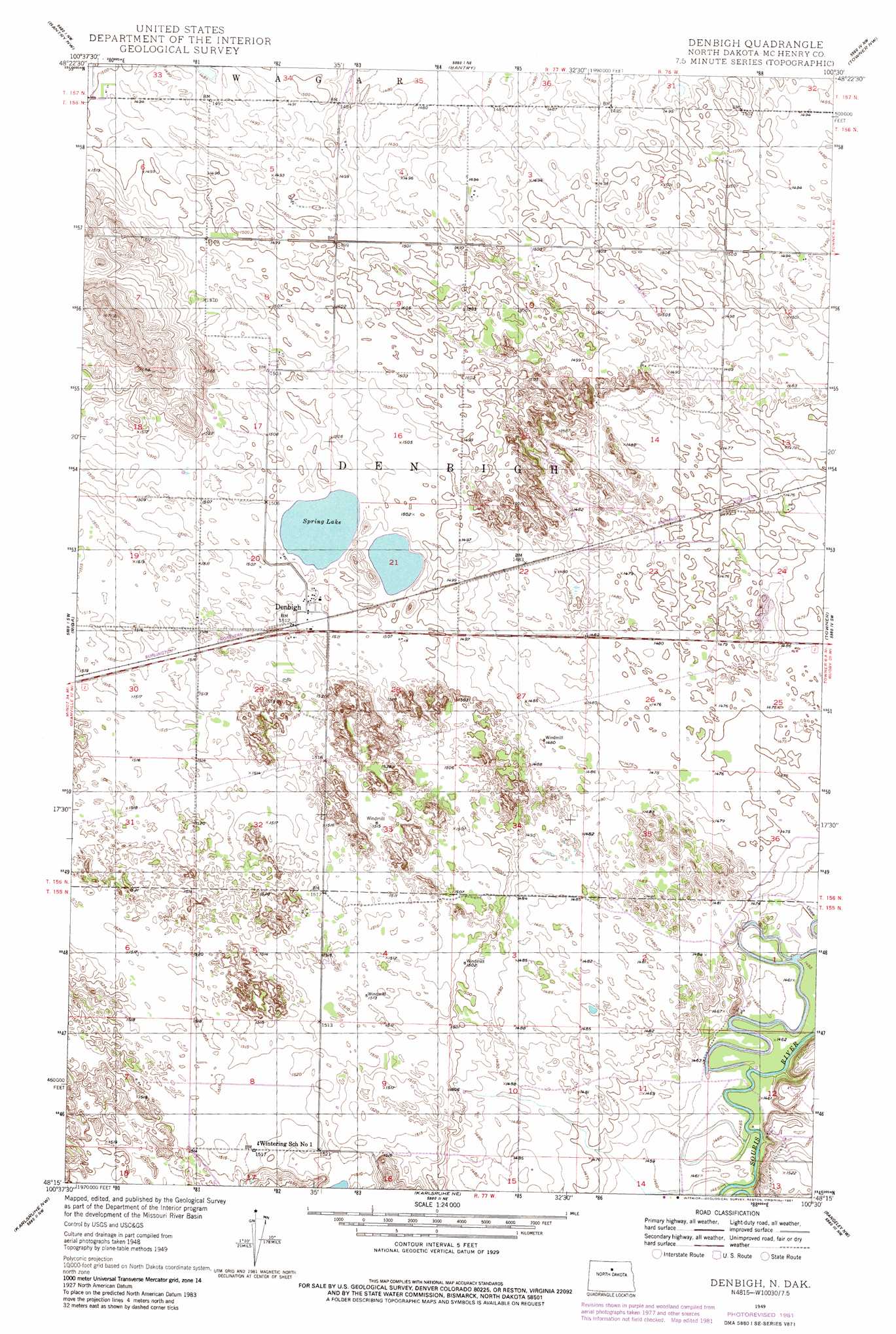
USGS Topo Quad 48100c5 - 1:24,000 scale
| Topo Map Name: | Denbigh |
| USGS Topo Quad ID: | 48100c5 |
| Print Size: | ca. 21 1/4" wide x 27" high |
| Southeast Coordinates: | 48.25° N latitude / 100.5° W longitude |
| Map Center Coordinates: | 48.3125° N latitude / 100.5625° W longitude |
| U.S. State: | ND |
| Filename: | O48100C5.jpg |
| Download Map JPG Image: | Denbigh topo map 1:24,000 scale |
| Map Type: | Topographic |
| Topo Series: | 7.5´ |
| Map Scale: | 1:24,000 |
| Source of Map Images: | United States Geological Survey (USGS) |
| Alternate Map Versions: |
Denbigh ND 1949, updated 1977 Download PDF Buy paper map Denbigh ND 1949, updated 1981 Download PDF Buy paper map Denbigh ND 1950, updated 1950 Download PDF Buy paper map Denbigh ND 2011 Download PDF Buy paper map Denbigh ND 2014 Download PDF Buy paper map |
1:24,000 Topo Quads surrounding Denbigh
Newburg Se |
Upham |
Upham Se |
Willow City Sw |
Willow City |
Granville Ne |
Bantry Nw |
Bantry |
Towner Nw |
Towner Ne |
Granville |
Riga |
Denbigh |
Towner |
Towner Se |
Simcoe |
Karlsruhe Nw |
Karlsruhe Ne |
Rangeley Nw |
Rangeley Ne |
Voltaire |
Bergen |
Karlsruhe |
Rangeley |
Rangeley Se |
> Back to 48100a1 at 1:100,000 scale
> Back to 48100a1 at 1:250,000 scale
> Back to U.S. Topo Maps home
Denbigh topo map: Gazetteer
Denbigh: Airports
Leach Ranch Landing Strip elevation 456m 1496′Denbigh: Lakes
Spring Lake elevation 458m 1502′Denbigh: Populated Places
Denbigh elevation 461m 1512′Denbigh digital topo map on disk
Buy this Denbigh topo map showing relief, roads, GPS coordinates and other geographical features, as a high-resolution digital map file on DVD:
Eastern North Dakota & Eastern South Dakota
Buy digital topo maps: Eastern North Dakota & Eastern South Dakota