Minot Nw Topo Map North Dakota
To zoom in, hover over the map of Minot Nw
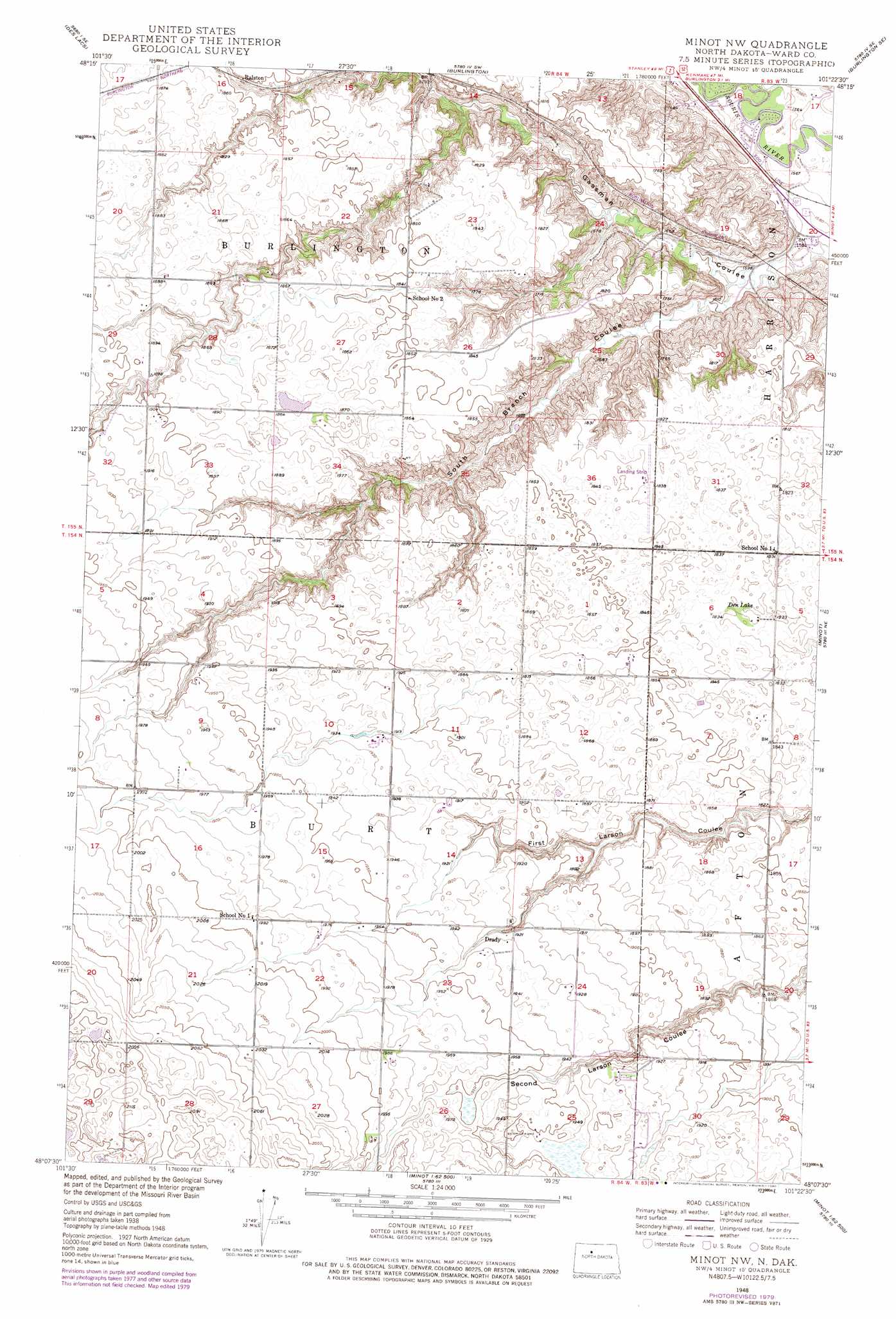
USGS Topo Quad 48101b4 - 1:24,000 scale
| Topo Map Name: | Minot Nw |
| USGS Topo Quad ID: | 48101b4 |
| Print Size: | ca. 21 1/4" wide x 27" high |
| Southeast Coordinates: | 48.125° N latitude / 101.375° W longitude |
| Map Center Coordinates: | 48.1875° N latitude / 101.4375° W longitude |
| U.S. State: | ND |
| Filename: | O48101B4.jpg |
| Download Map JPG Image: | Minot Nw topo map 1:24,000 scale |
| Map Type: | Topographic |
| Topo Series: | 7.5´ |
| Map Scale: | 1:24,000 |
| Source of Map Images: | United States Geological Survey (USGS) |
| Alternate Map Versions: |
Minot NW ND 1948, updated 1976 Download PDF Buy paper map Minot NW ND 1948, updated 1980 Download PDF Buy paper map Minot NW ND 1949, updated 1949 Download PDF Buy paper map Minot NW ND 2011 Download PDF Buy paper map Minot NW ND 2014 Download PDF Buy paper map |
1:24,000 Topo Quads surrounding Minot Nw
Carpio |
Carpio Ne |
Burlington Nw |
Burlington Ne |
Deering Nw |
Berthold |
Des Lacs |
Burlington |
Burlington Se |
Deering Sw |
Rice Lake Nw |
Mork Lake |
Minot Nw |
Minot |
Surrey |
Underdahl Lake |
Rice Lake |
Minot Sw |
South Prairie |
Sawyer Sw |
Ryder |
Lake Vernon |
Rush Lake |
Max Ne |
Benedict Nw |
> Back to 48101a1 at 1:100,000 scale
> Back to 48100a1 at 1:250,000 scale
> Back to U.S. Topo Maps home
Minot Nw topo map: Gazetteer
Minot Nw: Lakes
Den Lake elevation 559m 1833′Minot Nw: Populated Places
Drady elevation 589m 1932′Ralston elevation 563m 1847′
Minot Nw: Valleys
Gassman Coulee elevation 479m 1571′South Branch Coulee elevation 486m 1594′
Minot Nw digital topo map on disk
Buy this Minot Nw topo map showing relief, roads, GPS coordinates and other geographical features, as a high-resolution digital map file on DVD:
Eastern North Dakota & Eastern South Dakota
Buy digital topo maps: Eastern North Dakota & Eastern South Dakota