Berthold Topo Map North Dakota
To zoom in, hover over the map of Berthold
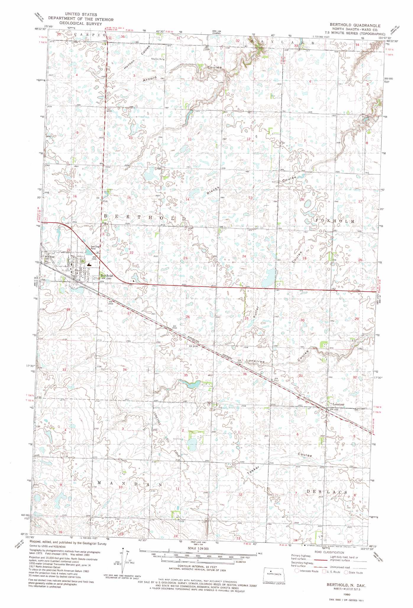
USGS Topo Quad 48101c6 - 1:24,000 scale
| Topo Map Name: | Berthold |
| USGS Topo Quad ID: | 48101c6 |
| Print Size: | ca. 21 1/4" wide x 27" high |
| Southeast Coordinates: | 48.25° N latitude / 101.625° W longitude |
| Map Center Coordinates: | 48.3125° N latitude / 101.6875° W longitude |
| U.S. State: | ND |
| Filename: | O48101C6.jpg |
| Download Map JPG Image: | Berthold topo map 1:24,000 scale |
| Map Type: | Topographic |
| Topo Series: | 7.5´ |
| Map Scale: | 1:24,000 |
| Source of Map Images: | United States Geological Survey (USGS) |
| Alternate Map Versions: |
Berthold ND 1980, updated 1981 Download PDF Buy paper map Berthold ND 2011 Download PDF Buy paper map Berthold ND 2014 Download PDF Buy paper map |
1:24,000 Topo Quads surrounding Berthold
Donnybrook |
Tolley Se |
Grano Sw |
Grano |
Lansford Sw |
Aurelia |
Hartland |
Carpio |
Carpio Ne |
Burlington Nw |
Tagus |
Tagus Se |
Berthold |
Des Lacs |
Burlington |
Plaza Nw |
Plaza Ne |
Rice Lake Nw |
Mork Lake |
Minot Nw |
Plaza |
Plaza Se |
Underdahl Lake |
Rice Lake |
Minot Sw |
> Back to 48101a1 at 1:100,000 scale
> Back to 48100a1 at 1:250,000 scale
> Back to U.S. Topo Maps home
Berthold topo map: Gazetteer
Berthold: Dams
Neshem Dam elevation 623m 2043′Berthold: Populated Places
Berthold elevation 637m 2089′Lonetree elevation 610m 2001′
Berthold digital topo map on disk
Buy this Berthold topo map showing relief, roads, GPS coordinates and other geographical features, as a high-resolution digital map file on DVD:
Eastern North Dakota & Eastern South Dakota
Buy digital topo maps: Eastern North Dakota & Eastern South Dakota