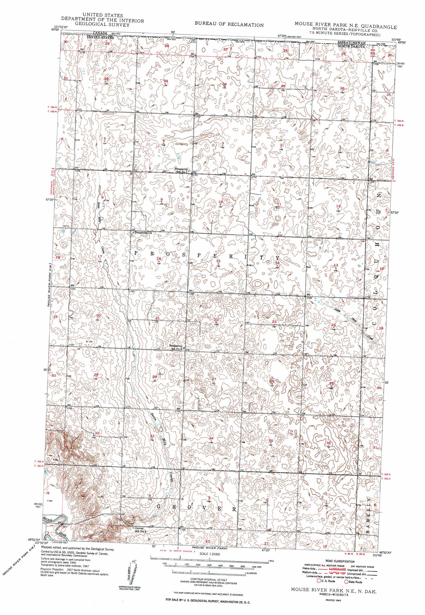
Mouse River Park Ne Topo Map North Dakota
To zoom in, hover over the map of Mouse River Park Ne
USGS Topo Quad 48101h7 - 1:24,000 scale
| Topo Map Name: | Mouse River Park Ne |
| USGS Topo Quad ID: | 48101h7 |
| Print Size: | ca. 21 1/4" wide x 27" high |
| Southeast Coordinates: | 48.875° N latitude / 101.75° W longitude |
| Map Center Coordinates: | 48.9375° N latitude / 101.8125° W longitude |
| U.S. State: | ND |
| Filename: | O48101H7.jpg |
| Download Map JPG Image: | Mouse River Park Ne topo map 1:24,000 scale |
| Map Type: | Topographic |
| Topo Series: | 7.5´ |
| Map Scale: | 1:24,000 |
| Source of Map Images: | United States Geological Survey (USGS) |
| Alternate Map Versions: |
Mouse River Park NE ND 1949, updated 1949 Download PDF Buy paper map Mouse River Park NE ND 1949, updated 1949 Download PDF Buy paper map Mouse River Park NE ND 2011 Download PDF Buy paper map Mouse River Park NE ND 2014 Download PDF Buy paper map |
1:24,000 Topo Quads surrounding Mouse River Park Ne
Bowbells Ne |
Mouse River Park Nw |
Mouse River Park Ne |
Sherwood |
Mohall Ne |
Bowbells Se |
Mouse River Park Sw |
Mouse River Park |
Mohall Sw |
Mohall |
Kenmare |
Norma |
Tolley |
Greene |
Grano Ne |
> Back to 48101e1 at 1:100,000 scale
> Back to 48100a1 at 1:250,000 scale
> Back to U.S. Topo Maps home
Mouse River Park Ne topo map: Gazetteer
Mouse River Park Ne: Streams
Little Deep Creek elevation 525m 1722′Mouse River Park Ne digital topo map on disk
Buy this Mouse River Park Ne topo map showing relief, roads, GPS coordinates and other geographical features, as a high-resolution digital map file on DVD:
Eastern North Dakota & Eastern South Dakota
Buy digital topo maps: Eastern North Dakota & Eastern South Dakota