Tioga Se Topo Map North Dakota
To zoom in, hover over the map of Tioga Se
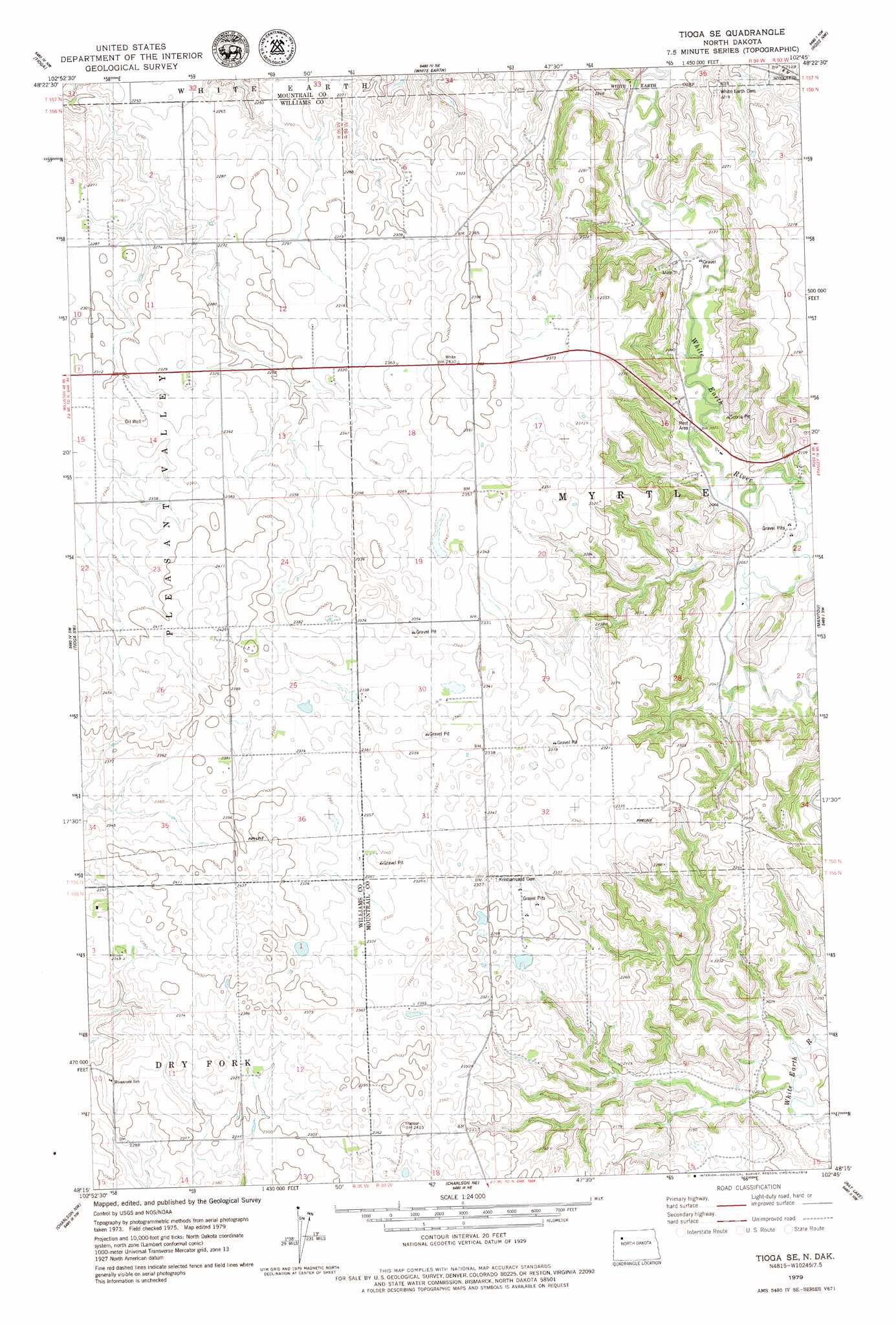
USGS Topo Quad 48102c7 - 1:24,000 scale
| Topo Map Name: | Tioga Se |
| USGS Topo Quad ID: | 48102c7 |
| Print Size: | ca. 21 1/4" wide x 27" high |
| Southeast Coordinates: | 48.25° N latitude / 102.75° W longitude |
| Map Center Coordinates: | 48.3125° N latitude / 102.8125° W longitude |
| U.S. State: | ND |
| Filename: | O48102C7.jpg |
| Download Map JPG Image: | Tioga Se topo map 1:24,000 scale |
| Map Type: | Topographic |
| Topo Series: | 7.5´ |
| Map Scale: | 1:24,000 |
| Source of Map Images: | United States Geological Survey (USGS) |
| Alternate Map Versions: |
Tioga SE ND 1979, updated 1979 Download PDF Buy paper map Tioga SE ND 2011 Download PDF Buy paper map Tioga SE ND 2014 Download PDF Buy paper map |
1:24,000 Topo Quads surrounding Tioga Se
Big Meadow |
Mcgregor |
Battleview |
Powers Lake |
Lunds Valley |
Temple |
Tioga |
White Earth |
Ross Nw |
Cottonwood Lake |
Ray Se |
Tioga Sw |
Tioga Se |
Manitou |
Ross |
Red Mike Hill |
Charlson Nw |
Charlson Ne |
Rat Lake |
Robinson Lake |
Tobacco Garden Bay |
Charlson Sw |
Charlson |
Rat Lake Sw |
Rat Lake Se |
> Back to 48102a1 at 1:100,000 scale
> Back to 48102a1 at 1:250,000 scale
> Back to U.S. Topo Maps home
No gazetteer data is available for the Tioga Se topo map sheet.
Tioga Se digital topo map on disk
Buy this Tioga Se topo map showing relief, roads, GPS coordinates and other geographical features, as a high-resolution digital map file on DVD:
Eastern Montana & Western North Dakota
Buy digital topo maps: Eastern Montana & Western North Dakota