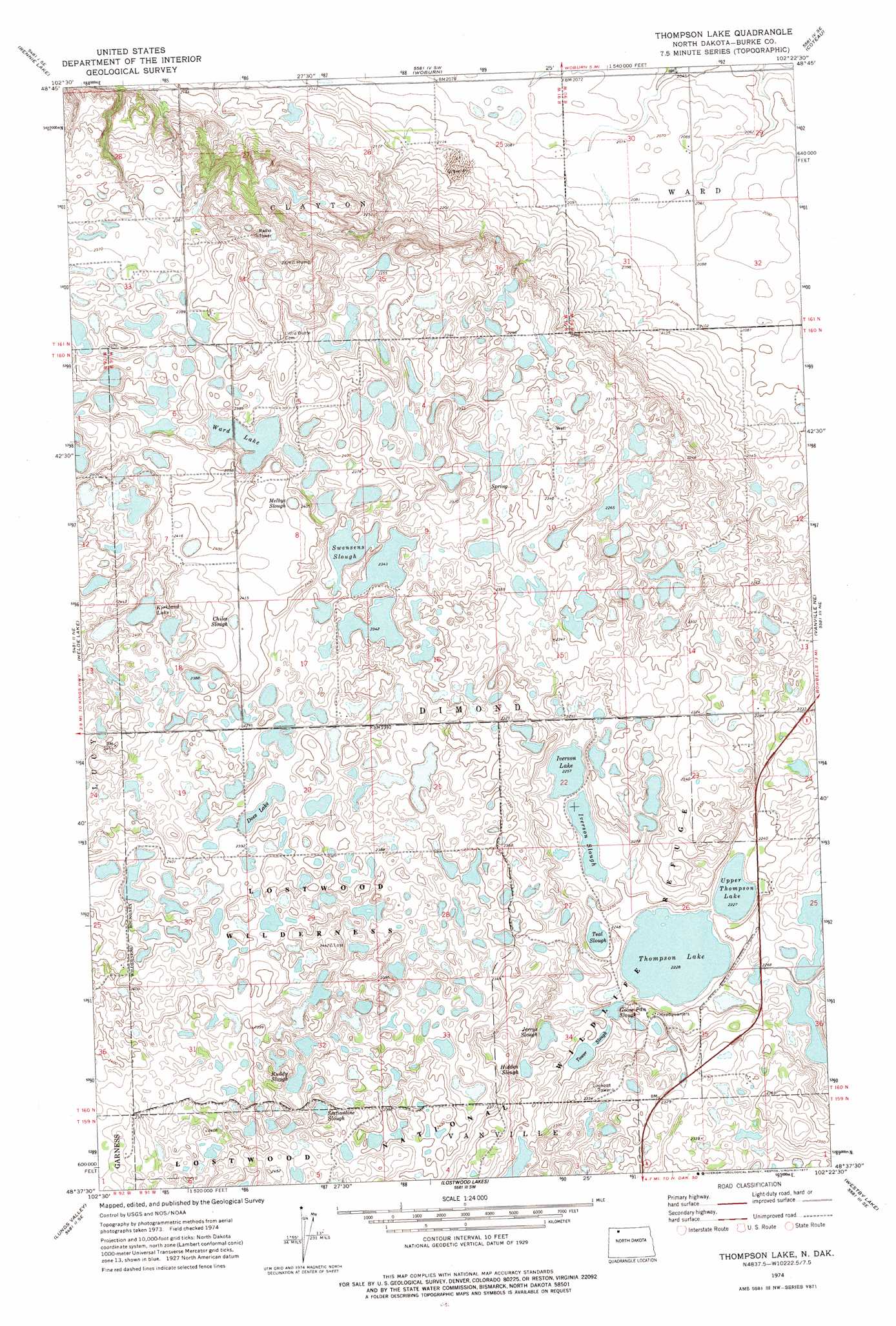
Thompson Lake Topo Map North Dakota
To zoom in, hover over the map of Thompson Lake
USGS Topo Quad 48102f4 - 1:24,000 scale
| Topo Map Name: | Thompson Lake |
| USGS Topo Quad ID: | 48102f4 |
| Print Size: | ca. 21 1/4" wide x 27" high |
| Southeast Coordinates: | 48.625° N latitude / 102.375° W longitude |
| Map Center Coordinates: | 48.6875° N latitude / 102.4375° W longitude |
| U.S. State: | ND |
| Filename: | O48102F4.jpg |
| Download Map JPG Image: | Thompson Lake topo map 1:24,000 scale |
| Map Type: | Topographic |
| Topo Series: | 7.5´ |
| Map Scale: | 1:24,000 |
| Source of Map Images: | United States Geological Survey (USGS) |
| Alternate Map Versions: |
Thompson Lake ND 1974, updated 1977 Download PDF Buy paper map Thompson Lake ND 2011 Download PDF Buy paper map Thompson Lake ND 2014 Download PDF Buy paper map |
1:24,000 Topo Quads surrounding Thompson Lake
Stampede |
Portal |
Flaxton |
Northgate |
Bowbells Nw |
Beaver Lake |
Rennie Lake |
Woburn |
Coteau |
Bowbells |
Grubb Lake |
Helde Lake |
Thompson Lake |
Vanville Ne |
Niobe |
Powers Lake |
Lunds Valley |
Lostwood Lakes |
Westby Lake |
Mosquito Butte |
Ross Nw |
Cottonwood Lake |
Lostwood |
Clearwater Lake |
Palermo Nw |
> Back to 48102e1 at 1:100,000 scale
> Back to 48102a1 at 1:250,000 scale
> Back to U.S. Topo Maps home
Thompson Lake topo map: Gazetteer
Thompson Lake: Guts
Chiles Slough elevation 735m 2411′Melbys Slough elevation 730m 2395′
Thompson Lake: Lakes
Docs Lake elevation 724m 2375′Goose Pan Slough elevation 682m 2237′
Hidden Slough elevation 697m 2286′
Iverson Lake elevation 682m 2237′
Iverson Slough elevation 688m 2257′
Jerrys Slough elevation 691m 2267′
Kirkland Lake elevation 721m 2365′
Ruddy Slough elevation 721m 2365′
Sectionline Slough elevation 727m 2385′
Swensens Slough elevation 715m 2345′
Teal Slough elevation 685m 2247′
Thompson Lake elevation 680m 2230′
Tower Slough elevation 685m 2247′
Upper Thompson Lake elevation 679m 2227′
Ward Lake elevation 721m 2365′
Thompson Lake digital topo map on disk
Buy this Thompson Lake topo map showing relief, roads, GPS coordinates and other geographical features, as a high-resolution digital map file on DVD:
Eastern Montana & Western North Dakota
Buy digital topo maps: Eastern Montana & Western North Dakota