Williston West Topo Map North Dakota
To zoom in, hover over the map of Williston West
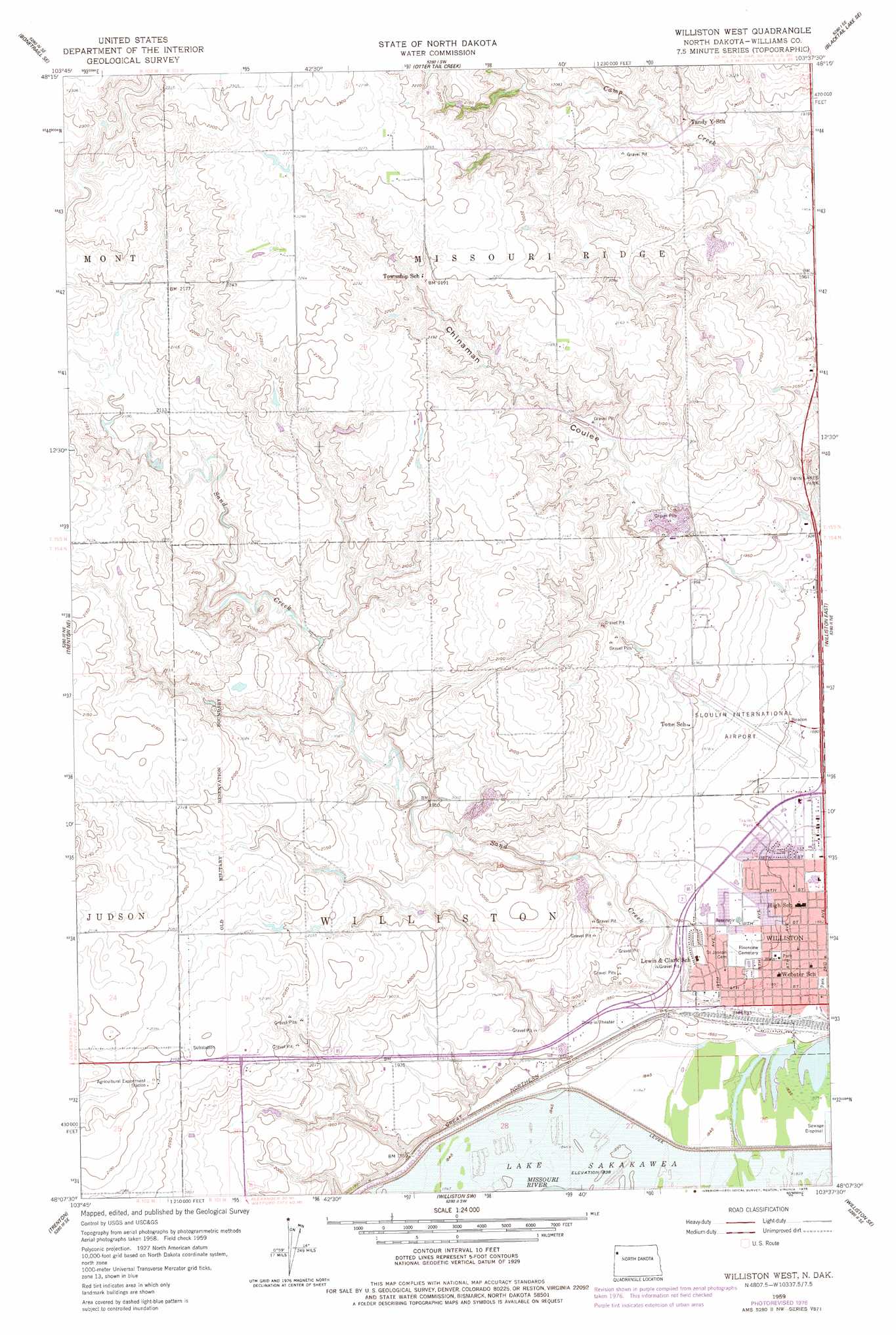
USGS Topo Quad 48103b6 - 1:24,000 scale
| Topo Map Name: | Williston West |
| USGS Topo Quad ID: | 48103b6 |
| Print Size: | ca. 21 1/4" wide x 27" high |
| Southeast Coordinates: | 48.125° N latitude / 103.625° W longitude |
| Map Center Coordinates: | 48.1875° N latitude / 103.6875° W longitude |
| U.S. State: | ND |
| Filename: | O48103B6.jpg |
| Download Map JPG Image: | Williston West topo map 1:24,000 scale |
| Map Type: | Topographic |
| Topo Series: | 7.5´ |
| Map Scale: | 1:24,000 |
| Source of Map Images: | United States Geological Survey (USGS) |
| Alternate Map Versions: |
Williston West ND 1959, updated 1960 Download PDF Buy paper map Williston West ND 1959, updated 1978 Download PDF Buy paper map Williston West ND 2011 Download PDF Buy paper map Williston West ND 2014 Download PDF Buy paper map |
1:24,000 Topo Quads surrounding Williston West
West Bonetraill |
Bonetraill |
Blacktail Lake |
Twin Lakes |
Epping Nw |
Bonetraill Sw |
Bonetraill Se |
Otter Tail Creek |
Blacktail Lake Se |
Spring Brook |
Trenton Nw |
Trenton Ne |
Williston West |
Williston East |
Stockyard Creek |
Trenton Sw |
Trenton |
Williston Sw |
Williston Se |
Lake Jessie |
Buford |
Cartwright Ne |
Camp Creek West |
Camp Creek East |
Watford City Nw |
> Back to 48103a1 at 1:100,000 scale
> Back to 48102a1 at 1:250,000 scale
> Back to U.S. Topo Maps home
Williston West topo map: Gazetteer
Williston West: Airports
Sloulin Field International Airport elevation 584m 1916′Williston West: Streams
Sand Creek elevation 559m 1833′Williston West digital topo map on disk
Buy this Williston West topo map showing relief, roads, GPS coordinates and other geographical features, as a high-resolution digital map file on DVD:
Eastern Montana & Western North Dakota
Buy digital topo maps: Eastern Montana & Western North Dakota