Blacktail Lake Se Topo Map North Dakota
To zoom in, hover over the map of Blacktail Lake Se
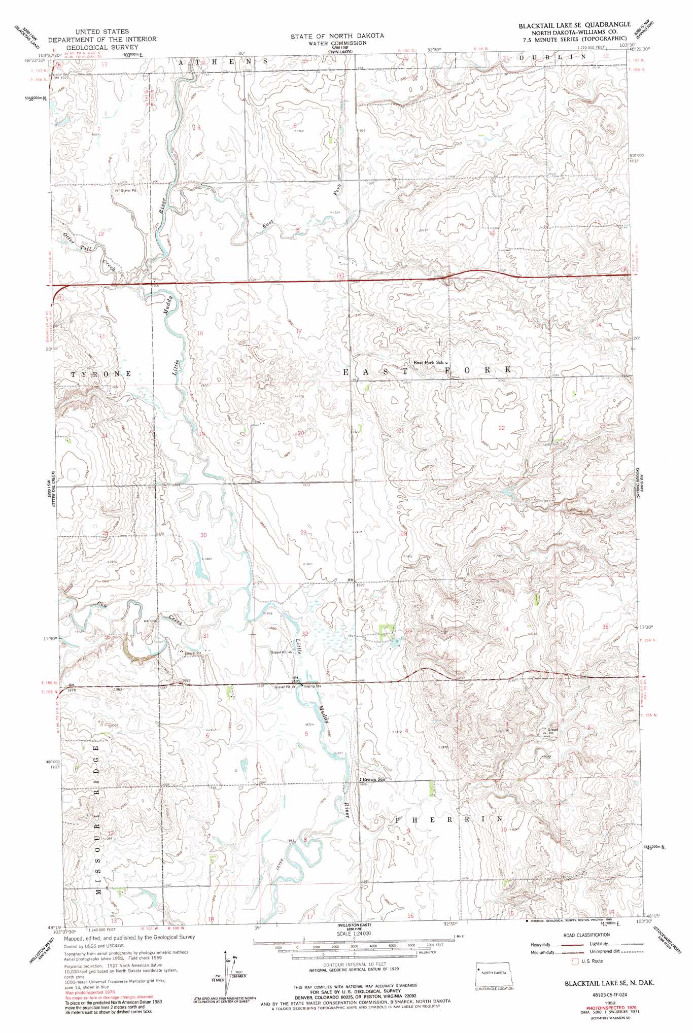
USGS Topo Quad 48103c5 - 1:24,000 scale
| Topo Map Name: | Blacktail Lake Se |
| USGS Topo Quad ID: | 48103c5 |
| Print Size: | ca. 21 1/4" wide x 27" high |
| Southeast Coordinates: | 48.25° N latitude / 103.5° W longitude |
| Map Center Coordinates: | 48.3125° N latitude / 103.5625° W longitude |
| U.S. State: | ND |
| Filename: | O48103C5.jpg |
| Download Map JPG Image: | Blacktail Lake Se topo map 1:24,000 scale |
| Map Type: | Topographic |
| Topo Series: | 7.5´ |
| Map Scale: | 1:24,000 |
| Source of Map Images: | United States Geological Survey (USGS) |
| Alternate Map Versions: |
Marmon SE ND 1959, updated 1960 Download PDF Buy paper map Marmon SE ND 1959, updated 1980 Download PDF Buy paper map Blacktail Lake SE ND 1959, updated 1989 Download PDF Buy paper map Blacktail Lake SE ND 2011 Download PDF Buy paper map Blacktail Lake SE ND 2014 Download PDF Buy paper map |
1:24,000 Topo Quads surrounding Blacktail Lake Se
Hanks |
Zahl |
Appam |
Alamo |
Corinth |
Bonetraill |
Blacktail Lake |
Twin Lakes |
Epping Nw |
Epping Ne |
Bonetraill Se |
Otter Tail Creek |
Blacktail Lake Se |
Spring Brook |
Epping |
Trenton Ne |
Williston West |
Williston East |
Stockyard Creek |
Gamache Creek |
Trenton |
Williston Sw |
Williston Se |
Lake Jessie |
Chris Creek |
> Back to 48103a1 at 1:100,000 scale
> Back to 48102a1 at 1:250,000 scale
> Back to U.S. Topo Maps home
Blacktail Lake Se topo map: Gazetteer
Blacktail Lake Se: Cliffs
Grizzly Bluffs (historical) elevation 619m 2030′Blacktail Lake Se: Streams
Cow Creek elevation 573m 1879′East Fork Little Muddy River elevation 578m 1896′
Otter Tail Creek elevation 576m 1889′
Blacktail Lake Se digital topo map on disk
Buy this Blacktail Lake Se topo map showing relief, roads, GPS coordinates and other geographical features, as a high-resolution digital map file on DVD:
Eastern Montana & Western North Dakota
Buy digital topo maps: Eastern Montana & Western North Dakota