Ray Nw Topo Map North Dakota
To zoom in, hover over the map of Ray Nw
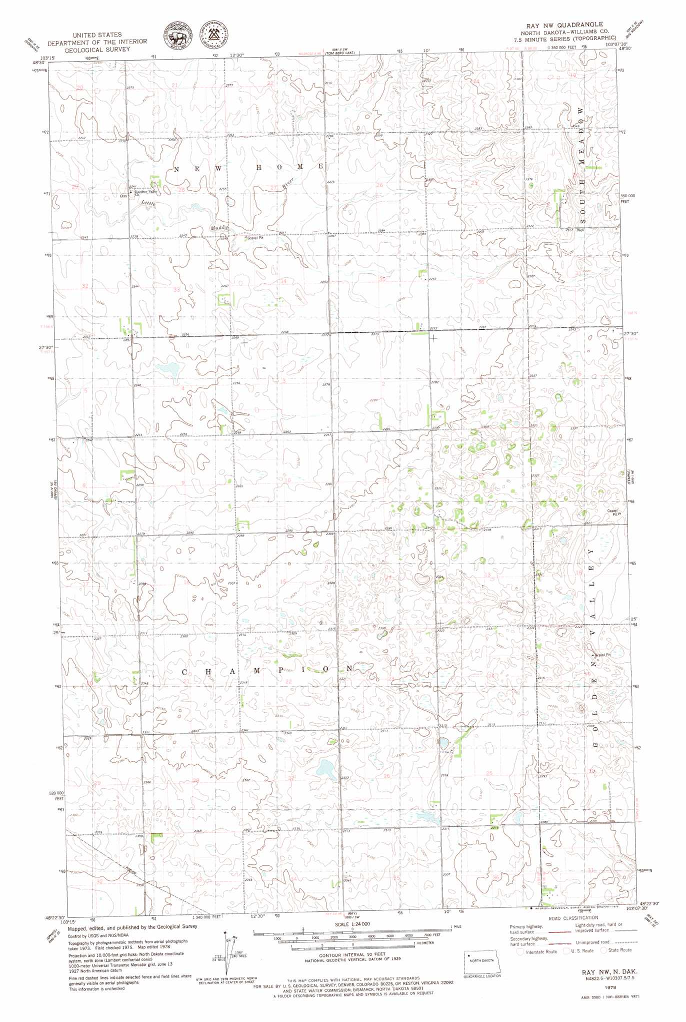
USGS Topo Quad 48103d2 - 1:24,000 scale
| Topo Map Name: | Ray Nw |
| USGS Topo Quad ID: | 48103d2 |
| Print Size: | ca. 21 1/4" wide x 27" high |
| Southeast Coordinates: | 48.375° N latitude / 103.125° W longitude |
| Map Center Coordinates: | 48.4375° N latitude / 103.1875° W longitude |
| U.S. State: | ND |
| Filename: | O48103D2.jpg |
| Download Map JPG Image: | Ray Nw topo map 1:24,000 scale |
| Map Type: | Topographic |
| Topo Series: | 7.5´ |
| Map Scale: | 1:24,000 |
| Source of Map Images: | United States Geological Survey (USGS) |
| Alternate Map Versions: |
Ray NW ND 1978, updated 1979 Download PDF Buy paper map Ray NW ND 2011 Download PDF Buy paper map Ray NW ND 2014 Download PDF Buy paper map |
1:24,000 Topo Quads surrounding Ray Nw
Bright Water Lake |
Alamo Ne |
Wildrose |
Hamlet |
Bush Lake |
Alamo |
Corinth |
Tom Berg Lake |
Big Meadow |
Mcgregor |
Epping Nw |
Epping Ne |
Ray Nw |
Temple |
Tioga |
Spring Brook |
Epping |
Ray |
Ray Se |
Tioga Sw |
Stockyard Creek |
Gamache Creek |
Cussicks Spring |
Red Mike Hill |
Charlson Nw |
> Back to 48103a1 at 1:100,000 scale
> Back to 48102a1 at 1:250,000 scale
> Back to U.S. Topo Maps home
No gazetteer data is available for the Ray Nw topo map sheet.
Ray Nw digital topo map on disk
Buy this Ray Nw topo map showing relief, roads, GPS coordinates and other geographical features, as a high-resolution digital map file on DVD:
Eastern Montana & Western North Dakota
Buy digital topo maps: Eastern Montana & Western North Dakota