Alkabo Topo Map North Dakota
To zoom in, hover over the map of Alkabo
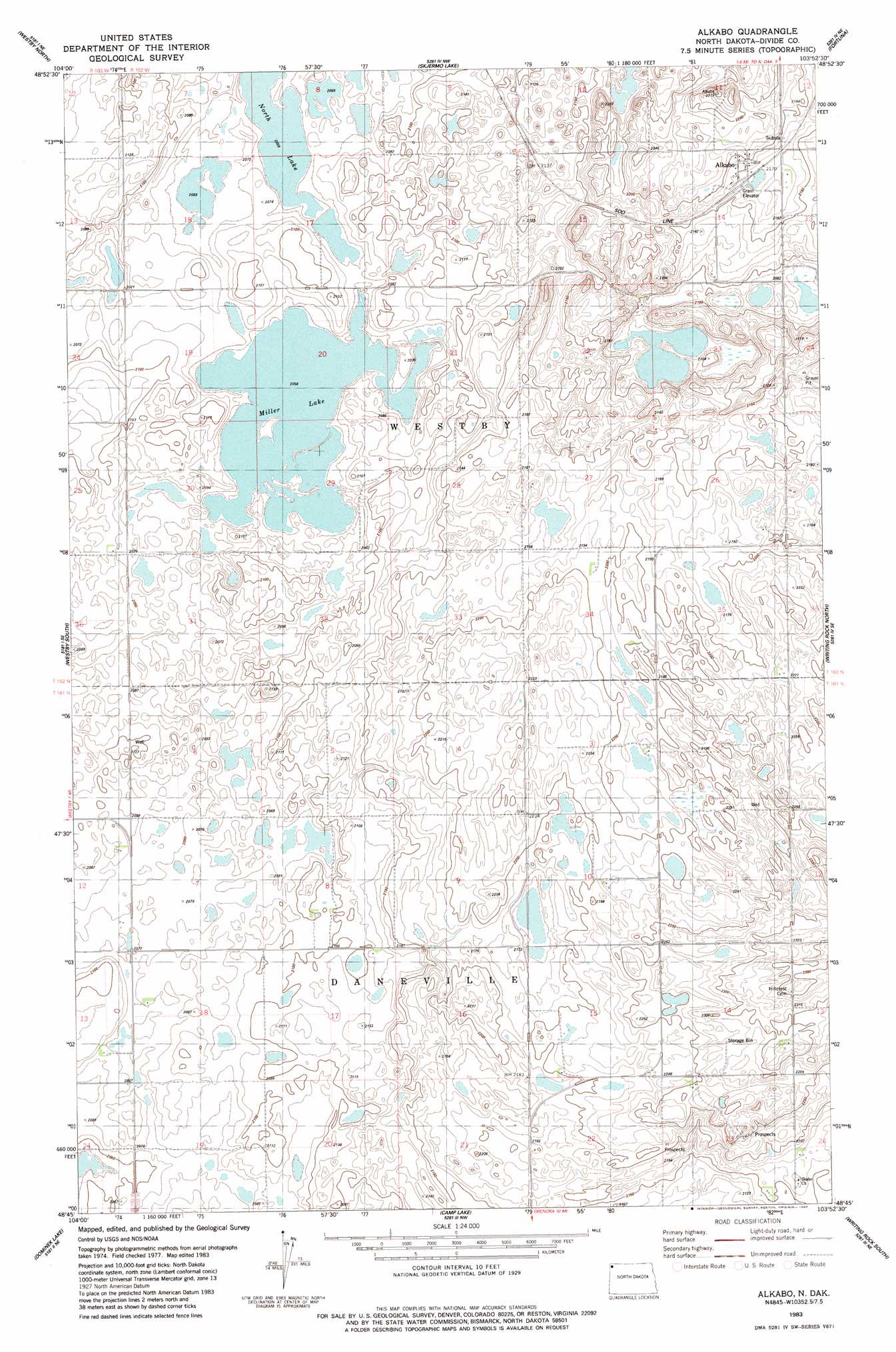
USGS Topo Quad 48103g8 - 1:24,000 scale
| Topo Map Name: | Alkabo |
| USGS Topo Quad ID: | 48103g8 |
| Print Size: | ca. 21 1/4" wide x 27" high |
| Southeast Coordinates: | 48.75° N latitude / 103.875° W longitude |
| Map Center Coordinates: | 48.8125° N latitude / 103.9375° W longitude |
| U.S. State: | ND |
| Filename: | O48103G8.jpg |
| Download Map JPG Image: | Alkabo topo map 1:24,000 scale |
| Map Type: | Topographic |
| Topo Series: | 7.5´ |
| Map Scale: | 1:24,000 |
| Source of Map Images: | United States Geological Survey (USGS) |
| Alternate Map Versions: |
Alkabo ND 1983, updated 1984 Download PDF Buy paper map Alkabo ND 2011 Download PDF Buy paper map Alkabo ND 2014 Download PDF Buy paper map |
1:24,000 Topo Quads surrounding Alkabo
Lone Tree Lake |
Westby North |
Skjermo Lake |
Fortuna |
Colgan West |
Tadpole Lake |
Westby South |
Alkabo |
Writing Rock North |
Alexandria |
Coalridge |
Dominek Lake |
Camp Lake |
Writing Rock South |
Stady |
Dagmar |
Brush Lake |
Grenora |
Hanks |
Zahl |
> Back to 48103e1 at 1:100,000 scale
> Back to 48102a1 at 1:250,000 scale
> Back to U.S. Topo Maps home
Alkabo topo map: Gazetteer
Alkabo: Lakes
Miller Lake elevation 628m 2060′Miller Lake elevation 628m 2060′
North Lake elevation 628m 2060′
Alkabo: Populated Places
Alkabo elevation 667m 2188′Alkabo: Reservoirs
North Lake elevation 630m 2066′Alkabo digital topo map on disk
Buy this Alkabo topo map showing relief, roads, GPS coordinates and other geographical features, as a high-resolution digital map file on DVD:
Eastern Montana & Western North Dakota
Buy digital topo maps: Eastern Montana & Western North Dakota