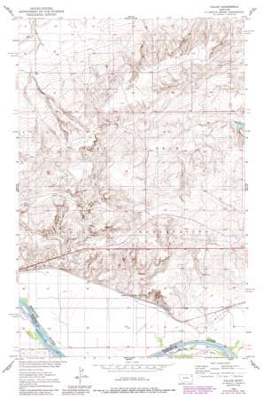
Calais Topo Map Montana
To zoom in, hover over the map of Calais
USGS Topo Quad 48104b7 - 1:24,000 scale
| Topo Map Name: | Calais |
| USGS Topo Quad ID: | 48104b7 |
| Print Size: | ca. 21 1/4" wide x 27" high |
| Southeast Coordinates: | 48.125° N latitude / 104.75° W longitude |
| Map Center Coordinates: | 48.1875° N latitude / 104.8125° W longitude |
| U.S. State: | MT |
| Filename: | o48104b7.jpg |
| Download Map JPG Image: | Calais topo map 1:24,000 scale |
| Map Type: | Topographic |
| Topo Series: | 7.5´ |
| Map Scale: | 1:24,000 |
| Source of Map Images: | United States Geological Survey (USGS) |
| Alternate Map Versions: |
Calais MT 1950, updated 1952 Download PDF Buy paper map Calais MT 1950, updated 1989 Download PDF Buy paper map Calais MT 2011 Download PDF Buy paper map Calais MT 2014 Download PDF Buy paper map |
1:24,000 Topo Quads surrounding Calais
> Back to 48104a1 at 1:100,000 scale
> Back to 48104a1 at 1:250,000 scale
> Back to U.S. Topo Maps home
Calais topo map: Gazetteer
Calais: Dams
Bertino Dam elevation 617m 2024′Calais: Mines
Alton Mine elevation 657m 2155′Calais: Populated Places
Calais elevation 592m 1942′Calais: Reservoirs
Bertino Reservoir elevation 618m 2027′Calais: Streams
Box Elder Creek elevation 590m 1935′Calais: Trails
Lewis and Clark National Historic Trail elevation 584m 1916′Calais: Wells
27N53E03AA__01 Well elevation 587m 1925′27N53E03BA__01 Well elevation 594m 1948′
27N53E04AA__01 Well elevation 596m 1955′
28N53E22DA__01 Well elevation 601m 1971′
28N53E22DC__01 Well elevation 604m 1981′
28N53E22DC__02 Well elevation 604m 1981′
28N53E22DD__01 Well elevation 607m 1991′
28N53E22DD__02 Well elevation 607m 1991′
28N53E25AA__01 Well elevation 620m 2034′
28N53E25CA__01 Well elevation 609m 1998′
28N53E25DBBC01 Well elevation 596m 1955′
28N53E26AD__01 Well elevation 630m 2066′
28N53E26BC__01 Well elevation 589m 1932′
28N53E26CC__01 Well elevation 589m 1932′
28N53E27AA__01 Well elevation 613m 2011′
28N53E27CB__01 Well elevation 587m 1925′
28N53E34AD__01 Well elevation 589m 1932′
28N53E35DD__01 Well elevation 587m 1925′
28N54E19CADB01 Well elevation 647m 2122′
28N54E28CC__01 Well elevation 596m 1955′
28N54E29CD__01 Well elevation 606m 1988′
28N54E31AA__01 Well elevation 615m 2017′
28N54E32BA__01 Well elevation 603m 1978′
29N53E27CABD01 Well elevation 639m 2096′
29N53E32BBBB01 Well elevation 627m 2057′
29N53E36CDCC01 Well elevation 646m 2119′
Calais digital topo map on disk
Buy this Calais topo map showing relief, roads, GPS coordinates and other geographical features, as a high-resolution digital map file on DVD:
Eastern Montana & Western North Dakota
Buy digital topo maps: Eastern Montana & Western North Dakota


