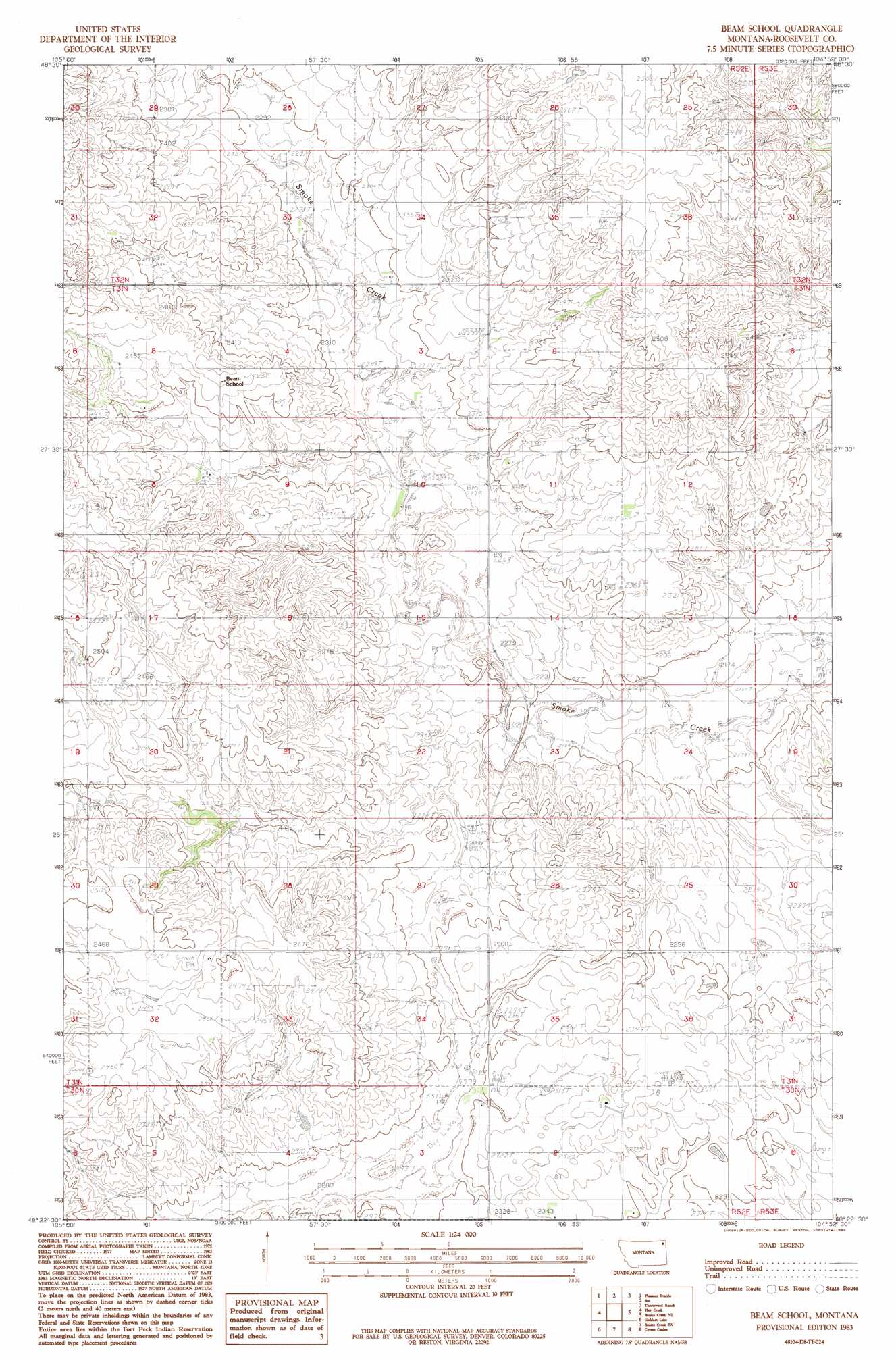
Beam School Topo Map Montana
To zoom in, hover over the map of Beam School
USGS Topo Quad 48104d8 - 1:24,000 scale
| Topo Map Name: | Beam School |
| USGS Topo Quad ID: | 48104d8 |
| Print Size: | ca. 21 1/4" wide x 27" high |
| Southeast Coordinates: | 48.375° N latitude / 104.875° W longitude |
| Map Center Coordinates: | 48.4375° N latitude / 104.9375° W longitude |
| U.S. State: | MT |
| Filename: | o48104d8.jpg |
| Download Map JPG Image: | Beam School topo map 1:24,000 scale |
| Map Type: | Topographic |
| Topo Series: | 7.5´ |
| Map Scale: | 1:24,000 |
| Source of Map Images: | United States Geological Survey (USGS) |
| Alternate Map Versions: |
Beam School MT 1983, updated 1983 Download PDF Buy paper map Biem School MT 2011 Download PDF Buy paper map Biem School MT 2014 Download PDF Buy paper map |
1:24,000 Topo Quads surrounding Beam School
Pleasant Prairie Nw |
Pleasant Prairie Ne |
Soo Nw |
Soo Ne |
Kisler Butte |
Pleasant Prairie Sw |
Pleasant Prairie |
Soo |
Thornwood Ranch |
Flagstaff Hill |
Hay Creek Nw |
Hay Creek |
Beam School |
Smoke Creek Ne |
Homestead Nw |
Long Creek East |
Geddart Lake |
Smoke Creek Sw |
Coyote Coulee |
Rocky Point |
Badger Creek |
Poplar Ne |
Brockton |
Calais |
Fort Kipp |
> Back to 48104a1 at 1:100,000 scale
> Back to 48104a1 at 1:250,000 scale
> Back to U.S. Topo Maps home
Beam School topo map: Gazetteer
Beam School: Populated Places
Biem elevation 718m 2355′Beam School: Post Offices
Biem Post Office (historical) elevation 718m 2355′Beam School: Wells
30N52E02AABD01 Well elevation 720m 2362′31N52E05CDCD01 Well elevation 732m 2401′
31N52E05CDDB01 Well elevation 734m 2408′
31N52E05CDDB02 Well elevation 736m 2414′
33N49E33DD__11 Well elevation 693m 2273′
33N49E33DD__12 Well elevation 693m 2273′
33N49E34BD__10 Well elevation 715m 2345′
33N49E34CB__10 Well elevation 696m 2283′
Beam School digital topo map on disk
Buy this Beam School topo map showing relief, roads, GPS coordinates and other geographical features, as a high-resolution digital map file on DVD:
Eastern Montana & Western North Dakota
Buy digital topo maps: Eastern Montana & Western North Dakota