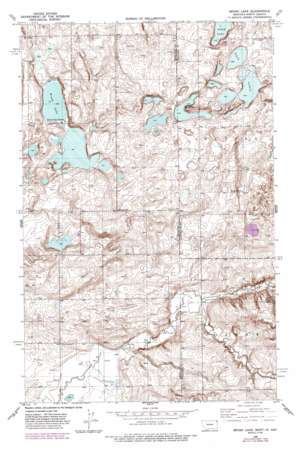
Brush Lake Topo Map Montana
To zoom in, hover over the map of Brush Lake
USGS Topo Quad 48104e1 - 1:24,000 scale
| Topo Map Name: | Brush Lake |
| USGS Topo Quad ID: | 48104e1 |
| Print Size: | ca. 21 1/4" wide x 27" high |
| Southeast Coordinates: | 48.5° N latitude / 104° W longitude |
| Map Center Coordinates: | 48.5625° N latitude / 104.0625° W longitude |
| U.S. States: | MT, ND |
| Filename: | o48104e1.jpg |
| Download Map JPG Image: | Brush Lake topo map 1:24,000 scale |
| Map Type: | Topographic |
| Topo Series: | 7.5´ |
| Map Scale: | 1:24,000 |
| Source of Map Images: | United States Geological Survey (USGS) |
| Alternate Map Versions: |
Brush Lake MT 1946, updated 1955 Download PDF Buy paper map Brush Lake MT 1946, updated 1985 Download PDF Buy paper map Brush Lake MT 1946, updated 1989 Download PDF Buy paper map Brush Lake MT 1948, updated 1948 Download PDF Buy paper map Brush Lake MT 2011 Download PDF Buy paper map Brush Lake MT 2014 Download PDF Buy paper map |
1:24,000 Topo Quads surrounding Brush Lake
> Back to 48104e1 at 1:100,000 scale
> Back to 48104a1 at 1:250,000 scale
> Back to U.S. Topo Maps home
Brush Lake topo map: Gazetteer
Brush Lake: Lakes
Brush Lake elevation 597m 1958′Horseshoe Lake elevation 599m 1965′
Horseshoe Lake elevation 599m 1965′
Stink Lake elevation 594m 1948′
Stink Lake elevation 594m 1948′
Twin Lakes elevation 600m 1968′
Brush Lake: Streams
Willow Creek elevation 617m 2024′Brush Lake: Wells
32N58E12DDCC01 Well elevation 613m 2011′32N58E13DDDB01 Well elevation 623m 2043′
32N59E04DDDD01 Well elevation 625m 2050′
32N59E08BCBA01 Well elevation 612m 2007′
32N59E09DDBC01 Well elevation 632m 2073′
32N59E19BDBC01 Well elevation 617m 2024′
32N59E29A___01 Well elevation 636m 2086′
33N58E23AADB01 Well elevation 614m 2014′
33N58E23CBCA01 Well elevation 613m 2011′
33N58E23CBCA02 Well elevation 613m 2011′
33N58E23CCAA01 Well elevation 611m 2004′
33N58E24AAAA01 Well elevation 611m 2004′
33N58E25AAAA01 Well elevation 606m 1988′
33N58E25AAAA02 Well elevation 607m 1991′
33N58E25AAAA03 Well elevation 607m 1991′
33N58E36AADD01 Well elevation 602m 1975′
33N58E36DDDD01 Well elevation 609m 1998′
Brush Lake digital topo map on disk
Buy this Brush Lake topo map showing relief, roads, GPS coordinates and other geographical features, as a high-resolution digital map file on DVD:
Eastern Montana & Western North Dakota
Buy digital topo maps: Eastern Montana & Western North Dakota


